
Foggy start to Saturday for many parts of Sydney
Thick fog enveloped a large part of the Sydney Basin on Saturday morning, hanging low in many areas until late morning.
Those in Sydney's northeast may not have noticed it, but fog brought visibility down to very low levels in many other parts of the basin on Saturday morning.
Clear skies, cold temperatures under an inversion, and very high relative humidity combined to form fog over western suburbs throughout the early hours of the morning, with visibility down to around 50 metres in some areas. By sunrise, fog had extended to the Harbour Bridge with the help of light westerly winds, where it remained until well after 9am. Blocking the morning sun, the fog kept the city under 10 degrees until 10am.
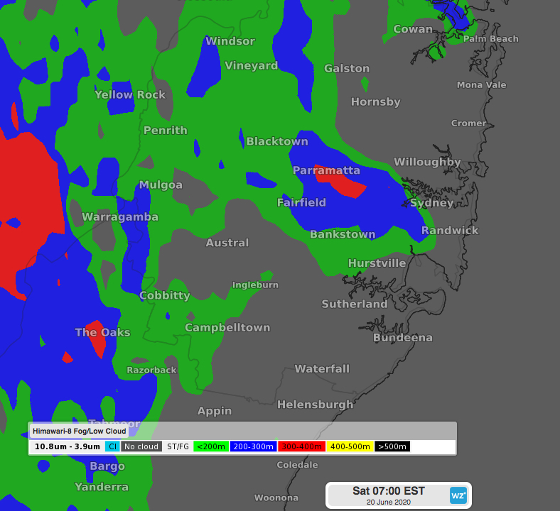 Image: Himawari-8 satellite layer showing fog in many parts of Sydney on Saturday morning. Green represents the lowest visibility, followed by blue then red.
Once the sun was high enough in the sky the fog lifted, revealing a bright blue sky. Saturday will end up mild for Sydney with light northerly winds, but enjoy it while it lasts as a change is due early Sunday morning, bringing a wet and cooler second half of the weekend.