
Fog lingering over Central West NSW at lunchtime
Thick fog blanketed parts of NSW on Tuesday morning, with some areas still shrouded by fog and mist at lunchtime.
Low overnight temperatures and sufficient atmospheric moisture combined to cause widespread fog over NSW on Tuesday morning.
At 6am AEST on Tuesday, visibility had reduced to 100 m at Orange and 200 m at Dubbo, Griffith and Young. The fog was so thick in some areas that it managed to limit the amount of heating on the ground, allowing fog and mist to linger through lunchtime.
Meteorologists define fog as a concentrated suspension of tiny water droplets that cause horizontal visibility below 1000 m. If the airborne water droplets allow visibility above 1000 m, this is defined as mist.
The animation below shows fog and mist lingering in low-lying parts of the landscape through on Tuesday morning to 11:30am.
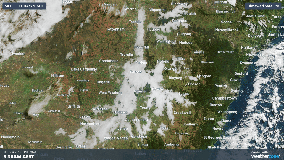
Video: Visible satellite images captured between 9:30am and 11:30am AEST on Tuesday. The stationary white areas that gradually reduce in size over Central West NSW are fog and mist, while the faster-moving white areas are clouds.
Temperatures struggled to climb beneath Tuesday’s fog, with the mercury still hovering around 7°C in Cowra at 1pm.
While fog and mist are common in NSW at this time of year, it is unusual for them to persist this late into the day.
Morning fog will remain a feature across inland areas of NSW through the middle of this week as a high pressure ridge lingers over the state.