Fog blankets Kalgoorlie
A rare sight of fog graced Kalgoorlie in the early hours of Sunday morning, starting from around 5am, peaking just after 6am as the sun rose, and lifting by 7am as winds started to pick up.
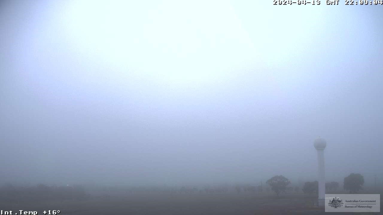
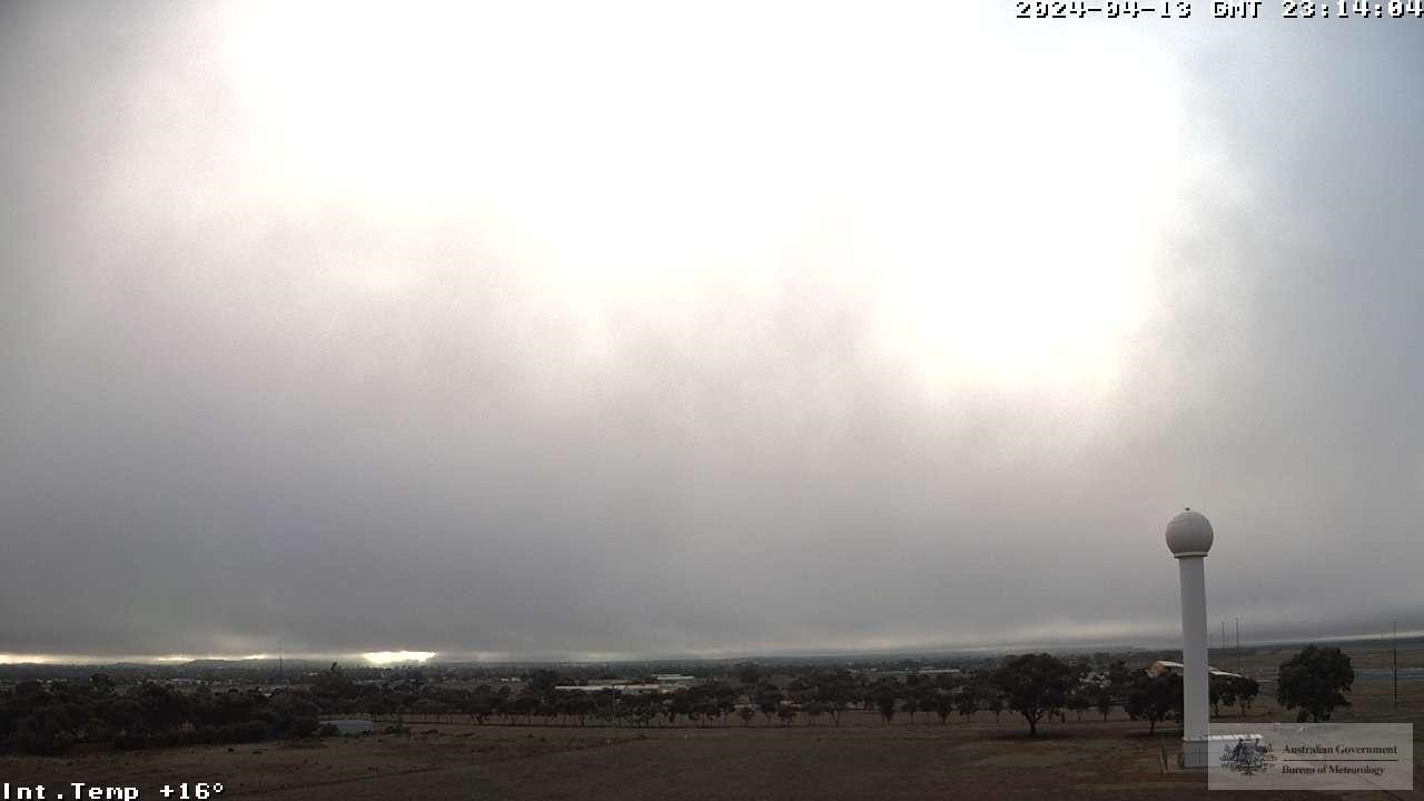
Images (west-facing) on Sunday, April 14 AWST: (Top)- Kalgoorlie at 6:09am, and (Bottom) - Kalgoorlie at 7:14am (Bureau of Meteorology).
How rare is such an event, you may ask? Under half of observed fog events at Kalgoorlie Airport occur after rainfall, and less than 10% occured outside the months of May-August.
Turns out, both occurred in the lead up to the morning shrouding.
The figures below show a snapshot of what was going on as the fog cleared.
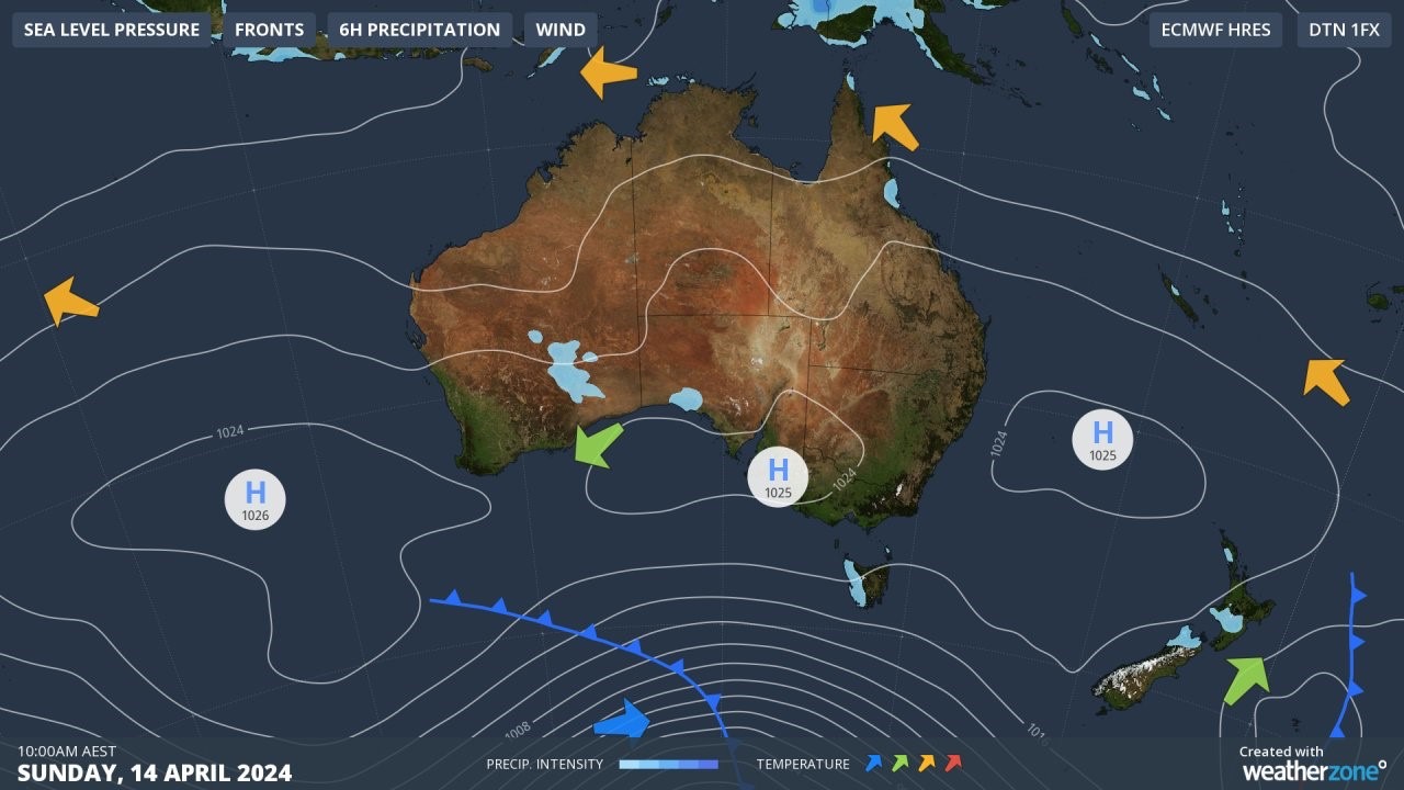
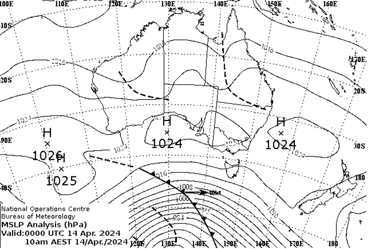
Figures: Sunday April 14th 8:00am AWST synoptic charts including (Top): rainfall & winds and (bottom): troughs (Bureau of Meteorology).
For the fog to form in such an isolated instance, specific meteorology was required at the right time.
A surface low pressure trough over WA's interior cradling mid-level moisture directed from the remnants of Ex-tropical Cyclone Olga brought some showers & the odd storm between 3am and 3:30am. Combined with this moisture, temperatures cooled to the dewpoint temperature to achieve nearly 100% humidity, winds began to ease, and conditions stabilised as the trough's moisture settled.
The temperature then continued to drop, and as it did, the ability to hold moisture followed suit. The result was suspended water particles suspended in the air near the ground; what we know as fog.
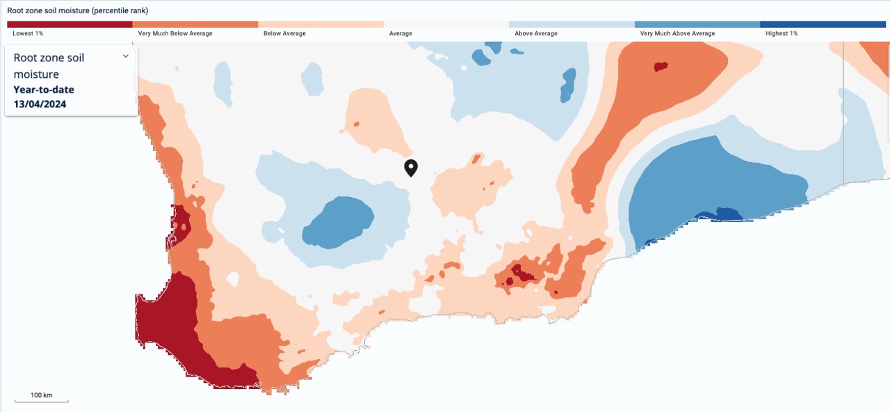
Figure: Soil moisture percentiles for April 13th, 2024 over southern Western Australia. Kalgoorlie is located at the black marker (Bureau of Meteorology).
What also helped the fog to form was the soil moisture at the time. Soil that is slightly moist makes it easier for the ground above it to condense into fog. Any drier soil would have likely not absorbed the showers, making it harder to produce fog.
Be sure to keep an eye on forecasts here, and stay up to date on the latest warnings here.