
Flooding rains on the way for parts of Queensland
Flooding rain is on the cards this week over Queensland's central and northern areas as a pair of troughs make use of the warm Coral Sea.
A trough over the Gulf of Carpentaria is starting to drift south, after producing plenty of thunderstorms with heavy rainfall each day since Christmas.
This trough will split up on Monday and Tuesday, sending one over the central west, and another just off the north coast. This coastal trough will then start to draw up moisture over the warm Coral Sea (see below) and send it towards the coast as heavy rain and storms.

Image: Ocean surface temperature anomalies over the Coral Sea, showing a broad area in the north 2-3 degrees above average for this time of year. This is a common feature of La Niña events.
Rainfall over the coming week, especially between Wednesday and Saturday, could be very heavy. Models are suggesting that some parts could receive more than 100mm in a day during this period, easily enough to produce flash-flooding. The tropical rainforests near Innisfail are particularly vulnerable, with local mountain ranges allowing the possibility of more than 200-300mm falling in a day or two.
A fair amount of this rainfall will make it over the Great Divide, providing some locally heavy rain throughout the north of the state. The inland trough will likely precipitate much of the rain as storms, inherently making falls more patchy and harder to predict. That said, severe thunderstorms are likely to produce at least a few rain dumps of 50mm or more in a short space of time.
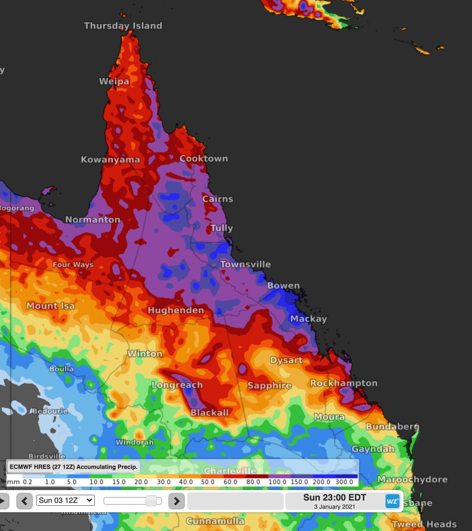
Image: Forecast Accumulated Rainfall to 10pm Saturday
By the end of the week, much of the north can expect to receive about 80-120mm in the gauge, with the coast expecting widespread falls of 100-150mm. However, there is likely to be some much heavier falls, possibly exceeding 300mm or even exceeding 500mm for some flood-prone parts.
With the likelihood of severe warnings being issued for heavy rain, as well as flood warning and watches, keep up to date with the latest warnings here.