
Flooding rain targeting South Australia
A northwest cloudband will cause heavy rain and thunderstorms over parts of South Australia on Wednesday, with flash flooding possible in some parts of the state.
Moisture-laden northwesterly winds interacting with a low pressure system passing over the Bight will cause a vast band of cloud, rain and storms to pass over SA on Wednesday and Thursday morning. The satellite image below shows the cloudband covering most of SA on Wednesday morning.
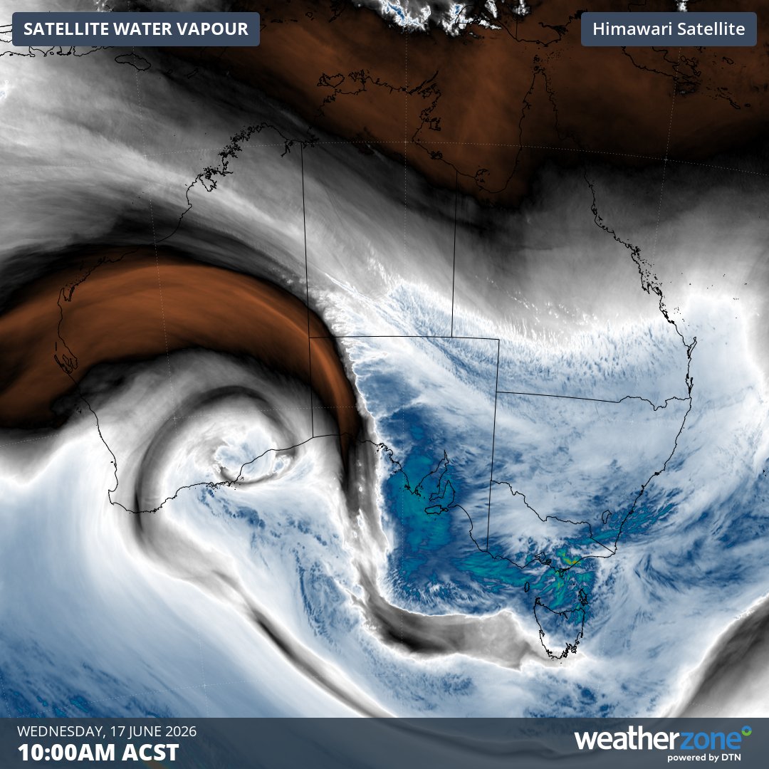
Image: Enhanced infrared satellite image, showing cloud over SA and a low pressure system near the south coast of Western Australia at 10 am ACST on Wednesday, June 17, 2026. Source: Weatherzone.
Some areas in SA received close to 50 mm of rain during the 24 hours ending at 9am on Wednesday. This included 47 mm at Tarcoola, which was its heaviest June daily rainfall on record, with data available back to 1907.
The heaviest rain on Wednesday is expected to fall over SA’s North West Pastoral, West Coast and Eyre Peninsula districts. Six-hourly rainfall rates of 30 to 40 mm are possible in these areas, most likely in the morning and afternoon.
After soaking the state’s west, the band of rain will spread across SA’s central and eastern districts between Wednesday afternoon and Thursday morning. This will include Adelaide, which could see around 10 to 20 mm of rain from this system.
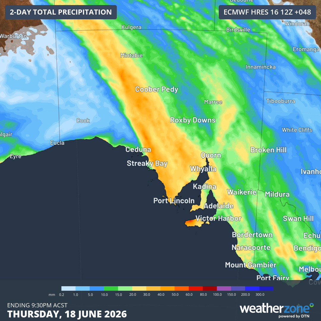
Image: Forecast accumulated rain during the 48 hours ending at 9:30 pm ACST on Thursday, June 18, 2026. Source: Weatherzone.
The rainband will clear from SA on Thursday morning, although another round of showers and blustery winds will develop on Thursday and Friday as the low passes to the south of the state. Damaging winds are possible in some areas on Thursday, most likely along the West Coast.