
Flooding rain over north Queensland
More than 100mm of rain has fallen over some part of northwest Qld for each of the last 6 days. East Qld hasn't been much drier, with every day except the 24 hours to 9am on the 27th also seeing 100mm+ of rain. And further heavy rain is forecast over the coming week. Rivers are rising, with the Gregory River in northwest Qld already at major flood levels.
The culprit in the northwest has been a low pressure system lingering over the Gulf Country. This drifted off to the western Top End in the latter part of the Christmas week but is now back with a vengeance, aided by a monsoon trough. In the east, last week's rain was triggered by an active trough moving northward. This has now stalled near the northeast Qld coast and will weaken. But as extremely humid air flows from the Coral Sea into the low or "landphoon" over northwest Qld, it will be uplifted over the tablelands and trigger heavy rain and a "quasi monsoon" in the region between Cooktown and Townsville.
The animation below shows one model's prediction of daily rainfall over the coming week.
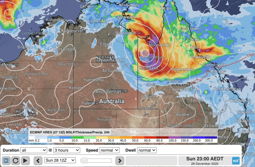
Image: Animation of 24-hour rainfall over the coming week, according to the ECMWF model with a north Qld "landphoon." Source: Weatherzone.
Some notable stats that have already occurred include the heaviest December rain since:
- At least 1978 for Cloncurry Airport. The 117.6mm to 9am on the 26th was the heaviest December rain on record for the station which opened in 1978. (It was also the heaviest for any month since 2019).
- 2011 for Gregory Downs on the 27th with 103mm.
- 2012 for Richmond on the 27th with 52.9mm.
- 2013 for Normanton on 28th with 92.4mm.
In the 24 hours to 9am today, Cardwell Gap was the wettest location in Australia with 217mm of rain recorded, 145mm of which fell in 3 hours late last night.
Heavy rain is, of course, not unusual for the tropics in the summer. However, December is quite early in the season for this intensity of rain over the northwest, as evidenced by the above stats.
Rainfall totals over the coming days are likely to be even higher with daily falls of 200-300mm expected over some areas. The wettest period, for both northwest and northeast Qld, looks like Sunday into Tuesday night. By the end of the month, some locations could accumulate nearly half a metre of rain, bringing December totals to well above average. There'll be an easing trend later in the week before another trough moving in from the west enhances rainfall again around the weekend before finally sending a drier change over most of Qld next week.
Fossickers in the northwest can then move in to see what garnets, gold, amethyst or dinosaur fossils might have been unearthed.
Keep up-to-date with the latest warnings and forecasts at:
https://www.weatherzone.com.au/warnings and https://www.weatherzone.com.au/qld
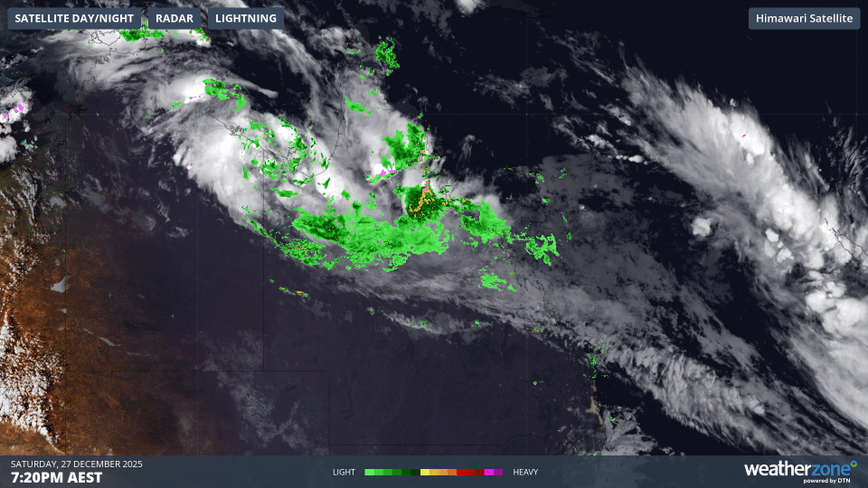
Image: Satellite and radar animation in the 12 hours to Sunday 28th morning, showing a low over the Gulf Country and rain and storms streaming over north Qld and the northeast NT. Source: Weatherzone.
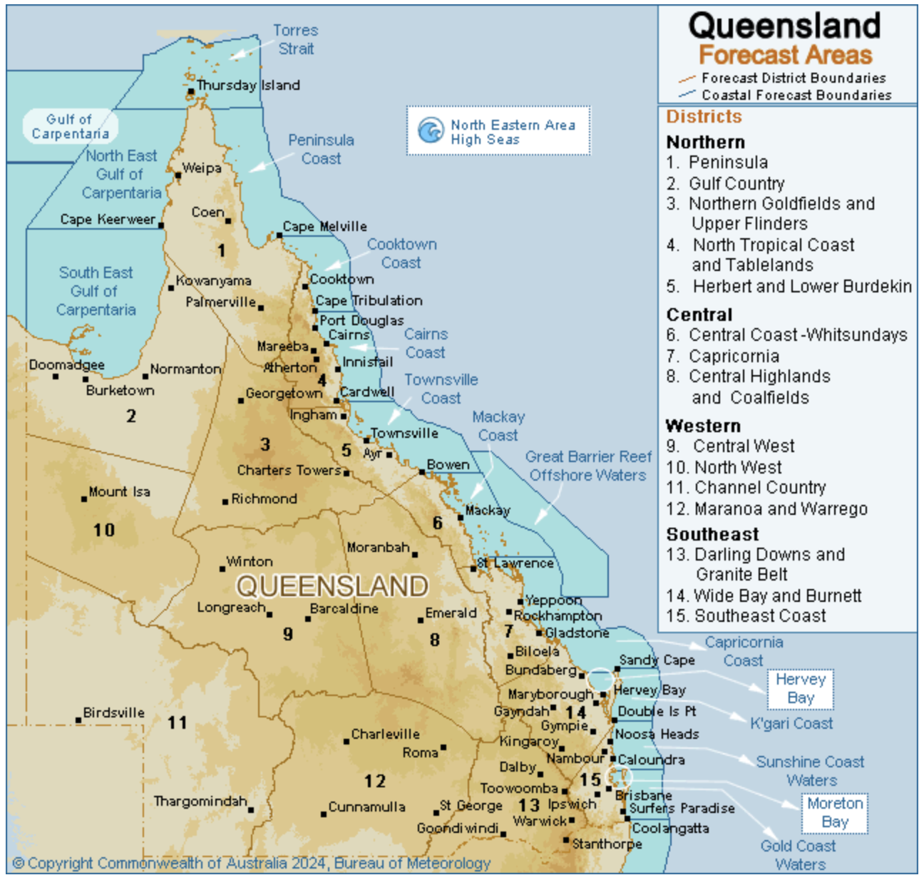 Image: Forecast district map of Qld. The Gulf Country, North West, Central West, Northern Goldfields and Upper Flinders, North Tropical Coast and Tablelands, and Herbert and Lower Burdekin will be the wettest areas in the coming few days. Source: Bureau of Meteorology.