
Flooding rain in north Queensland
A severe weather warning and flood watch are in place for parts of Queensland's North Tropical Coast after nearly 200mm fall in just six hours last night.
A near-stationary band of heavy rain, which formed along a line of converging winds, dumped 271mm at South Mission Beach during the 12 hours ending at 3:15am on Thursday.
Amid this deluge, the rain gauge reported 198mm in just six hours and 141mm in three hours. To put this into perspective, the February monthly average at Cairns Airport is about 445mm.
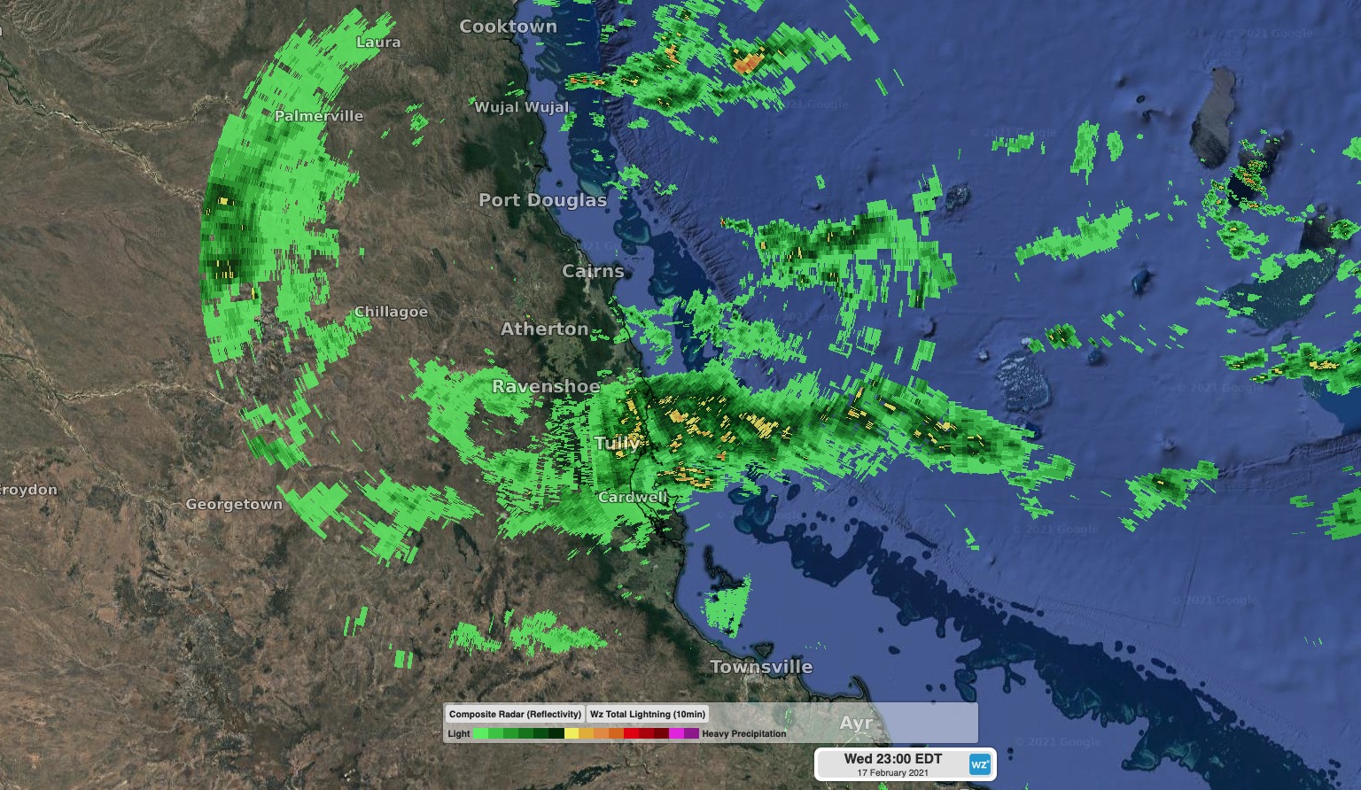
Image: Radar showing heavy rain targeting Queensland's North Tropical Coast on Wednesday night.
Tully's 255mm during the 24 hours to 9am on Thursday was its highest daily total in three years. Impressively 233mm of this fell in just 12 hours.
Last night's tropical soaking occurred as moisture-laden winds formed what's called a convergence line, which saw wind from different directions coming together in a line directly over Queensland's North Tropical Coast. The convergence line resulted in persistent, heavy and long-lasting rain over the same stretch of coastline.
Outside this region, heavy rain and thunderstorms will also affect other parts of northern Queensland, the NT's Top end and WA's Kimberley region during the next few days. A number of severe weather warnings, flood watches and flood warnings are in place across these three states.