
Flood threat shifting into Victoria
Victoria’s east will be next in the firing line with the heavy rainfall and flash flooding that affected NSW and northern Vic on Wednesday set to shift south.
A low-pressure system and an abnormally warm Tasman Sea caused heavy rainfall over a large area of NSW and northern Vic overnight Tuesday into Wednesday. The image below shows this heavy rain continuing to impact parts of NSW and Vic on Wednesday afternoon.
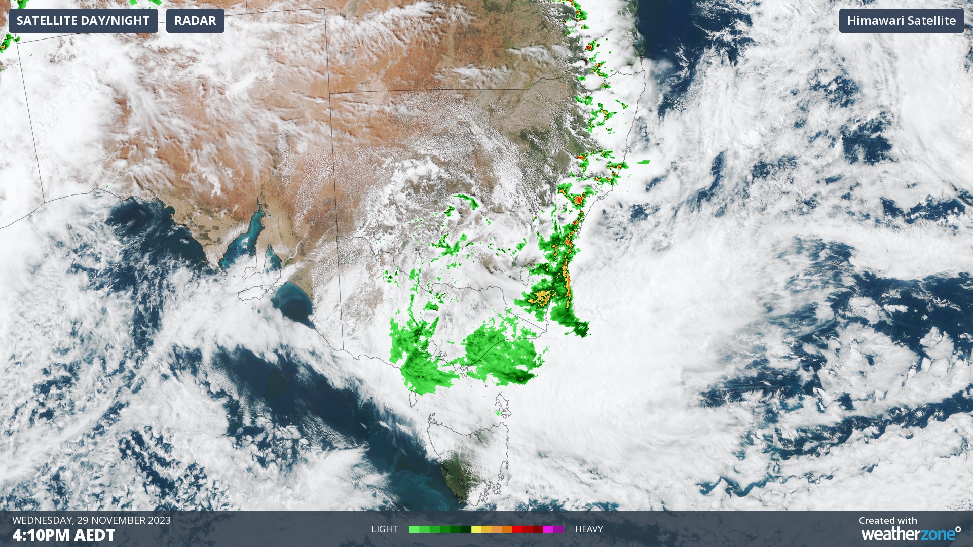
Image: Satellite image and radar at 4:10pm AEDT on Wednesday, November 29.
Falls exceeding 300mm have been recorded in the South Coast District of NSW, causing inundation of homes and multiple rescues by the SES overnight.
Swan Hill in Victoria’s north saw its wettest day in 25 years, recording 85.4mm in the 24 hours to 9 am AEDT on Wednesday, as we mentioned earlier this morning.
The low pressure system will move off the South Coast of NSW overnight tonight, dragging moisture laden air into eastern Vic as the easterly winds strengthen.
Heavy rainfall is expected to continue over the Otway Ranges on Wednesday afternoon and spread to parts of the Gippsland region in Victoria’s east overnight and into Thursday morning.
The map below shows that daily rainfall totals could reach 50 to 100mm over the Ottaway ranges on Wednesday, with isolated falls above 100mm possible. Eastern VIC could see 100 to 150mm on Wednesday evening into Thursday, with falls exceeding 150mm possible in East Gippsland on Thursday.
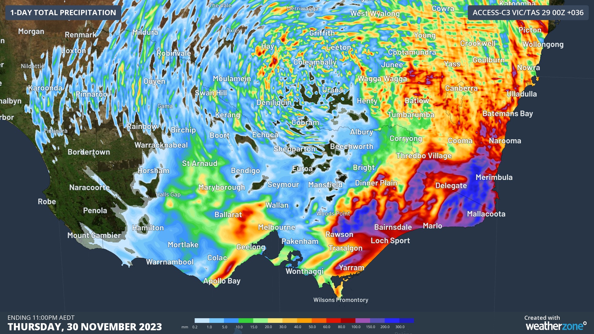
Image: ACCESS-C accumulated rainfall for the 36 hours ending at 11pm AEDT on Thursday, November 30.
A severe weather warning was current for parts of southern and eastern Vic at 5pm AEDT on Wednesday, alerting for the risk of heavy rainfall and damaging wind gusts on Wednesday afternoon and into Thursday.
Wind gusts may reach 90 km/h on Wednesday and East Gippsland on Thursday as strong easterly winds blow across the state’s east.
Looking ahead, the rainfall and winds should ease from Friday as the low pressure system moves east away from the mainland.