
Flood threat in Victoria on Friday
Heavy rain and thunderstorms could cause flooding in Victoria on Friday.
A cold front and low pressure trough interacting with a mass of moisture-laden air will trigger rain and storms over Victoria during the next two days.
Thursday will be the entrée of this event, with showers and some storms developing mainly over the state's central and western inland. A few places could pick up 10-20mm of rain, although most of the state will only see light falls.
However, things will ramp up on Friday as a pool of cold upper-level air approaches the state from the west, causing atmospheric instability to spike.
Rain and isolated thunderstorms are likely over western and central Victoria on Friday, with rain also spreading over the state's northeast mainly during the afternoon and overnight.
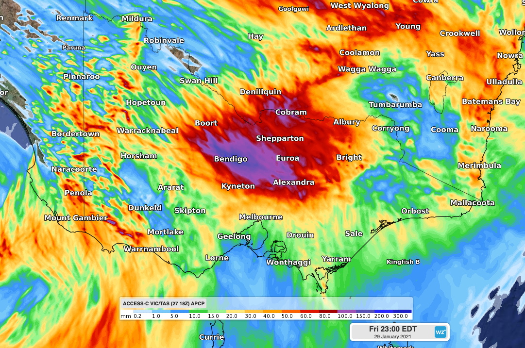
Image: Forecast accumulated rain during Thursday and Friday combined according to one computer model (ACCESS-C model).
Widespread falls of 20-40 mm are likely in central, western, and northeastern Victoria during Friday and into Saturday morning. Some places could pick up more than 50mm and a few models even suggest that isolated totals over 100mm will be on the cards.
Friday's rainfall could cause areas of flash flooding in Victoria, particularly where more intense rain rates develop with thunderstorms. Check the latest warnings for up-to-date information as this event unfolds.