
Flood risk returning to northeastern QLD
A tropical low is expected to develop in the northwestern Coral Sea, which could lead to flooding rainfall to northeastern parts of Queensland over the next several days.
The tropical low has the potential to lead to a significant weather event, although model uncertainty is high with respect to how this system evolves over the coming days.
A possible scenario is that the system remains slow-moving near the northeast coast of Queensland, leading to a prolonged spell of heavy rainfall in this area.
In this scenario, multi-day rainfall totals could exceed 500mm over parts of the North Tropical Coast and Tablelands, Herbert and Lower Burdekin and Central Coast-Whitsundays districts between Friday and next Wednesday, including Cairns and Townsville.
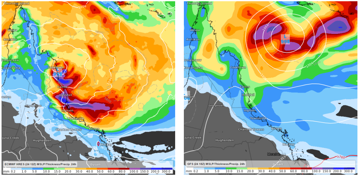
Image: comparison of ECMWF (left) and GFS (right), in terms of mean sea level pressure at 22:00 AEST on Tuesday 2nd March, and forecast 24 hours rainfall accumulation during the 24 hours to 22:00 AEST Tuesday 2nd March.
Another potential outcome is that the system moves away from the Queensland coastline, further into the Coral Sea, whilst it intensifies into a tropical cyclone.
This second scenario would see much less rain falling over northeastern Queensland, but the Great Barrier Reef and parts of the Queensland coastline would have to contend with a large swell.
As new models updates become available, meteorologists will begin to get a better idea of which path the tropical low will take, so it will be worth keeping an eye on the latest forecast - especially residents of northeastern Queensland.