
Flight delays, diversions and cancellations at Bali Airport with thunderstorms and volcanic ash
Intense and out-of-season thunderstorms, followed by a nearby volcanic eruption led to significant flight delays, diversions and cancellations at Bali's International Airport this past Sunday and Monday.
Unseasonal thunderstorms strike Bali
The satellite loop below shows thick thunderstorm clouds across the Indonesian islands of Lombok, Bali and Java on Sunday.
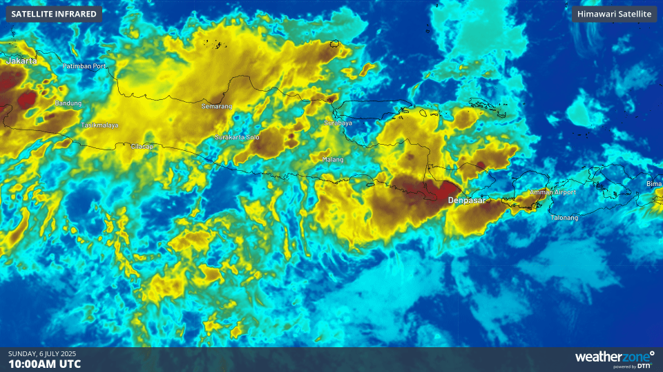
Image: Enhanced infrared satellite imagery showing intense thunderstorm activity across Bali and surrounding areas on the evening of Sunday, July 6, 2025.
A number of flights coming in and out of Bali's Denpasar Ngurah Rai International Airport between about 4:30pm and 10pm local time were delayed or diverted to nearby islands due to the intense thunderstorms. Low visibility in heavy downpours and the risk of lightning strikes hitting planes and tarmac operators make it unsafe for landing and taking off during thunderstorms.
Denpasar airport operates a single runway direction, which goes in an east-west direction, making it vulnerable to winds from the north or south. A 52 km/h wind gust from the southeast generated by a thunderstorm was recorded on Sunday.
Intense tropical rainfall as seen this weekend across the region was partly due to an equatorial Rossby Wave. July is in the middle of the dry season, which typically sees less frequent rain and thunderstorms under a pattern of more predictable trade wind conditions. Tropical waves can however disrupt this pattern, bringing weather more typical to the lush wet season that runs between November and March.
What is an Equatorial Rossby Wave?
Equatorial Rossby waves travel through the tropical atmosphere from east to west, typically producing an alternating sequence of high and low pressure systems on either side of the equator. This brings mirrored zones of cloudiness and clear weather in the tropics of both hemispheres.
The map below shows the modelled influence of the equatorial Rossby wave, with areas of enhanced and suppressed convection (rain and cloudiness) north and south of the equator near Indonesia.
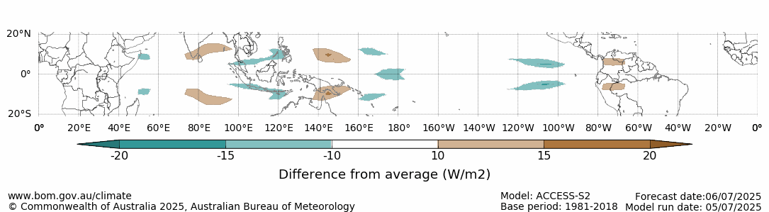
Image: Forecast outgoing long-wave radiation anomalies for July 6, 2025, associated with the equatorial Rossby wave. The green areas show where cloud cover is expected to be enhanced, while the brown shading represents suppressed cloud cover. Source: BoM.
Lewotobi Laki-Laki volcano erupts again
Just before 11am local time on Monday, the Lewotobi Laki-Laki volcano erupted on the island of Flores, Indonesia, sending a plume of volcanic ash and gases high into the atmosphere.
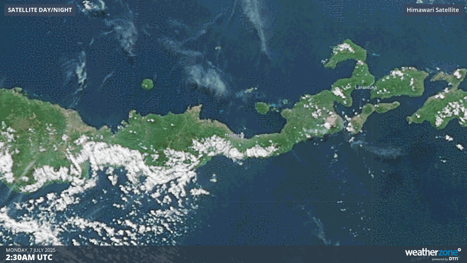
Image: Volcanic ash plume visible on satellite imagery on Monday, July 7, 2025.
Laki-Laki is one of the two twin Lewotobi volcanos, located approximately 800 kilometres east of Bali, Indonesia, and 1,000 kilometres northwest of Darwin, Australia.
#BREAKING Volcanic Eruption: Lewotobi Laki-Laki
— Volcaholic ???? (@volcaholic1) July 7, 2025
Click on video and sound up ????
On July 7, 2025, at 11:05 AM (Indonesia time), the Lewotobi Laki-Laki volcano, located in Southeast Nusa Tenggara, erupted.
The eruption produced an ash column reaching 18,000 meters above the… pic.twitter.com/vyym7I0rO1
The ash plume expelled by the volcano can be estimated reaching over 15 kilometres high using infrared satellite imagery.
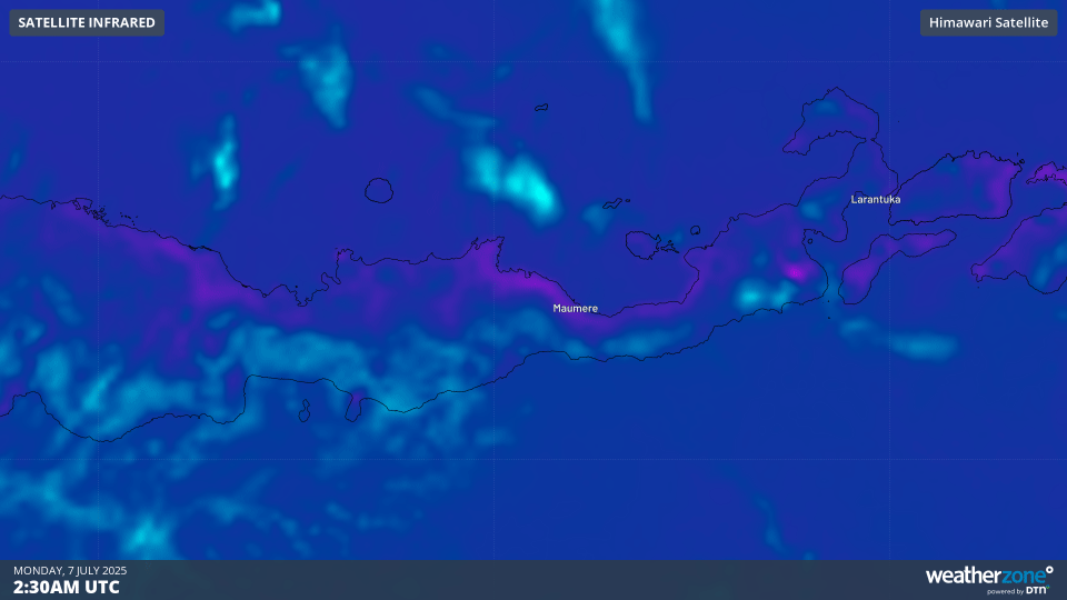
Image: Volcanic ash plume visible on enhanced infrared satellite imagery on Monday, July 7, 2025.
At this stage there are no reports of deaths or damage to property as a result of this eruption. Ongoing eruptions since 2023 have previously displaced thousands of people, with a major eruption in November 2024 killing 9 people, destroying homes and disrupting international aviation. Laki-Laki erupted again in March, May and June 2025, once again displacing people and disrupting aviation.
The volcanic ash did prompt a number of flight cancellations on Monday and a handful on Tuesday as a precautionary measure. Volcanic ash poses a huge risk to aircrafts through abrasion and accretion inside the turbines.