
Flash floods devastate Texas, what happened?
The flash floods that ripped through parts of rural Texas this week were caused by a disastrous combination of factors that resulted in one of the deadliest flash flood events in US history.
On the eve of America’s annual celebration of the 4th of July, the Guadalupe River in southern Texas rose 26 feet (almost 8 meters) within the span of up to an hour, depending on the location.
This rapid surge of water caused devastating flash flooding in the Texas Hills. Rescue teams are still working to save and locate as many people as possible following this deadly flash flood event.
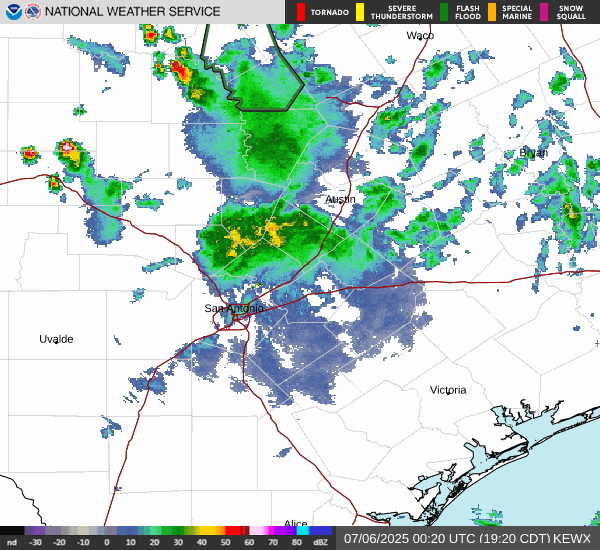
Image: Radar observations of rainfall on the 6th of July from 1:10 to 1:30 UTC (National Weather Service, NWS)
The torrential rains that led to the rapid rising of the Guadalupe River weren’t instantaneous. In the final days of June, Tropical Storm Barry crossed southeast Mexico but due to a less than optimal set up, Barry was short-lived and unorganised.
The tropical remnants of Barry were picked up and carried northward, where it interacted with the local storm activity of inland northern Mexico.
An area of low pressure then developed around Kerr County, Texas (about 140km northwest of San Antonio), which pulled this unstable and moisture-laden airmass over the Texas Hills.
From July 2, heavy rain was falling over the state’s south, but as the system slowed, rainfall rates increased to 2 to 4 inches an hour (50-100mm/h).
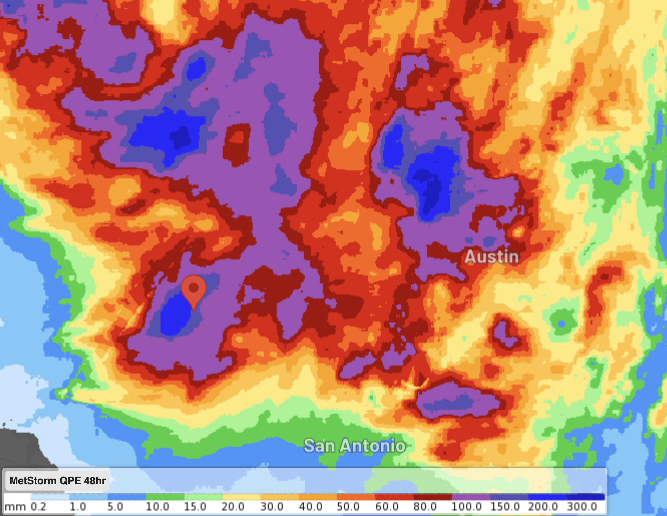
Image: Estimated rainfall over the past 2 days over the Texas Hills with a marker indicating the locations of Kerr County
The already saturated soils couldn’t hold this increased rate of rainfall, and so runoff into the Guadalupe River consequently increased from the Hills, leading to the flash flooding observed on Thursday evening into Friday.
The lack of a significant dry spell between rain events (see comparison for observed rainfall over 1,3,7 days) and a slow-moving low pressure system being fed by tropical moisture, created the environment for one of the deadliest flooding events the US has seen.
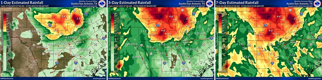
Image: Estimated rainfall over the past day (left), 3-days (centre) and 7-days (right) over Texas (NWS)
Portions of the Hill Country and Texas’ southeast were still under a Flood Watch on Saturday night local time. Parts of at least 8 counties were also still with Flash Flood Warnings as more rain is expected in the area (widespread rainfall of another 30-80mm and local falls of up to 130mm).
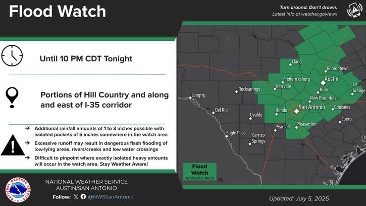
Image: Flood Watch for the 5th of July by the NWS
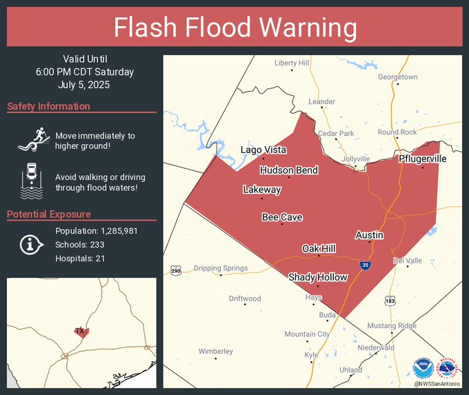
Image: Flash Flood Warning for the 5th of July by the NWS and NOAA
Visit the National Weather Service website at https://www.weather.gov/ for the latest weather and flood advisories.