
First strong burst of autumn weather
It only affected Tasmania and parts of the southeast mainland, but the first cold outbreak of autumn surged northwards from Antarctic waters overnight, reminding us that the seasons are changing.
- Tassie temps dipped below zero at several locations, including –1.8°C at kunanyi/Mt Wellington above Hobart just before midnight, while Devonport's low of 3.8°C was the coldest it's been this early in the year since 2003.
- There were also some very light snowfalls at upper elevations in Tasmania.
- Strong winds also accompanied the cold front, with sustained wind speeds exceeding 100 km/h at Maatsuyker Island off southern Tas, with several gusts topping 130 km/h. Gusts also topped 130 km/h at kunanyi/Mt Wellington, while Hobart itself saw a gust of 95 km/h at 9:42 am.
- Subzero readings were also registered in the Victorian Alps at Mt Hotham (–1.4°C on Monday morning) while even Cooma Airport in NSW, east of the Snowy Mountains, fell to just 1°C.
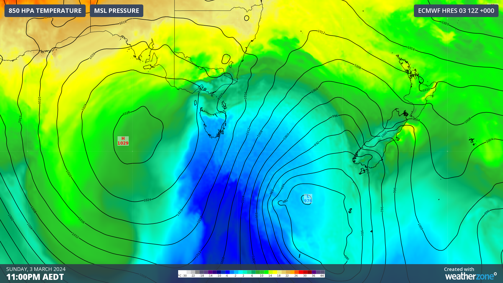
You can see the surge of cold air at 11 pm Sunday represented by the blue blob on the chart above, while on the loop below, you can see the tell-tale mass of speckled cloud indicating a cold airmass moving across the Tasman Sea to New Zealand.

Indeed, New Zealand is in for a burst of snowy early autumn weather, with snow expected to fall as low as 800 metres above sea level on parts of the South Island from 11 pm Monday into Tuesday morning.
The cold outburst will be a relief to many Tasmanians after a much warmer than usual summer when mean temperatures were 1.17°C above the long-term average, making it the state's 9th-warmest summer on record while Australia as a whole saw its 3rd-warmest summer on record.

Image: It was warmer almost everywhere in summer 2023/24, including across all of Tasmania. Source: BoM.
Conditions are already beginning to ease across our island state, with winds slowly moderating and temps set to rise quite rapidly after a cool Monday.
After a spell of weather with top temps in the mid-20s for much of the working week, Hobart could reach 33°C by Saturday. The city's hottest March day on record was 39.1°C on March 2, 2019.