
First cyclone of the season soaks northern Queensland
Heavy rainfall and damaging winds hit parts of northern Queensland late Sunday into Monday, as Cyclone Imogen made its presence felt.
The small cattle town of Normanton (population 1,200), in the far north of the state, picked up 263 mm in the 24 hours to 9am on Monday. That's more than it normally receives in the whole month of January.
Tropical Cyclone Imogen became the first tropical cyclone of the season when it was named on Sunday afternoon.
The category 1 cyclone then tracked southeast, crossing the southeast Gulf of Carpentaria coast around 9 pm Sunday evening. By late Monday morning, the system had weakened to a tropical low as it moved further inland, having lost its warm ocean energy source.
Despite no longer being a cyclone, the tropical low will continue to bring very heavy rainfall to the northeast of the state in the next few days as it tracks slowly to the southeast.
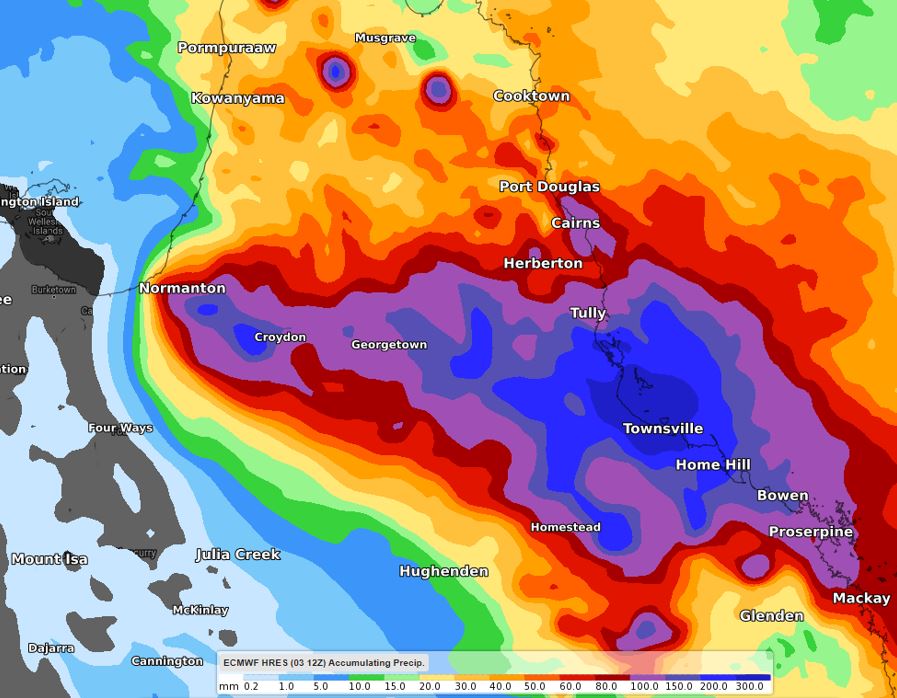
Image: Forecast accumulated rain from Monday morning to midnight Thursday.
Widespread falls of 200-300 mm of rainfall are likely in the coming days from Cairns to Bowen, extending inland to Georgetown. Isolated heavier totals are possible, particularly in thunderstorms, with a risk of flash flooding.
A severe weather warning, a flood watch and a number of flood warnings are already current in the region. These are likely to be updated and added to as the situation evolves so keep up to date with warnings here.