
Fire danger returning to southeastern Australia
Another round of hot and windy weather will elevate fire danger ratings in southern and southeastern Australia on Thursday and Friday, before a brief burst of showers and storms.
Hot air from central Australia will be transported across SA, NSW, Victoria and Tasmania on Thursday and Friday as northwesterly winds strengthen ahead of an approaching front.
On Thursday, the heat will build over southern and central parts of the country. Temperatures are forecast to reach the low to mid forties over large areas of South Australia's inland and high thirties on parts of the state's coast, including Kangaroo Island. Some areas of western NSW and northwest Victoria should also see the mercy reach or exceed 40 degrees.

Image: Forecast surface temperature at 5pm AEDT on Thursday, according to the ECMWF-HRES model.
The combination of heat and wind will cause Severe fire danger ratings in some central parts of South Australia on Thursday. Very High ratings will also extend across parts of northern Victoria and southern NSW.
On Friday, the heat will spread across southeastern Australia and affect large areas of NSW, Victoria and Tasmania.
Temperatures are likely to exceed 45 degrees in western NSW and reach the low forties in northern Victoria on Friday afternoon. Some near-coastal areas in eastern Victoria and NSW could also reach the high thirties, while parts of Tasmania should nudge 30 degrees.
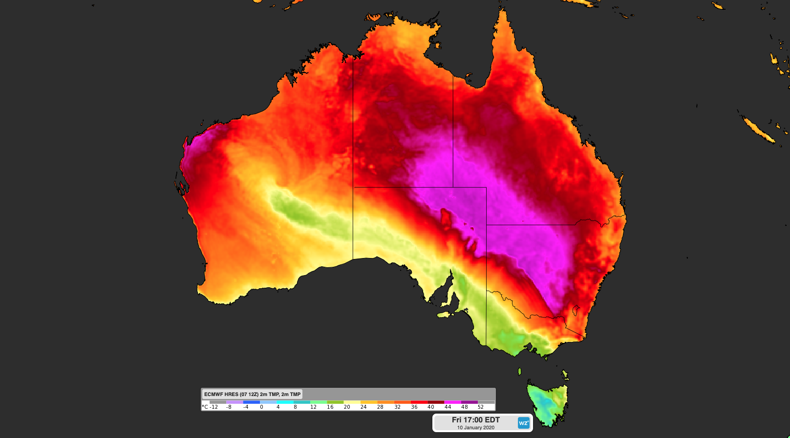
Image: Forecast surface temperature at 5pm AEDT on Friday, according to the ECMWF-HRES model.
Fortunately, this week's pulse of heat won't be as intense as recent weeks and the air will be more humid, leading to comparatively lower fire danger ratings. However, Severe ratings are still likely to occur in parts of NSW and Victoria, possibly reaching Extreme in northern Victoria.
A cool change will sweep over SA from late Thursday and spread over Victoria and Tasmania on Friday, before pushing into NSW from Friday afternoon into Saturday morning. This change should reach Adelaide on Thursday night, Hobart and Melbourne during the day on Friday, Canberra on Friday night and Sydney late Friday night or early on Saturday morning.
Moisture associated with the remnants of Tropical Cyclone Blake will cause showers and thunderstorms to develop in parts of SA, Tasmania, Victoria and NSW on Friday and Saturday, behind the cool change.
While this rain will be welcome in many areas, it won't be enough to extinguish all of the fires in southeastern Australia. At 6am on Wednesday, there were 119 fires burngin across NSW.