
Fire bans with snow on the way
Soaring temperatures and blustery winds are raising fire danger ratings in eastern Australia today, while a pool of snow-bearing cold air starts to spread over the nation's south.
A strong cold front crossing southeastern Australia on Friday is separating these two contrasting air masses.
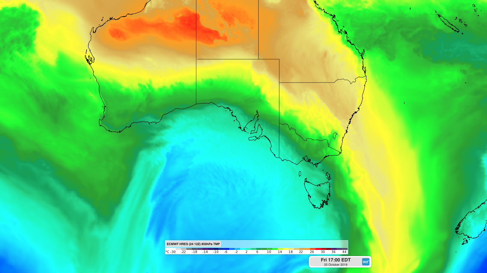
Image: Cold air spreading over southern Australia as warm air sweeps across the nation's east on Friday.
To the east of this front, temperatures have climbed more than 10 degrees above average in parts of NSW, where Very High fire danger ratings prompted total fire bans in some areas on Friday.
Sydney had already reached 36.4 degrees by 2pm, which is 14 above average for this time of year and the city's warmest October day since 2015.
Some other places in Sydney and eastern NSW were having their hottest October day in four years as of 2:00pm, including Penrith (38.2C), Moruya (35.6C) and Ulladulla (33C).
Shortly after 2pm, Sydney Airport registered 37.9 degrees, making this the site's hottest October day in 15 years.
The hot air will shift towards the Tasman Sea on Saturday, causing Very High to severe fire danger ratings in parts of NSW and Queensland. Fire bans have been issued in some areas on Saturday, including Sydney.
But while Australia's eastern state's are experiencing a taste of summer, much cooler air is affecting Tasmania, Victoria and South Australia in the wake of the front.
Melbourne was still sitting on 27 degrees at 7am on Friday in warm prefrontal northerly winds. By 9am, the mercury had dropped below 17 degrees as cooler southwesterly winds flowed over the city.
Adelaide was only 14.6 degrees at 1:30pm on Friday as showers passed over the city. This was much cooler than their 35.2 degrees at the same time on Thursday, prior to the arrival of the cold front.
Progressively colder air will spread over southern and southeastern Australia during the next two days, bringing a wintry mix of showers, thunderstorms, hail and snow.
The air should get cold enough for snow to reach about 800 metres elevation in Tasmania this weekend and 1100-1500 metres in Victoria and southern NSW on Saturday. Forecast models suggest that parts of the alps could see 5-10cm of snow from this system.
This system is causing severe weather in parts of eastern and southeastern Australia. Visit https://www.weatherzone.com.au/warnings.jsp for the latest warnings.