
‘Feels like’ temperature of -20°C at midday as Antarctic blast chills Tasmania
Bitterly cold winds are chilling Tasmania and the far southeastern mainland this Thursday, as a frigid airmass which originated near Antarctica crosses the region.
Due to the combination of cold air and strong winds associated with this system, some of the apparent or “feels like” temperatures in Tasmania were bone-chillingly low throughout Thursday morning and even the middle of the day.
The "feels-like" temperature accounts for humidity and wind to represent how hot or cold it actually feels, whereas "ambient temperature" is the actual air temperature measured by a thermometer.
How cold did it feel in Tasmania and the southern mainland on Thursday?
At midday, the 1271-metre summit of kunanyi/Mt Wellington above Hobart had an ambient temperature of -3.2°C, but mean wind speeds around 76 km/h made for an apparent temperature of -20.1°C.
At 9:30 am in downtown Hobart, the ambient temperature was 6.7°C but winds around 30 km/h meant that it felt like -1.2°C.
At 9 am, the notoriously windy Maatsuyker Island on Tasmania’s southwestern tip had an ambient temperature of 7.3°C and an apparent temperature of -13.8°C (due to mean wind speeds exceeding 100 km/h), which was impressively cold for a weather station located on cliffs beside the sea.
At 10:50 am, the tiny Tasmanian Central Highlands town of Liawenee had an ambient temperature of -0.8°C, with an apparent temperature of -10.5°C.
On the mainland, Mt William – the highest point in the Grampians in southwestern Victoria (summit 1167 m, weather station at 1150 m) – had an ambient temperature of -0.7°C and an apparent temperature of -8.5°C.
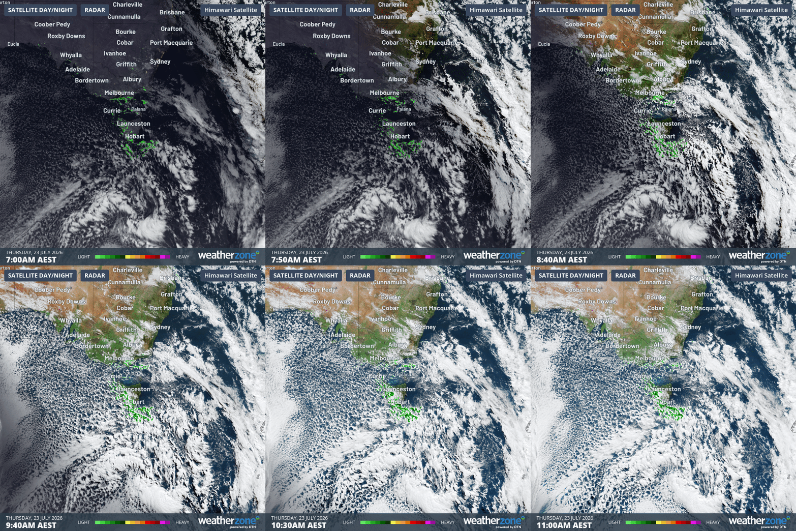
Image: Four-hour combined radar and satellite loop for Tasmania and the SE mainland to 11 am (AEST) on Thursday, July 23 2026. Source: Weatherzone.
How much rain and snow has fallen?
The satellite and radar loop above shows how Tasmania has caught most of the moisture from this system while the southeast mainland has largely missed out on significant precipitation, with the exception of the southernmost parts of Victoria.
In the 24 hours to 9 am Thursday, Wonthaggi in Victoria’s South Gippsland region received 23 mm, while several western Tasmanian locations exceeded 25 mm.
Widespread snowfalls have also been reported in Tasmania on Wednesday night into Thursday morning, with the snow level expected to drop as low as 300 metres above sea level today. That could mean flakes falling in Hobart’s highest suburbs.
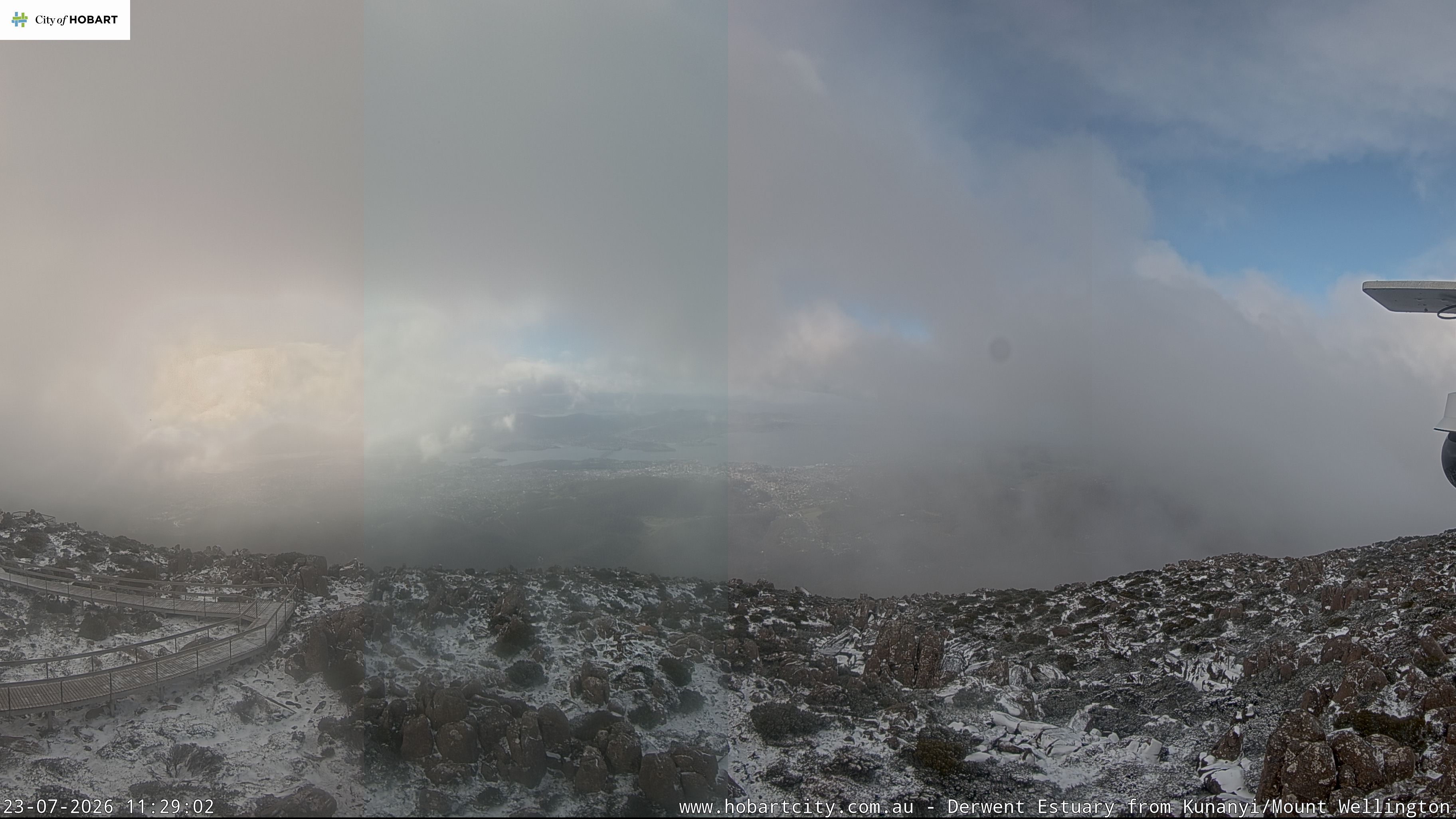
Image: The scene near the summit of kunanyi/Mt Wellington just before 11:30 am. Source: hobartcity.com.au.
Unfortunately, the mainland alpine region has only seen a dusting of snow thus far with this system, and while snow showers persist this Thursday, only a centimetre or two of fresh snow is likely to augment the moderate existing snow cover at most ski resorts.
As mentioned in our story on Wednesday, there are signs of a much snowier system for the mainland alpine region next week, and we’ll keep you informed about that one as the models update.
Please check the Weatherzone snow page for the latest forecasts, live cam images and more.