
Ex-Tropical Cyclone Seth lingering near southeast QLD
Dangerous waves, rain and blustery winds will continue to affect eastern Australia this week, with severe weather warnings in place for parts of QLD and NSW.
Over the last couple of days, popular holiday beaches and surf breaks along southeast QLD and northeast NSW have been feeling the impacts of Ex-Tropical Cyclone Seth.
While the former tropical cyclone hasn't yet made landfall, the system is been spiraling several hundred kilometers offshore and sending huge waves and blustery winds towards the coast.
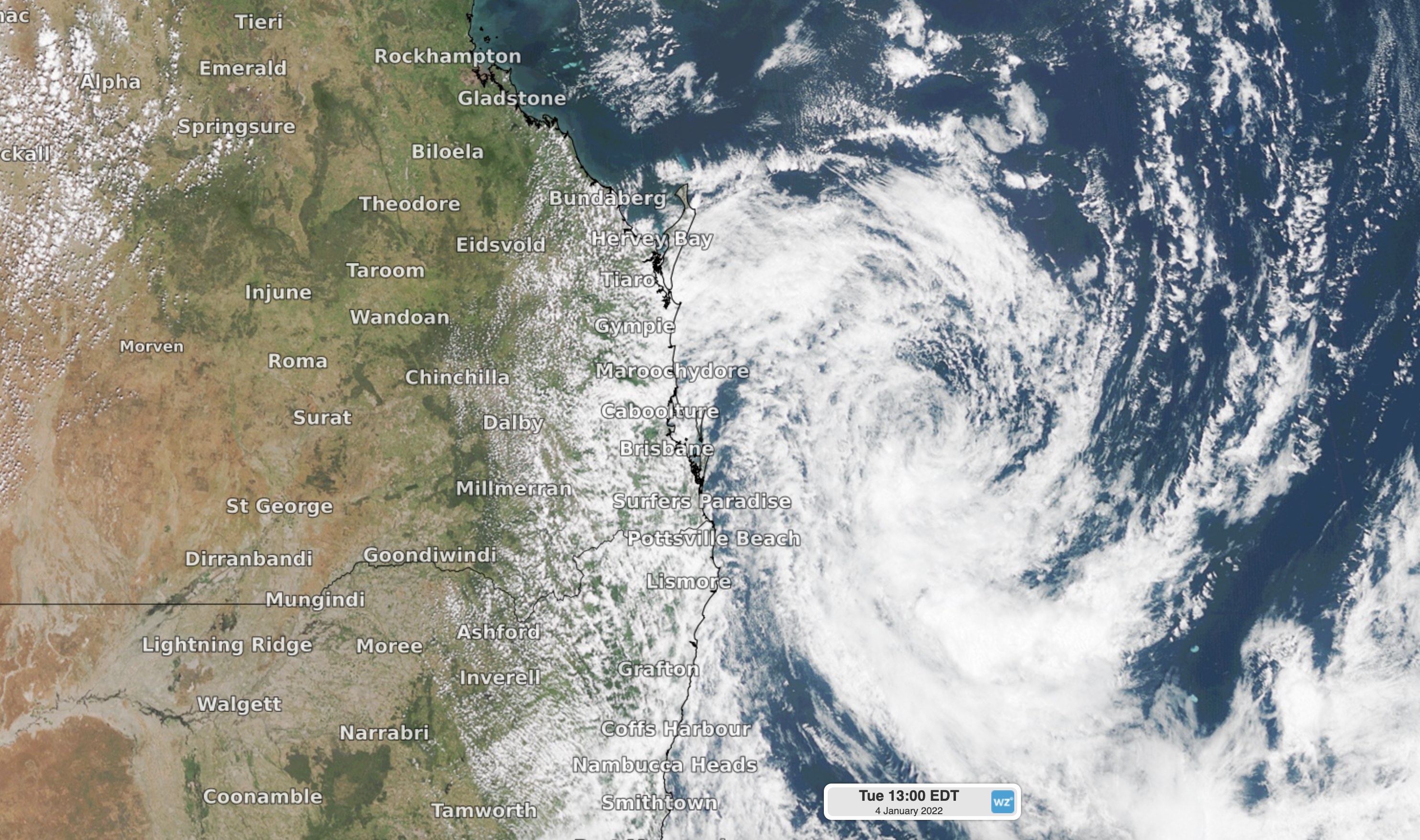
Image: Visible true colour satellite image of ex-Tropical Cyclone Seth at 1pm AEDT on Tuesday, January 4, 2022.
This easterly swell has been combining with high astronomical tides to cause coastal erosion and inundation in some areas.
Waverider buoys near Tweed Heads, North Stradbroke Island and Byron Bay all registered significant wave heights of around 4-5 metres between Sunday evening and Tuesday morning. On Monday night, maximum wave heights were hitting 10 metres off the coast of Byron Bay.
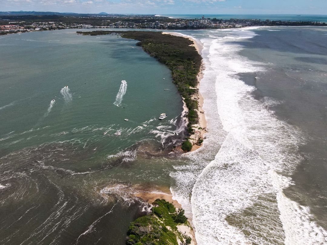
Image: Large swell and high tides combined to cut through Bribie Island, QLD. Source: @our.local.discoveries / Instagram
The impact of this swell is also being exacerbated by its long wave period, which is the time that elapses between the crests of each successive wave. Swells with longer periods have more energy and typically cause larger waves at the beach and more damage along the coast.
While this swell is slowly easing, it will continue to be dangerous for at least another day or two and will also spread further south along the NSW coast.
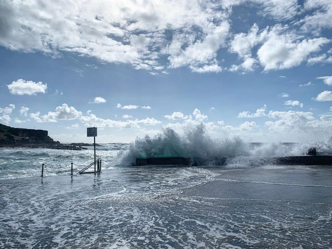
Image: Big waves and tids arrive in Clovelly, NSW at the peak of the summer holidays, on January 4, 2022. Source: @paperbark55 / Instagram
As of midday AEST on Tuesday, severe weather warnings were in place for damaging winds and abnormally high tides on some areas of northeast NSW and southeast QLD. A hazardous surf warning was also in effect from QLD’s Fraser Island down to the Illawarra Coast in NSW, including Sydney.
Ex-Tropical Cyclone Seth is expected to weaken and gradually move towards the northwest during the next few days. The movement of Seth, combined with a high pressure ridge above the Tasman Sea, will cause showery onshore winds over eastern NSW and southeast QLD during the next few days.
The moisture being pumped over southeastern Australia by the remnants of Cyclone Seth will also contribute to a more widespread rain and thunderstorm activity over NSW, the ACT, VIC and TAS between Wednesday and the weekend.
Check the latest forecasts and warnings for up-to-date details on the weather near you.