
Ex-Tropical Cyclone Luana intensifies over central Australia
Ex-Tropical Cyclone Luana has done something tropical cyclones don’t usually do: it gained strength over land three days after making landfall.
Luana made landfall as a category two tropical cyclone on the afternoon of Saturday, January 24, 2026, crossing the Dampier Peninsula coast to the northeast of Broome.
Luana quickly weakened over the Kimberley region after landfall and had become a tropical low pressure system, below cyclone strength, by Sunday morning.
Rapid post-landfall weakening is common for tropical cyclones because once they move over land, they become cut off from the warm sea water that provided energy prior to landfall.
However, on rare occasions, tropical cyclones and tropical lows can maintain or even gain strength over land.
Luana deepens over WA Interior
Ex-Tropical Cyclone Luana gained strength over the interior of WA on Tuesday, with its central pressure dropping slightly into the afternoon. Satellite images also show the tropical low maintaining very good structure throughout Tuesday, keeping a tropical cyclone-like appearance despite being around 600 km inland.
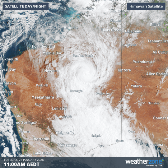
Image: Visible satellite images showing ex-Tropical Cyclone Luana moving over the WA Interior on Tuesday, January 27, 2026. Source: Weatherzone.
One reason ex-Tropical Cyclone Luana gained strength on Tuesday was a phenomenon known as the ‘brown ocean’ effect. This occurs when heat and moisture provided by water on and in the ground mimics the influence of warm ocean water. The WA Interior had received rain from cloud extending ahead of Luana earlier in the week, and this water helped maintain the system’s strength as it moved further inland.
It’s also likely that broad-scale weather systems surrounding the ex-tropical cyclone helped it gain some strength as it tracked south. This included a strong and near-stationary high to the east and a short-wave trough to the southwest.
Rain and flood threat for WA
Areas of heavy rain and damaging winds will spread south from the WA Interior as ex-Tropical Cyclone Luana tracks towards the south and weakens on Wednesday and Thursday. The heaviest rain and strongest winds will occur near and south of the low pressure system.
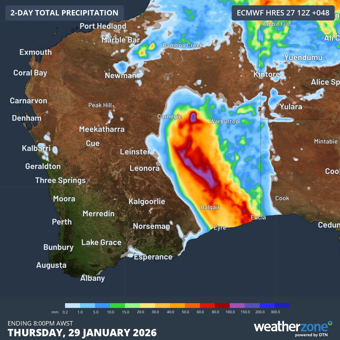
Image: Forecast accumulated rain during the 48 hours ending at 8pm AWST on Thursday, January 29, 2026. Source: Weatherzone.
A severe weather warning was in place on Wednesday morning for heavy rainfall and damaging wind gusts in parts of the South Interior, eastern Goldfields and northern Eucla districts. A flood watch has also been issued for parts of the Salt Lake and Nullarbor district rivers.