
Ex-Tropical Cyclone Lincoln causing severe weather in the NT, may re-develop in WA waters next week
A tropical low in the Gulf of Carpentaria reached cyclone strength very briefly around midday Friday and was named Lincoln. A few hours later Tropical Cyclone Lincoln crossed the NT coast near Borroloola. In the 24 hours to 9am (ACST) Saturday, thick convective cloud around the core of the tropical cyclone hammered Centre Island with a whopping 202mm of rainfall, a 7-year high amount. This Island is just off the coast near Borroloola.
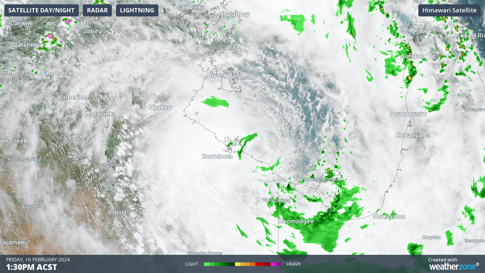
Animation: Himawari-9 visible satellite imagery, BOM radar and WZ lightning showing Tropical Cyclone Lincoln crossing the NT coast on Friday afternoon
Lincoln weakened below tropical cyclone strength overnight as it moved further away from the warm waters of the Gulf. However, the system still poses a serious risk of heavy and locally intense rainfall and damaging wind gusts with a warning currently active for parts of Carpentaria, Barkly, Gregory, and Tanami districts. A Flood Watch is also in place for several rivers.
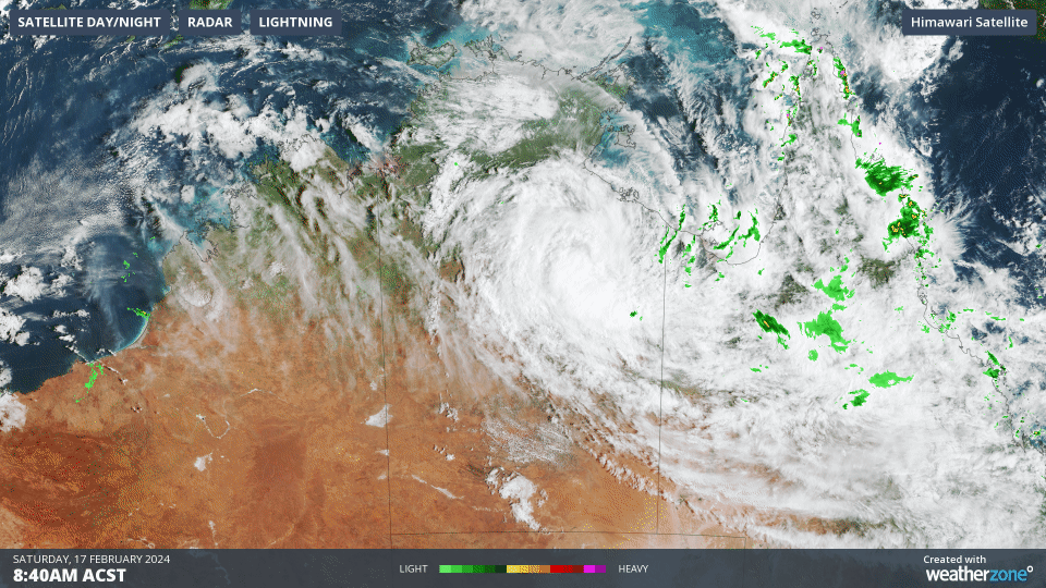
Animation: Himawari-9 visible satellite imagery, BOM radar and WZ lightning on Saturday morning
The tropical low is expected to move westward across the NT into WA, dumping hundreds of millimetres of rainfall along its track. It may reach the WA Kimberley region early-to-mid next week, and then possibly move back over water later in the week.
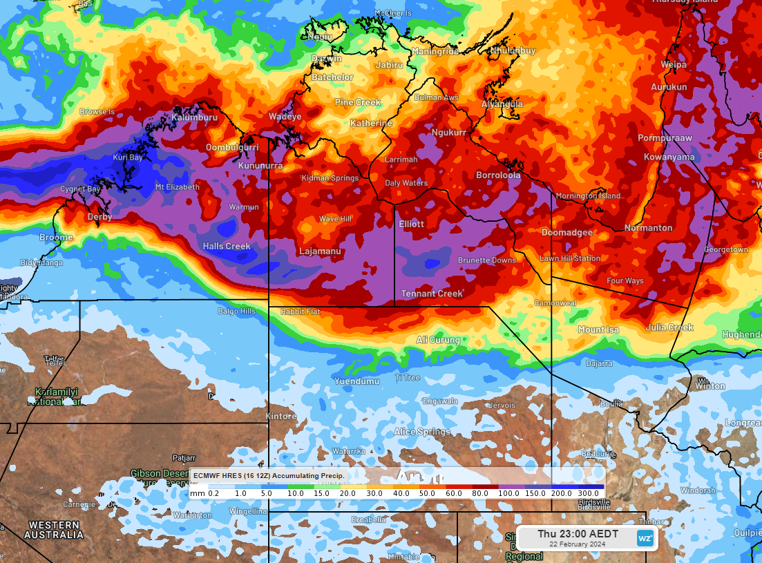
Image: Accumulating rainfall from Saturday 17th to Thursday 22nd according to the ECMWF model
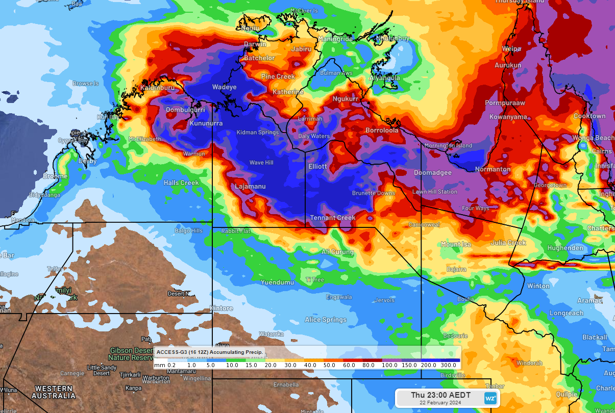
Image: Accumulating rainfall from Saturday 17th to Thursday 22nd according to the ACCESS-G model
If ex-Tropical Cyclone Lincoln makes it to the waters near the Kimberley or the Pilbara, then it could re-develop into a tropical cyclone, potentially a severe tropical cyclone. The BOM currently have a moderate chance for the system to reach tropical cyclone strength starting from late Wednesday.
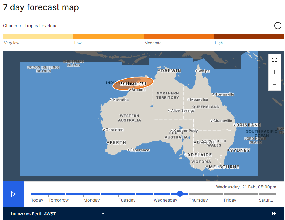
Image: BOM tropical cyclone probability forecast for Wednesday 21st 8pm AWST issued on Saturday 17th
If ex-Tropical Cyclone Lincoln redevelops then it would be the first tropical cyclone of the season to impact the WA region. This is an unusually late time for a first tropical cyclone in the WA region, most likely a result of the prolonged positive Indian Ocean Dipole which ended only about a fortnight ago:
The positive IOD is finally over (weatherzone.com.au)
Please stay up to date with the latest warnings and news at weatherzone.com.au.