
Extremely windy weekend ahead for southwest WA
Damaging winds are likely for Perth and parts of southwest Western Australia, especially near the coast, as a cold front roars in later this weekend.
Both Saturday and Sunday should see frequent showers, with comparatively calm conditions on Saturday morning before winds pick up in the afternoon.
The strongest winds will rip through the southwest on Sunday as a cold front crosses the coastline, with gusts possibly reaching 100-120 km/h in the Perth CBD and potentially exceeding 140 km/h in exposed coastal areas.
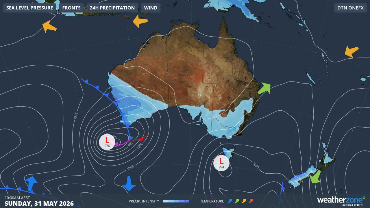
Image: Synoptic chart for Sunday, May 31, 2026, showing the low pressure system and associated cold front approaching southwest WA with isobars packed closely together (indicating strong winds) over a relatively widespread area around the low. Source: Weatherzone.
Why will it be so windy this weekend?
A complex low pressure system will push past the southwest tip of WA on the weekend, and an associated cold front will surge across the South West Land Division, followed by a powerful burst of westerly winds which will peak on Sunday.
"Even though we see cold fronts at this time of year, this is a strong system for late autumn or early winter," Weatherzone meteorologist Ben Domensino explains.
"The isobars are not just packed tight around the low, but all the way up the west coast as far as southern parts of the Gascoyne forecast district.
"The low is quite large in size and there’s a really strong pressure gradient as the low presses against the ridge of high pressure."
As of Friday afternoon, the only current wind warning in Western Australia is a strong wind warning up until midnight on Saturday for the following coastal areas: Perth Local Waters, Gascoyne Coast, Geraldton Coast, Lancelin Coast, Perth Coast, Bunbury Geographe Coast, Leeuwin Coast, Albany Coast and Esperance Coast.
Further warnings are likely to be issued by the BoM, including for some inland areas. Please check all the latest updates on the Weatherzone warnings page.
How cold and wet will it be?
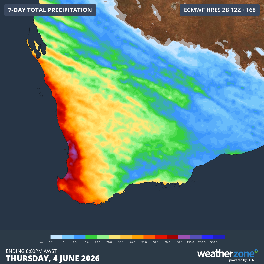
Image: Predicted rainfall accumulation in southwest WA to next Thursday, June 4, 2026, according to the ECMWF model. Source: Weatherzone.
Despite the likelihood of grey skies and intermittent downpours on both Saturday and Sunday, neither day will be particularly cold in Perth, with forecast maximums of 22°C and 21°C respectively.
Because of the strong winds, it will still be wise to rug up if you're attending the West Coast Eagles vs Essendon AFL match at Perth's Optus Stadium on Sunday evening.
In the cooler, unstable airmass behind the cold front, showery weather will persist into the neew week, with top temperatures in the high teens (close to the June average of 18.5°C) expected for the first few days of winter, which begins on Monday.