
Extreme fire danger after Darwin's hottest day of the year
A fire weather warning for extreme fire danger in the Darwin and Adelaide River district of the Northern Territory is in effect this Wednesday, as numerous fires burn in the immediate vicinity of the NT capital.
The NT government has two main categories for non-structural fires in the outdoors – bushfires, and grass and scrub fires – and both types of fires were burning this Wednesday.
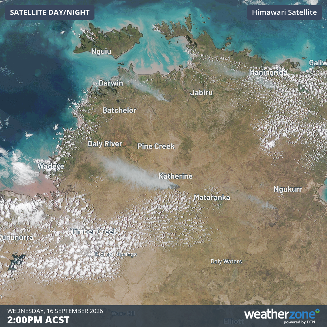
Image: Bushfire smoke can be seen near Katherine and southeast of Darwin at 2 pm (ACST) on Wednesday, September 16, 2026, Source: Weatherzone.
Let's take a look at the short-term and long-term weather conditions in Darwin which have fuelled today's extreme fire danger near the city.
Seasonal factors: dry season was even drier than usual
While minimal rainfall is expected during the middle of the year in Darwin, the city has still received less than usual to date in the 2026 dry season.
- As of this Wednesday, September 16, Darwin has received just 7 mm of rainfall since the commencement of the official dry season on May 1.
- May typically sees 20.0 mm of rainfall on average, but Darwin received just 2.2 mm.
- Rainfall in what southerners call the "winter" months of June, July and August is almost negligible in Darwin. But it's still worth mentioning that both July and August were bone dry in Darwin this year.
- So far in September, just 1.8 mm of rainfall has been recorded. The long-term monthly average is 16.8 mm.
- Darwin’s average monthly maximums and minimums were both around one degree above average during each of June, July and August.
The above differences from the average are relatively marginal (especially the rainfall deficiencies, given you are starting from such a low base).
But these factors have nonetheless dried out the Top End landscape a little more than usual.
This week's weather: southeasterly winds bring heat to the Top End
Darwin hit 36°C on Sunday, its hottest day of the year to date, while this Wednesday marks the seventh straight day that Darwin's maximum has exceeded September's average high of 32.7°C by at least a degree.
Interestingly, the same weather system which has pushed chilly winds to the southeast corner of the country is largely responsible for Wednesday's extreme Top End fire danger.
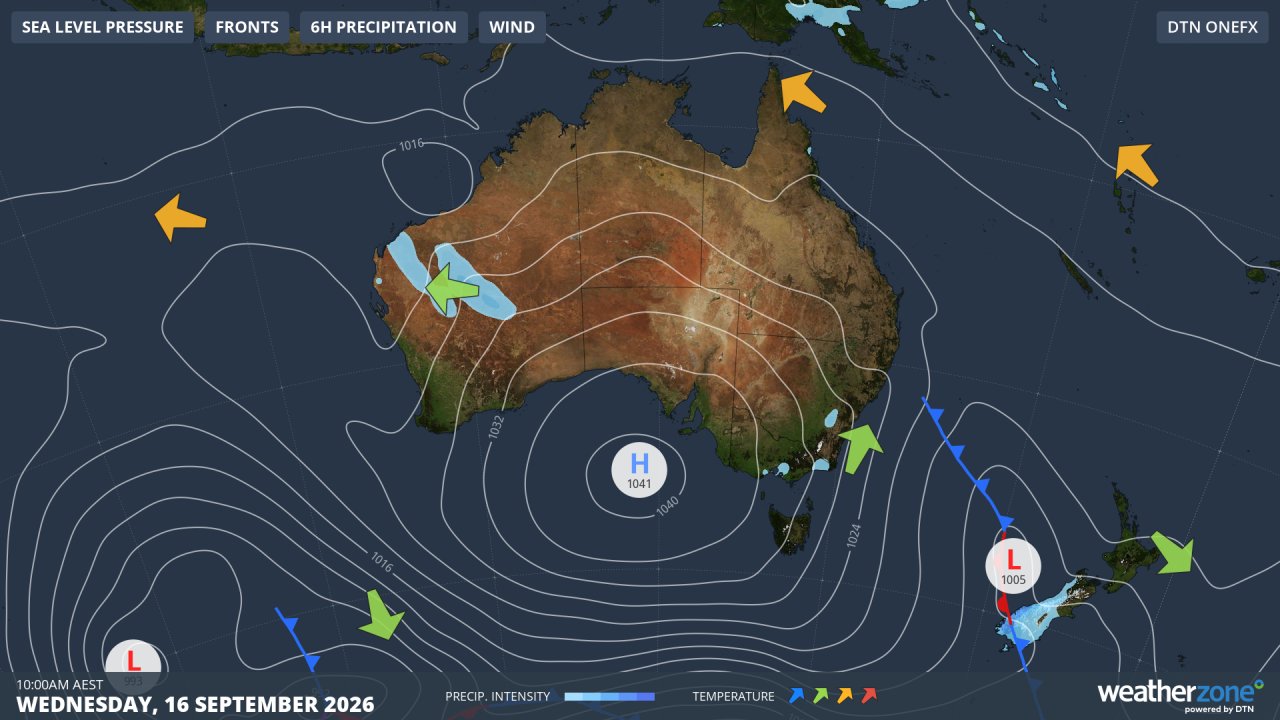
Image: Synoptic chart for September 16, 2026. Source: Weatherzone.
In the wake of a cold front that passed over the southeast corner of the country, air circulating anti-clockwise around the high pressure system continues to funnel chilly air with polar origins onto Tasmania and the southeastern mainland.
But as the air moves inland and continues to circulate around the high, it gains warmth from the interior of the continent and is very warm by the time it reaches the Top End.
Southeasterly winds are also gusty in the Top End this Wednesday, with gusts exceeding 50 km/h recorded in most NT forecast districts.
It all adds up to the classic recipe for Top End fire danger, and with more hot weather and no significant rain on the horizon for the next week, it's likely that further fire danger warnings will be issued.
You can monitor the location and status of fires on the NT Fire Incident Map.