
Explosion of vegetation in western Queensland

Images from space reveal that fresh vegetation has spread across western Queensland following heavy rain and flooding during the last four months.
Most of Queensland entered 2019 off the back a warm and relatively dry year. The state as a whole experienced its fifth warmest calendar year on record in 2018. While statewide rainfall was only 15 percent below the long-term average last year, parts of the central and southern interior registered annual totals in the lowest 10 percent of historical records.
However, things took a turn during the beginning of 2019. A series of monsoon troughs, tropical lows and ex-tropical cyclones caused widespread rain in parts of northern, central and southern inland Queensland between January and April.
By the end of April, year-to-date rainfall totals were in the top 10 percent of historical records for parts of northern and western Queensland.
Unsurprisingly, this rain lead to prolonged riverine flooding in the state's western inland. Rain that fell in Queensland during February has been steadily filling Lake Eyre during the last several weeks. Meanwhile, rivers in southwest Queensland were still experiencing major flooding in April from rain that fell back in March.
The above-average rain at the beginning of 2019 has produced a blanket of fresh vegetation across large areas of outback Queensland.
Satellite images from space show how the appearance of the landscape has drastically changed since the end of 2018. Images from NASA's Suomi NPP satellite reveals that large areas of inland Queensland have been taken over by new plant life.

Image: False-colour image from NASA's Suomi-NPP satellite on November 19th, 2018. Credit: NASA Worldview.

Image: False-colour image from NASA's Suomi-NPP satellite on February 12th, 2019. Credit: NASA Worldview.

Image: False-colour image from NASA's Suomi-NPP satellite on May 5th, 2019. Credit: NASA Worldview.
The Normalised Difference Vegetation Index, which uses satellite data to monitor the amount of live green vegetation, also shows that plant life has been above average in western Queensland during the last few months.
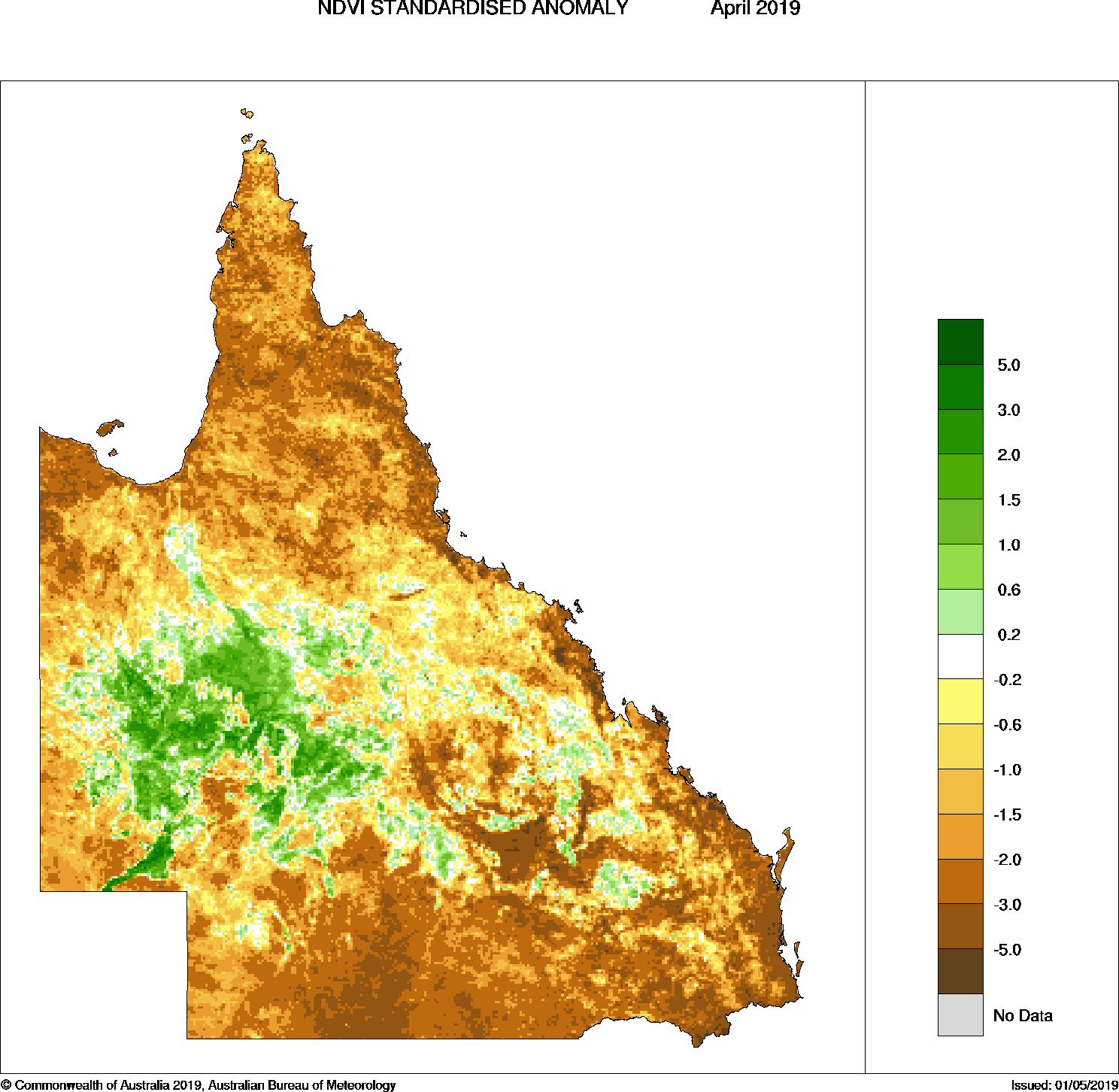
Image: Normalised Difference Vegetation Index (NDVI) anomaly in April 2019. Source: BoM
Floodwater from Queensland is expected to continue flowing into Lake Eyre until at least June.