
Equal-lowest South Australian minimum in five years
A deep midwinter chill descended on South Australia overnight, with the state recording its lowest minimum in three years – and the equal-lowest in five years – when Yunta fell to -5.0°C just before 7 am on Wednesday.
Yunta is a small town 275 km NE of Adelaide in the far south of SA’s North East Pastoral forecast district, at an elevation of about 300 metres above sea level.
The tiny map speck of 60 residents has an arid climate with just 205.2 mm of rainfall annually, and August is typically the driest month with just 12.7 mm on average. Last night was the sixth consecutive night that the town has shivered through sub-zero temperatures.
Last night’s minimum in Yunta was also just 1.6 degrees warmer than the record state August low of -6.6°C, which also occurred in Yunta (in 2014).
Widespread frigid temperatures in South Australia overnight
It was chilly in plenty of other South Australian locations overnight too, with the mercury falling below zero at some coastal weather stations including Port Pirie (-0.4°C) and Port Augusta (-0.3°C).
Adelaide had its coldest night of the month so far with a low of 4.4°C while the airport fell to 1.9°C.
Clare, at the centre of the famous Clare Valley wine area about 130 km north of Adelaide, had its coldest night of 2026 to date with a low of -1.9°C.
Why was last night so cold in parts of South Australia?
A high pressure system centred over the region around the SA/NSW border ensured calm, dry conditions overnight. This allowed rapid cooling of the wintry airmass lingering over parts of SA in the wake of a cold front that moved through on Monday.
It’s worth noting that the far southeast of the state – which often provides the statewide low at towns like Keith – wasn't quite as cold as some other areas overnight due to slightly higher humidity.
Western parts of SA also weren’t unusually cold, due to slightly warmer air ahead of the next cold front approaching Western Australia, and thickening cloud cover which provided a blanket effect.
Will the very cold SA nights continue?
The short answer is no. Yunta is expecting a minimum of 1°C on Thursday morning, which is hardly warm, but it would still be six degrees warmer than Wednesday's minimum.
Windy weather will prevent overnight cooling to freezing levels across virtually the whole of SA in coming days, as a procession of troughs and weak cold fronts surges across southern parts of the state ahead of a strong cold front due Sunday.
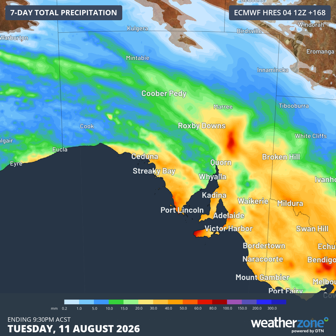
Image: Predicted rainfall totals across South Australia up until Tuesday, August 11, 2026, according to the ECMWF model. Source: Weatherzone.
The South Australian weather story will then be dominated by chilly maximums and low “feels like” temperatures rather than cold minimums. Rainfall will also be a big part of the picture, with Sunday looking particularly wet for Adelaide and many other areas.