
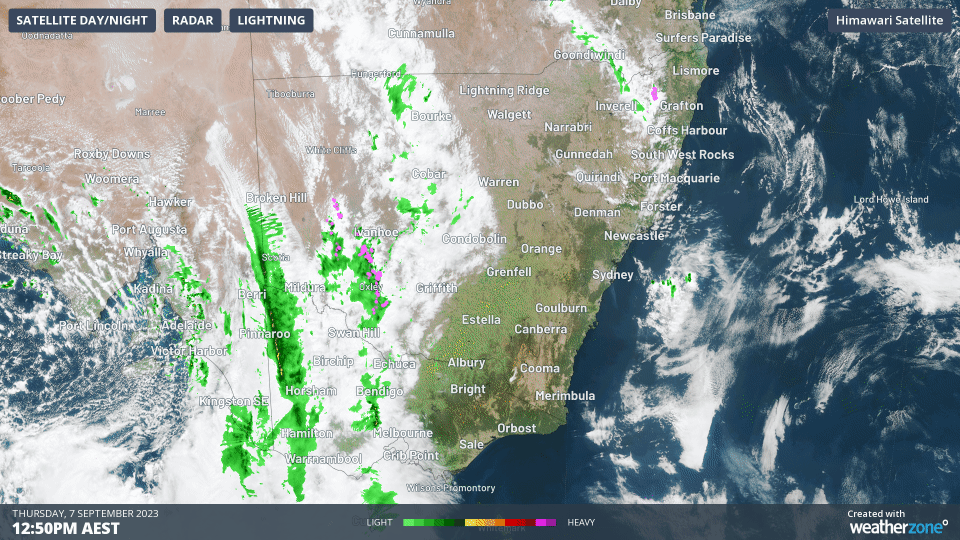
Enormous line of storms crossing three states
The strong early spring cold front continues its march across eastern Australia, generating wild winds and a huge line of storms stretching from southern Qld, all the way through NSW, and into Victoria.
No notable rainfall totals have been reported yet with this system in NSW or Vic as it's moving pretty quicky and tending to drop just a few millimetres of rain in most places.
But winds are extremely wild, with a reading at 3:45 pm of 122 km/h at Mt William in The Grampians in western Vic, and just under 100 km/h at several locations in the Victorian Alps.
Severe weather warnings are in place for two states, as well as numerous other alerts, so please check our warnings page for the latest.
Another feature of Thursday afternoon's wild weather is the sharp temperature contrasts either side of the front.
As mentioned this morning, Adelaide was around six degrees cooler at midday than midnight, while numerous locations lost up to 10 degrees during daylight hours after the front passed through.
- For example, Hay Airport in the NSW Riverina region reached 28.2°C just before 12:30 pm, but by 3:30 pm it was 17.4°C
As for Melbourne, it was still sitting above 20 degrees as we write this story late on Thursday afternoon, having reached a top of 22.1°C just before 3 pm.
Don't expect those warm temps to last much longer. As we wrote yesterday in our AFL footy finals weather story, the cold air and showers should arrive just in time to make things really uncomfortable at the MCG tonight for the match between the Magpies and Demons.