
End of summer heatwave to sweep over southeast Australia
As autumn closes in on Australia, a wave of heat will swing across southern and eastern Australia in the final few days of summer.
Inland heat currently over eastern Western Australia will start moving into South Australia over the coming days. Tuesday will be the hottest day of this coming spell for much of the state, with Adelaide set to reach 36°C, and parts of the west and north expected to reach into the 40s.
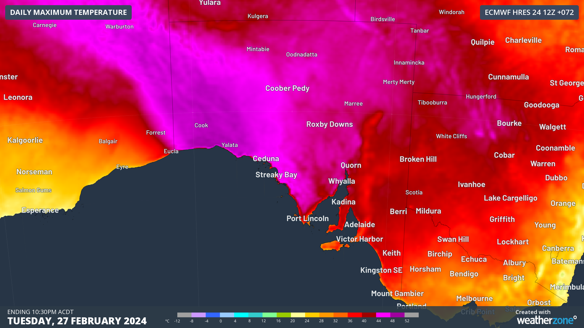
Modelled daily maximum temperatures on Tuesday 27th February over South Australia.
On Wednesday, while northern and eastern South Australia will remain warm, the focus of this heat will shift to Victoria and western New South Wales. Temperatures will peak in the low 40s over northern Victoria and much of western New South Wales, with Melbourne also set to reach 36°C. As Wednesday goes on, a cold front will cross southern South Australia and into Victoria, bringing the potential for some rapid cooling in Melbourne later in the day.
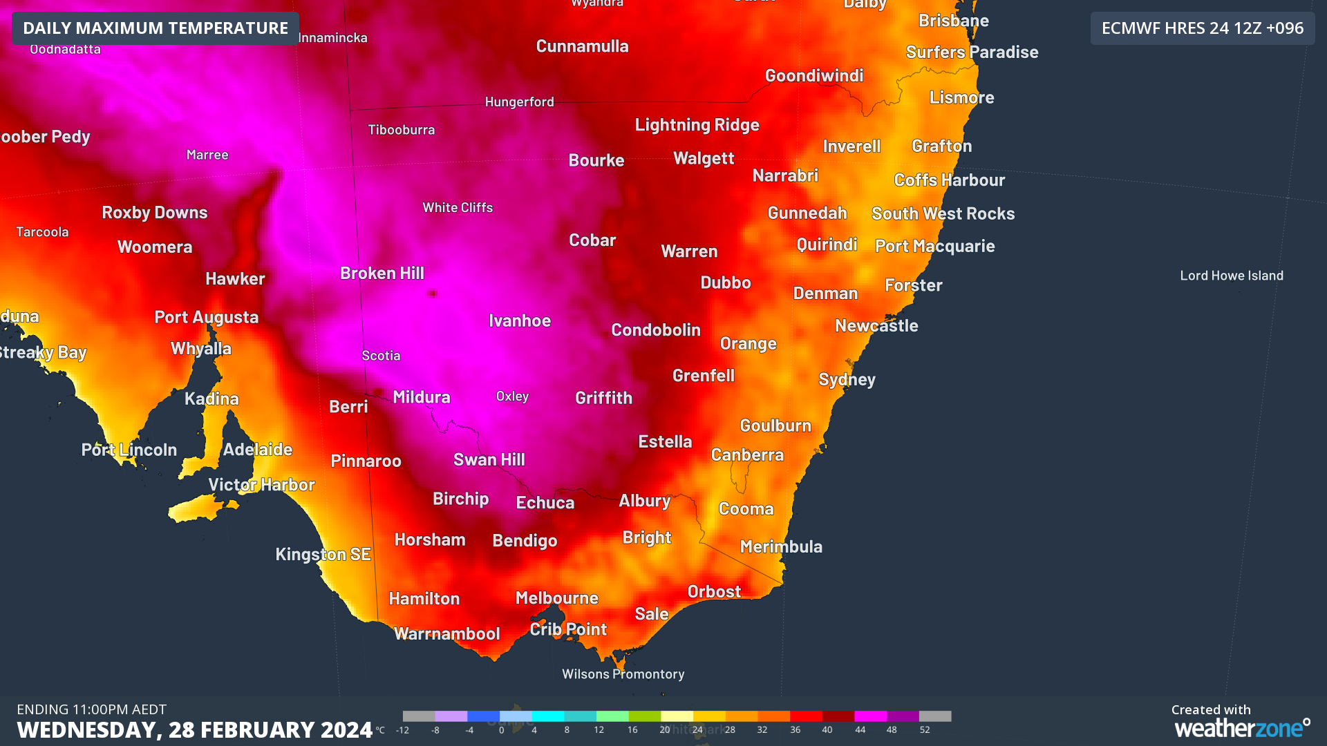
Modelled daily maximum temperatures on Wednesday 28th February over southeastern Australia.
By Thursday, this intense inland heat will start easing, but large parts of New South Wales are set to reach the high 30s and low 40s. Sydney is forecast to reach 35°C on Thursday, while western suburbs are expected to reach close to 40°C. In a fitting end to this warm and humid summer, a brisk and gusty southerly change is forecast to reach the Metropolitain area in the late afternoon or evening, wiping away the build-up of heat and humidity into the start of autumn.

Low Intensity to Severe Heatwave conditions across much of New South Wales between Wednesday and Friday.
While the start of autumn will not quite be cool following this heat, a reduction in humidity is expected for parts of eastern Australia, making it feel more fit for the new season. A more significant cold front is indicated around next weekend, bringing a more definite drop in temperatures, at least for the next week and a bit.