
Edmund Fitzgerald and the Witch of November
This month marks 50 years since the tragic sinking of the SS Edmund Fitzgerald in a storm on Lake Superior, a storm known locally as the ‘Witch of November’.
The ship set sail from Superior, Wisconsin, on November 9th, 1975, at 2:20pm Central Time, on a 746 mile route to Detroit, laden with 26,000 tons of taconite pellets (balls of iron ore).
20 minutes after departure, the National Weather Service issued gale warnings (later upgraded to storm warnings), and at 1:00am on the 10th, the Edmund Fitzgerald reported wind speeds of 52 knots with 10 feet waves, 20 miles south of Isle Royale. Not too much of a problem for a vessel of that size; but conditions would only worsen. Winds reached 70-75 knots in the brunt of the storm, with wave heights of 25 feet.
“One of the worst seas...”
Radio transmissions revealed that the ship suffered topside damage later that day, and by about 4:00pm had lost both its radars. One to two hours later, it was listing badly with heavy seas breaking over its deck: “One of the worst seas I’ve ever been in”, according to Captain Ernest McSorley.
The last message received from the Edmund Fitzgerald was “we are holding in our own” at 7:10pm. Sadly, they were not, and sometime between 7:20 and 7:30pm the ship was hit by a squall, and, along with all 29 on board, was lost to the fearsome weather, just 20 miles short of shelter at Whitefish Bay, Michigan.
The wreckage was not officially identified until May of 1976, after which, in July, the U.S. Coast Guard released its conclusion that the ship most likely took on water through improperly closed hatches, although other theories were put forward: hull damage from striking the bottom, rogue waves, structural problems or cargo overload.
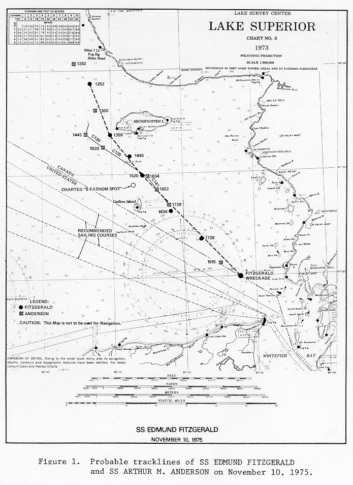
Image: Possible trackline/course of the SS Edmund Fitzgerald (black circles) according to the National Transportation Safety Board. Source: NTSB / Wikimedia Commons
Explosive Cyclogenesis
The storm that ultimately brought the demise of the Edmund Fitzgerald started out innocuously enough as a low pressure system moving out of the Rockies and across Oklahoma on November 8th. It then turned northeasterly on course for the Great Lakes and Midwest, steadily deepening, with the center passing over Lake Superior late morning on November 10th.
That actually brought some temporary respite from the wind, but as it continued onwards towards Hudson Bay the depression underwent explosive deepening, with its central pressure dropping 28hPa in just 18 hours.
Winds initially blew across Lake Superior from the east to northeast, which had prompted Captain Ernest McSorley to set a course farther north than usual, to take advantage of some shelter from the Canadian coastline. But as the deepening storm passed, winds backed northwesterly or west-northwesterly and strengthened. This meant a longer fetch across the width of Lake Superior, causing mounting waves and swells across eastern and southeastern portions: exactly where the doomed vessel was heading.
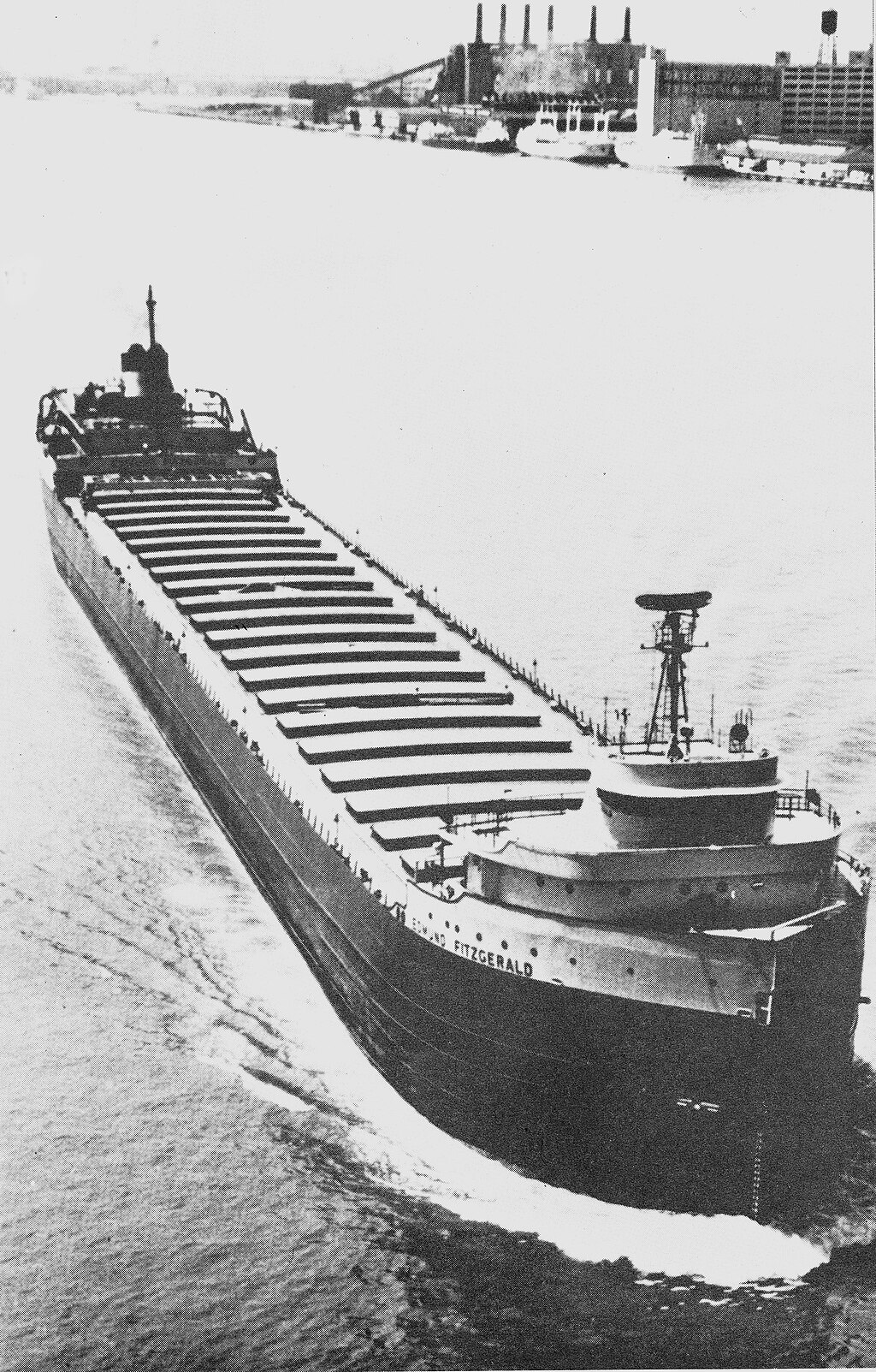
Image: The Edmund Fitzgerald in ballast. Source: U.S. Coast Guard / Wikimedia Commons
Witch of November
Although a powerful storm, this was not a particularly unusual event for the Great Lakes, especially in late fall. In fact, November is known in the region as the month of storms, and such an event is well-known enough to have a name: a Witch of November or November Witch; or also known more simply as a November Gale.
Many of the lost boats and ships in the Great Lakes over the centuries can be attributed to November Witches. The Mataafa Storm of November 27-28, 1905 is another example from Lake Superior, when the eponymous steamship and about 28 other vessels foundered in storm force winds and blizzards, with the loss of 36 lives. And between 7th and 10th of November 1913, the “Big Blow” or “White Hurricane” also brought stormy, near hurricane-force winds and whiteouts, sinking ships across four of the five lakes.
Why November?
As fall progresses, the shortening days at high latitudes mean that temperatures steadily turn colder, while the tropics and even the middle latitudes cool more slowly. The overall difference in temperature from north to south – the ‘temperature gradient’ – therefore becomes steeper.
This steep temperature gradient can provide energy to power the jet stream and fuel mid-latitude low pressure systems, with moist, warm air ahead of them converging with surges of cold and drier Arctic air behind. Further impetus is supplied by the vast reservoir of relatively warm waters across the Lakes themselves before they start to cool and freeze heading through winter.
Typically, the weather systems that kick-off these intense depressions are of a couple of types: Colorado Lows / Panhandle Hooks (like the Edmund Fitzgerald storm) or Alberta Clippers, which quickly slide across from the Canadian Prairies. Either way, they can spawn some of North America’s roughest weather conditions, outside of hurricanes and tornadoes.