
Eastern NSW bracing for heavy rain
A period of intense rain and damaging winds will hit parts of eastern NSW early next week, with flooding likely in some parts of the state.
A pair of low pressure troughs are already causing showers over a broad area of Australia this week, with the satellite image below showing plenty of cloud above NSW and Qld on Thursday.
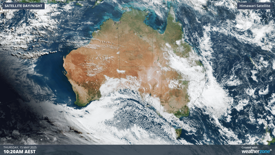
Image: Visible true-colour satellite image showing cloud over Australia on Thursday afternoon.
Some of this rain has been heavy, showing that the atmosphere is holding plenty of moisture. In the 24 hours ending at 9am on Thursday, Moree Airport in northern NSW collected 47.4 mm, which was the site's heaviest May rain in records dating back to 1995.
The pair of troughs will continue to cause showers and a few thunderstorms over parts of NSW and Qld during the next few days, including locally heavy falls. This wet end to the week will be a preview of a period of much heavier rain over eastern NSW early next week.
A cut-off upper-level low pressure system will cause a surface-based low pressure trough to deepen near the NSW coast from Sunday into early next week. This deepening coastal trough, which may also contain an embedded low pressure system, should produce two-to-three days of heavy rain and blustery winds from about Sunday to Tuesday.
While there is some model disagreement regarding the location, duration and intensity of this rain and wind event, the most likely area to be affected will be the central coast and ranges of NSW from Sydney and the Blue Mountains up to the Mid North Coast, including the Hunter.
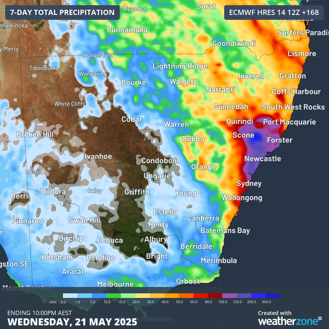
Image: Forecast accumulated rain during the 7 days ending at 10pm AEST on Wednesday, May 21, according to the ECMWF-HRES model.
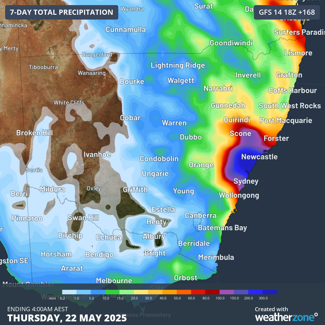
Image: Forecast accumulated rain during the 7 days ending at 4am AEST on Thursday, May 22, according to the ECMWF-HRES model.
Based on current model guidance, accumulated rainfall totals of 100 to 200 mm are likely between Sunday and Tuesday, with isolated falls of about 300 to 400 mm. This rain will be falling onto ground that is already wet from recent rainfall, including what’s falling this week, which will heighten the risk of flooding.
In addition to the rain, the coastal trough and embedded low will cause powerful onshore winds that could produce damaging gusts and large waves in some areas during Monday and Tuesday.
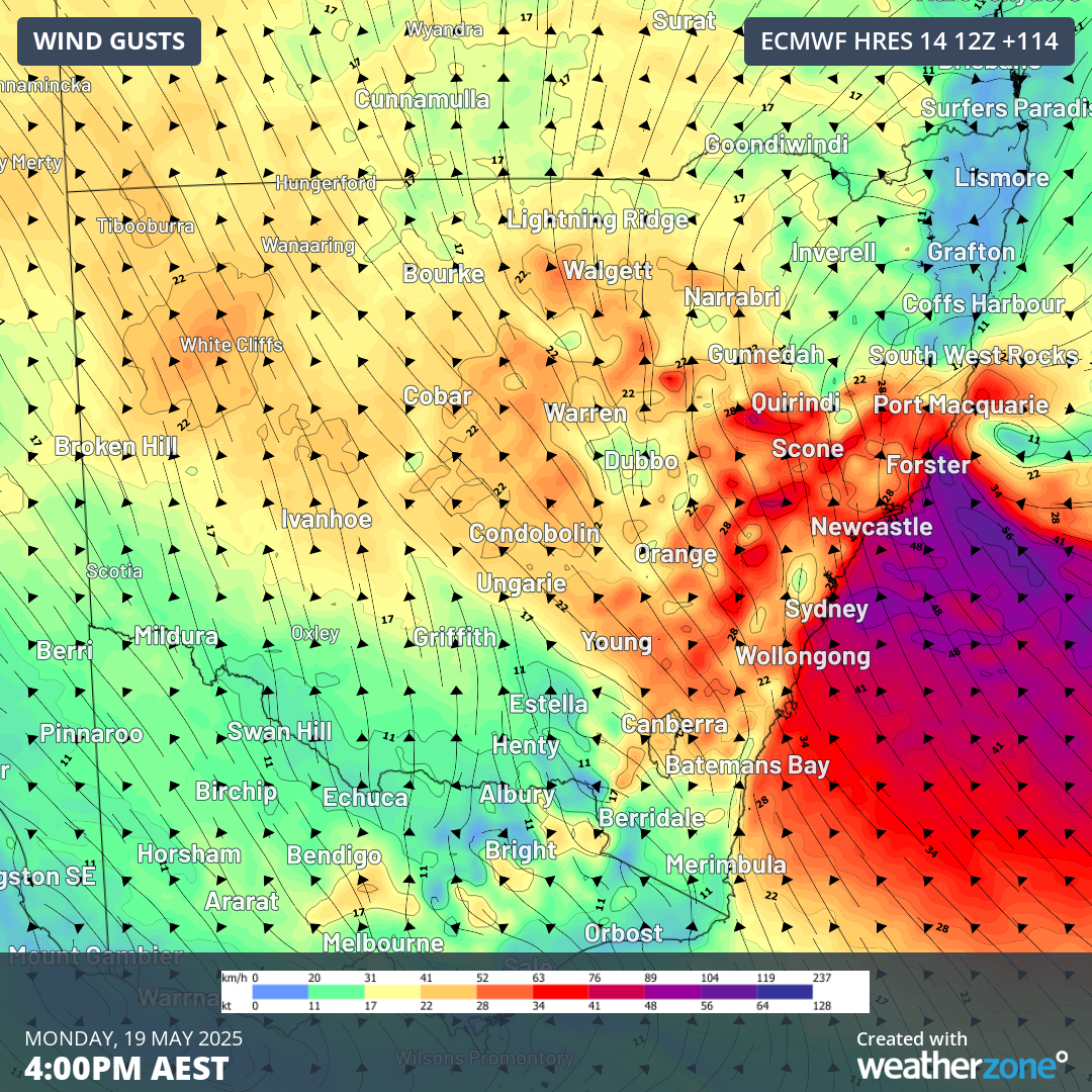
Image: Forecast wind gusts at 4pm AEST on Monday, May 19, according to the ECMWF model.
Most forecast models suggest the trough will move away from the NSW coast on Wednesday, allowing rain and wind to ease. However, this won’t be the end of the dangerous weather.
A cold front sweeping over southeastern Australia in the middle of next week will drive cold south to southwesterly winds across eastern NSW on Thursday. These cold winds may become strong enough to bring down trees in the rain-softened soil when they reach their peak strength on Thursday.
This is a dynamic weather system and details may change from day to day. Anyone living in eastern NSW, particularly between Sydney and Coffs Harbour, should keep a close eye in the latest forecasts and warnings in the coming week.