
Eastern Australia watching Tropical Cyclone Uesi
A tropical cyclone located to the north of New Caledonia could move closer to Australia later this week. After days of heavy rain and flooding in parts of Queensland and NSW, many are wondering: will Uesi impact Australia?
- Where is Uesi now? -
Tropical Cyclone Uesi formed to the west of Vanuatu at midnight (Fiji time) on Sunday night. By midday on Monday, Uesi had moved south and strengthened into a category two tropical cyclone.
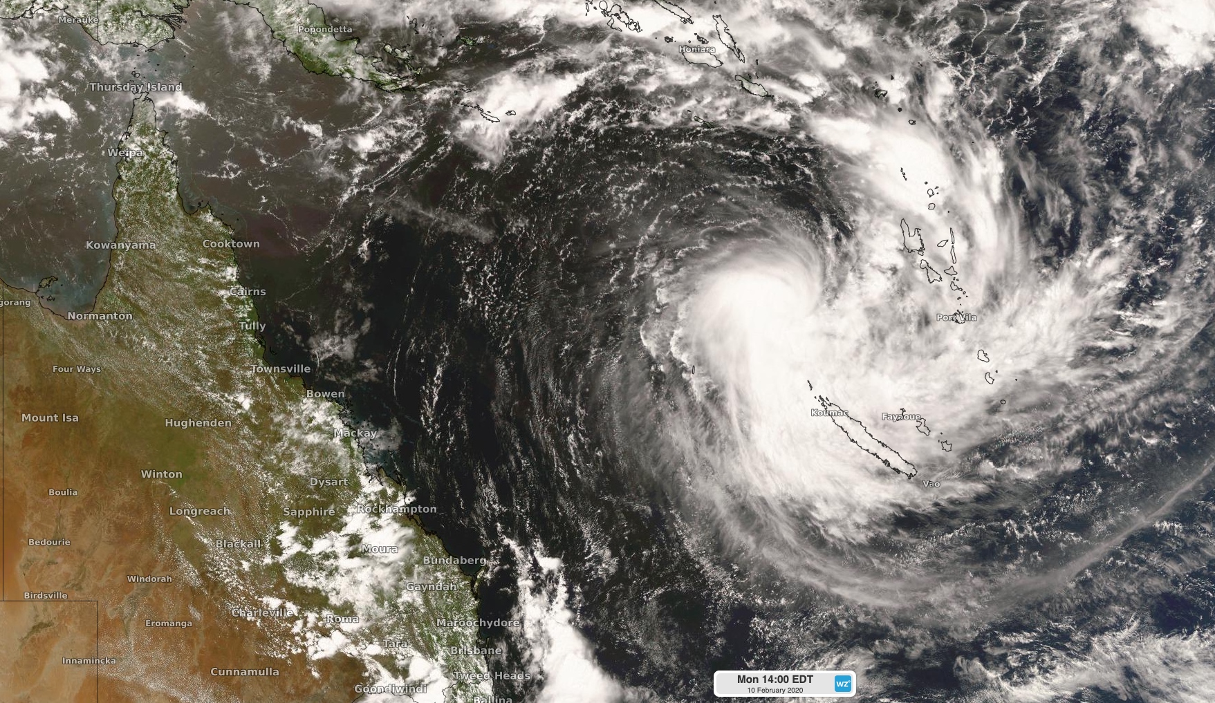
Image: Tropical Cyclone Uesi on Monday afternoon.
Cyclone Uesi should continue to strengthen as it moves towards the south during the next 24 hours, with the Fiji Meteorological Service predicting the system will reach category three intensity by midday on Tuesday.
As Tropical Cyclone Uesi continues to move south, it should pass close to the north of New Caledonia's Grande-Terre Island on Tuesday night or Wednesday, most likely as a category two system. According to Meteo-France, weather is likely to deteriorate in northern New Caledonia between now and Wednesday and a coastal crossing on the islands of Belep or Grand Terre can't be ruled out.
- Where will Uesi go next? -
After impacting northern New Caledonia through to Wednesday, Tropical Cyclone Uesi should continue moving towards the south while weakening. The official track map issued by the Fiji Meteorological Service suggests that Uesi will have weakened to category one tropical cyclone by Wednesday night and be located over the southeastern Coral Sea, roughly 1,000km away from Australia's east coast.
Where Uesi moves beyond Wednesday night will be of interest to communities in eastern Australia, particularly coastal areas that have recently been affected by damaging surf and flooding.
At this stage, there is a fair bit of uncertainty around the movement of this system from Thursday onwards, with a range of plausible scenarios.
Some forecast models suggest that Uesi will move towards the southwest on Thursday and Friday, which would allow it to move closer to Australia's east coast towards the end of the week. If this happens, the remnants of Tropical Cyclone Uesi, most likely in the form of an extra-tropical cyclone, could cause direct impacts in eastern NSW or southeast Queensland. These impacts could include large and dangerous surf, strong winds and heavy rain. It's worth pointing out that dangerous wind and rain would only occur if the system gets close enough to the coast, while powerful surf can reach Australia even if the system stays well offshore.
It's also entirely possible that Uesi will stay far away from eastern Australia as it moves south into the Tasman Sea later this week. It's simply too early to know with certainty.
Given the range of possibilities towards the end of this week, people living in eastern Australia should keep an eye on the development of this system without getting alarmed at this stage.