
Eastern Australia next in the firing line
The ever deepening low that brought severe thunderstorms to Western Australia yesterday, and is smashing South Australia today, will continue its south-eastern trajectory over the coming days. Unfortunately, this doesn’t mean the eastern states are spared from the incoming horrendous weather. A trough and cold front extending northwards from the low will continue to draw in tropical moisture and generate yet another thunderstorm outbreak across the eastern states on Monday.
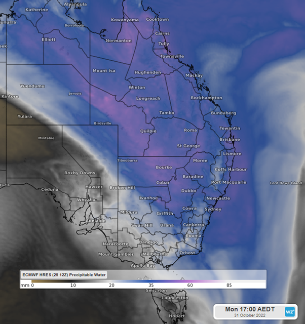
Image: precipitable water over eastern AUS on Mon 31st 5pm AEDT using ECMWF
Thunderstorms are already pushing into far western NSW, QLD and VIC this afternoon, potentially becoming quite intense in VIC later tonight as the low passes just to the south of the mainland. These thunderstorms could generate heavy rain and damaging wind gusts exceeding 100km/h. Coober Pedy has already seen a wind gust of 102km/h due to one of these storms this morning. Even outside of these storms, wind gusts are likely to exceed 80km/h in TAS, as well as parts of SA, NSW, VIC & QLD as strong winds get pulled into the low.
On Monday, the focus will turn to inland NSW, QLD and northern VIC as the trough and cold front sweep across the eastern states. Storms are likely to flare up in the morning across western NSW and northern VIC, spreading towards the western slopes, and then north into Queensland as the day progresses.
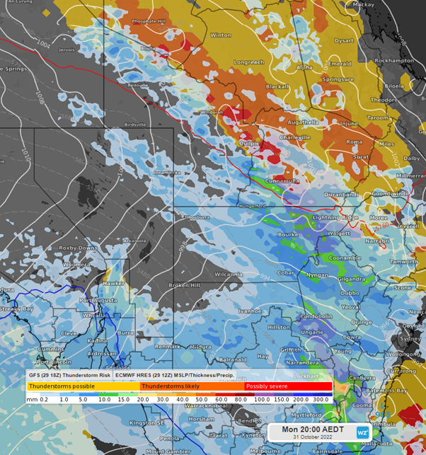
Image: 3hr total precipitation and GFS thunderstorm risk on Mon 31st 8pm AEDT using ECMWF
While this may not be the most severe or long lasting of the series of thunderstorm outbreaks we have seen over the last two months, there are some indications that a squall line could form during the day. If this eventuates, storms could bring flash flooding, large hail, and damaging wind gusts exceeding 90km/h well into the night. By Tuesday morning, the system will be crossing the QLD coast, having cleared from NSW. But that’s only the start of what will be an unusual week for weather, as frigid air behind the cold front is set to temporarily plunge southeast Australia back into the middle of winter.
Make sure to keep up with the latest information and warnings as the system moves through the east here.