
Eastern Australia heating up as wetter weather sets in for the south
A developing negative Southern Annular Mode (SAM) will influence weather patterns across the Australian region this week, favouring relatively cool and wet weather in the country’s south and much warmer conditions in the east and north.
Negative SAM emerging
Recent warming in the stratosphere high above Antarctica is causing a negative SAM pattern to develop in the southern hemisphere this week.
A negative SAM is associated with a northward shift in the belt of westerly winds that flows between Australia and Antarctica. During spring, a negative SAM pattern typically causes cold fronts and low pressure to deliver more rain in southern Australia, while high pressure systems centred further north cause drier and warmer weather across much of northern and eastern Australia.
This week’s weather patterns across Australia will reflect the developing negative SAM and promote the following conditions:
- Southern Australia can expect to see frequent showers and periods of relatively cool weather in predominantly west to southwesterly winds.
- Northern and Eastern Australia will be dry and warm to hot under the influence of high pressure and dry continental air masses.
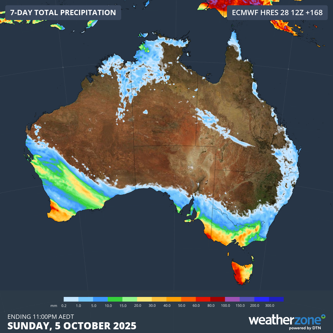
Image: Forecast accumulated rain this week, showing most of the rain falling over southern and southwestern Australia and indicating less wet weather in the north and east.
This week’s contrasting weather can be highlighted by comparing the forecasts across Australia’s southern and eastern cities.
Brisbane and Sydney are both in the area of eastern Australia that will see plenty of warm and dry weather this week. Brisbane is forecast to reach the low to mid-thirties on Monday and again from Wednesday to Friday, peaking at 34 to 35°C on Thursday. Sydney will also reach the high twenties from Tuesday to Thursday.
By contrast, Melbourne and Adelaide will see several days only reaching the mid to high teens this week, with showers also likely on multiple days.
Thursday will be a particularly contrasting day across southeastern and eastern Australia, with the following forecast maximum temperatures:
- Brisbane: 34°C
- Sydney: 28°C
- Canberra: 19°C
- Adelaide: 17°C
- Melbourne: 16°C
- Hobart: 17°C
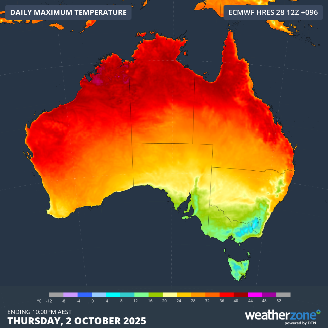
Image: Forecast maximum temperature on Thursday, October 2, 2025, showing warm air over northern and eastern Australia and cooler temperatures over the country’s south.
Northern Australia will see heat building up under this week’s weather pattern, with temperatures likely to reach the low forties in parts of the Kimberley, Pilbara and Top End. This won’t be the first time temperatures have exceeded 40°C in Australia this spring, but it has a good chance of being the country’s hottest weather so far this season.
The combination of heat and dry weather in northern and eastern Australia will also increase the potential for fires this week, with high fire danger likely over broad areas of WA, the NT, Qld and NSW.