
Early taste of spring in eastern Australia
A burst of early-season warmth is about to sweep over NSW and southern Queensland, although winter will hit back next week.
A series of cold fronts passing over southern Australia will cause warm and dry air to push across the country's eastern states later this week. The warmest weather will occur ahead of the strongest cold front, which is set to reach NSW early next week.
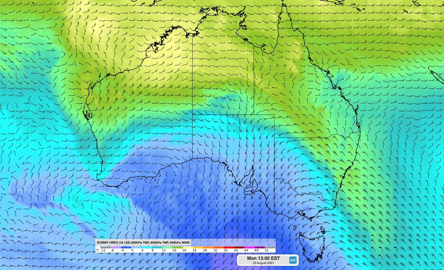
Image: Forecast 850 hPa temperature and wind on Monday, according to the ECMWF model, showing warm air pushing over eastern Australia ahead of an approaching cold front.
While this type of weather pattern is not uncommon at this time of year, temperatures could climb close to 10ºC above average in some areas in the coming days.
Maximum temperatures in Sydney Basin are forecast to be around 5-8ºC above average between this Friday and Monday next week, reaching tops of 23-26ºC in the city.
Brisbane will also get a taste of the warm weather, reaching around 25-26ºC from Saturday until at least Monday.
While warm spells of weather in late winter are not out of the ordinary, the number of warm days we have seen in Sydney this season has been surprising.
Unusual winter warmth for Sydney
Thursday was Sydney's 11th consecutive day above 20ºC. As Tom Saunders from Sky Weather pointed out, this is a new record for August.
This warm spell is likely to last until Monday next week, extending the run of days above 20ºC to 15, which will be a new record for winter as a whole.
Sydney has also already registered two days over 25ºC so far this winter, one in late-July and the other on the first day of August.
This week's warm spell has the potential to add up to three more days at or above 25ºC, which would take the season's tally to between three and five in total.
It's unusual to see so many days this warm during winter:
- Sydney hasn't had three winter days at or above 25ºC since 2009.
- Having four winter days this warm has only occurred four times in the last 162 years of records.
- Five days at or above 25ºC has only happened once. This was in 1995, when there were eight.
A change is on its way
Looking ahead, a stronger cold front is expected to make it to the eastern states on Monday into Tuesday, bringing a bit of rain and noticeable drop in temperature.
Northwesterly winds will also gain strength ahead of this approaching front, before a gusty southerly change makes its way up the NSW and southern QLD coastlines.
Be sure to keep an eye out for damaging wind warnings in eastern Australia early next week.