
Early morning storms soak Darwin
Storms rumbled near Darwin in the early hours of Saturday, bringing heavy rain to the western Top End.
Satellite imagery below shows areas of cloud associated with convection build across the early hours of Saturday over the Daly area of the Northern Territory. These storms brought heavy rain and 100,000 lightning strikes within a 300km radius of Darwin - 21,000 of which reached the ground.
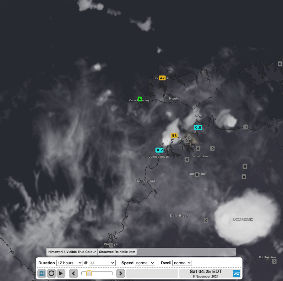
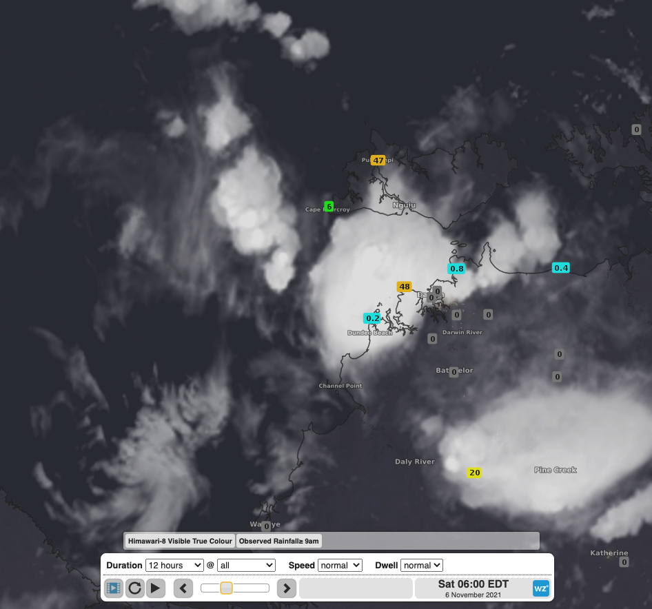

Satellite sequence (3am, 4:30am and 8:30am ACST, respectively) showing convective cells building to the south and west of Darwin through the early to mid-morning on Saturday. Rainfall since 9am observations overlaid show the rapid downpour associated with these storms.
The Charles Point observation station, 25km to the west of Darwin, received its highest daily rainfall total (24 hours to 9am) since February with 69.2mm falling in the 4 hours to 6am this morning. More than half of this rain fell in the 30 minutes to 3am as the storm formed overhead.
In Darwin, Fort Hill Wharf recorded 51mm in the 24 hours to 9am. Nearby Pirlangimpi, on the Tiwi Island, gathered 47mm of rain, 42mm of that falling in 30 minutes with a storm on Friday afternoon.
Storms over the northwest of the NT were generated by an unstable airmass feeding into a low pressure trough over the region. This low pressure will remain over the Top End and bring the ongoing risk of thunderstorms and heavy rainfall over the remainder of the weekend and into the coming week.