
Dynamic weather in Australia this week
A mix of heavy rain, thunderstorms, damaging winds, hail and snow will affect parts of southern and eastern Australia this week. Some of this weather will be severe and there are signs that a strong low pressure system could develop in the Tasman Sea by Friday.
A pair of cold fronts will sweep across southeastern Australia this week, triggering a volatile mix of weather in parts of SA, Tasmania, Victoria, NSW, the ACT and Queensland.
The first front will cause a brief burst of blustery winds, showers and thunderstorms in South Australia, Victoria and Tasmania on Tuesday and Wednesday, spreading from west to east. A low pressure trough associated with this front will also trigger a few showers and storms in western NSW and western Queensland.
A stronger cold front will reach South Australia, Tasmania and Victoria on Wednesday, before spreading over NSW, the ACT and southern Queensland on Thursday. As this front moves north, a rain and storm-bearing trough will also deepen over NSW and Queensland on Thursday. The combination of the front and trough will cause widespread showers, thunderstorms and blustery winds in multiple states on Wednesday and Thursday, some of which could become severe.
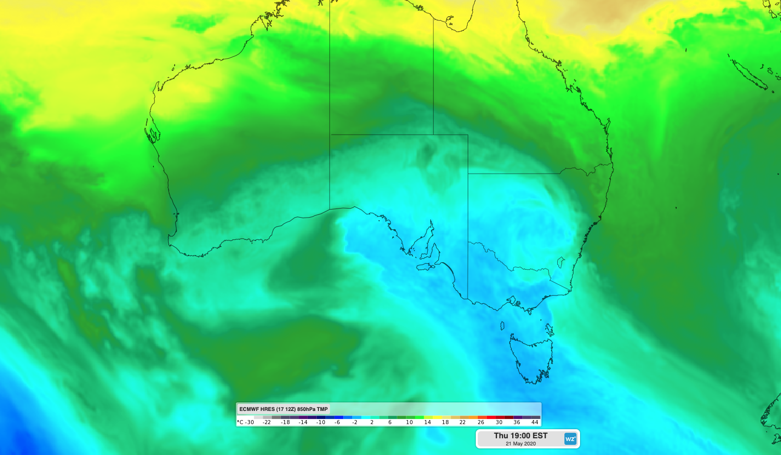
Image: ECMWF-HRES model showing cold air spreading over southeastern Australia on Thursday.
In addition to the inclement weather near and ahead of the front, a large mass of cold air from the Southern Ocean will sweep across southeastern Australia in its wake. This wintry air mass will cause hail and snow in parts of southeastern Australia on Wednesday and Thursday, along with a noticeable drop in temperatures. Melbourne is forecast to reach 19 degrees on Monday and Tuesday and just 14 degrees on Thursday and Friday.
By Friday, the pool of cold upper-level air is expected to move off the coast of NSW, where it will cause a low pressure system to develop and rapidly deepen over the Tasman Sea. If this low gets strong enough and stays close enough to the NSW coast, it could become an East Coast Low. If it stays further away from the coast, it will be classified as a Tasman Low.
East Coast Lows are capable of producing heavy rain, flooding, damaging winds and destructive surf. Tasman Lows typically cause less intense impacts on land, although showers, wind and large swell can still affect parts of eastern NSW from these systems. Forecast models will have a better idea of if and where the low pressure system is likely to develop as the week unfolds.
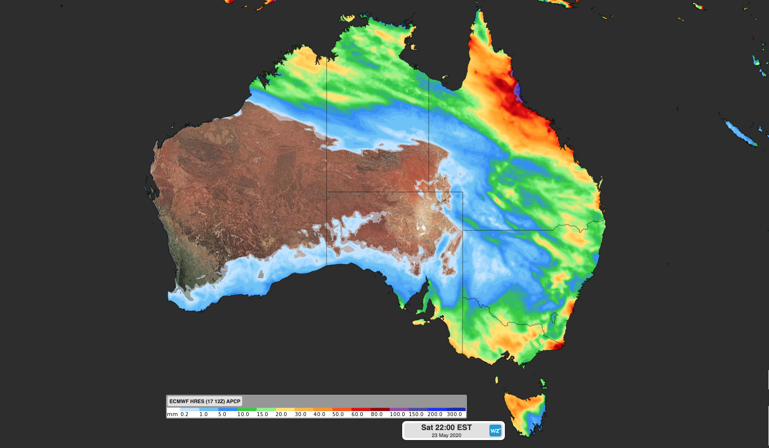
Image: This week's forecast accumulated rain up to Saturday night, according to the ECMWF-HRES model.
Another significant feature towards the tail-end of this system will be a burst of heavy rain in the tropics. Cold air moving into northern Australia from the south will interact with a mass of moisture-laden air coming from the Indian Ocean later in the week. This interaction will cause a band of cloud and rain to spread over tropical areas of WA, the NT and Queensland between Thursday and Saturday.
Severe weather warnings are likely to be issued and updated later in the week as more accurate information becomes available.