
Dust, rain and damaging winds as cold fronts slam SA
Damaging winds and squally showers will continue to lash SA over the next 36 hours as a pair of powerful cold fronts sweep over the state.
A complex low pressure system moving over the Bight will cause two cold fronts to cross SA between Monday and Wednesday this week.
The first front arrived in the south of SA on Monday, preceded by a powerful surge of northwesterly winds that whipped up a large dust storm over the parched Eyre Peninsula.
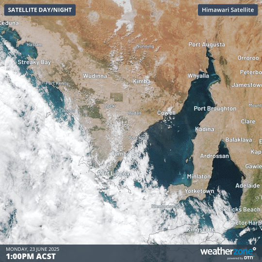
Image: Dust storm over SA’s Eyre Peninsula on Monday, June 23, 2025.
Monday’s dust storm occurred as blustery winds scoured dry topsoil from a part of SA that just had one of its driest starts to a year on record.
Rainfall totals for the first 5 months of 2025 have been in the lowest 5% of historical records for most of SA’s agricultural area, with some places enduring the driest start to a year on record. This included the Eyre Peninsula.
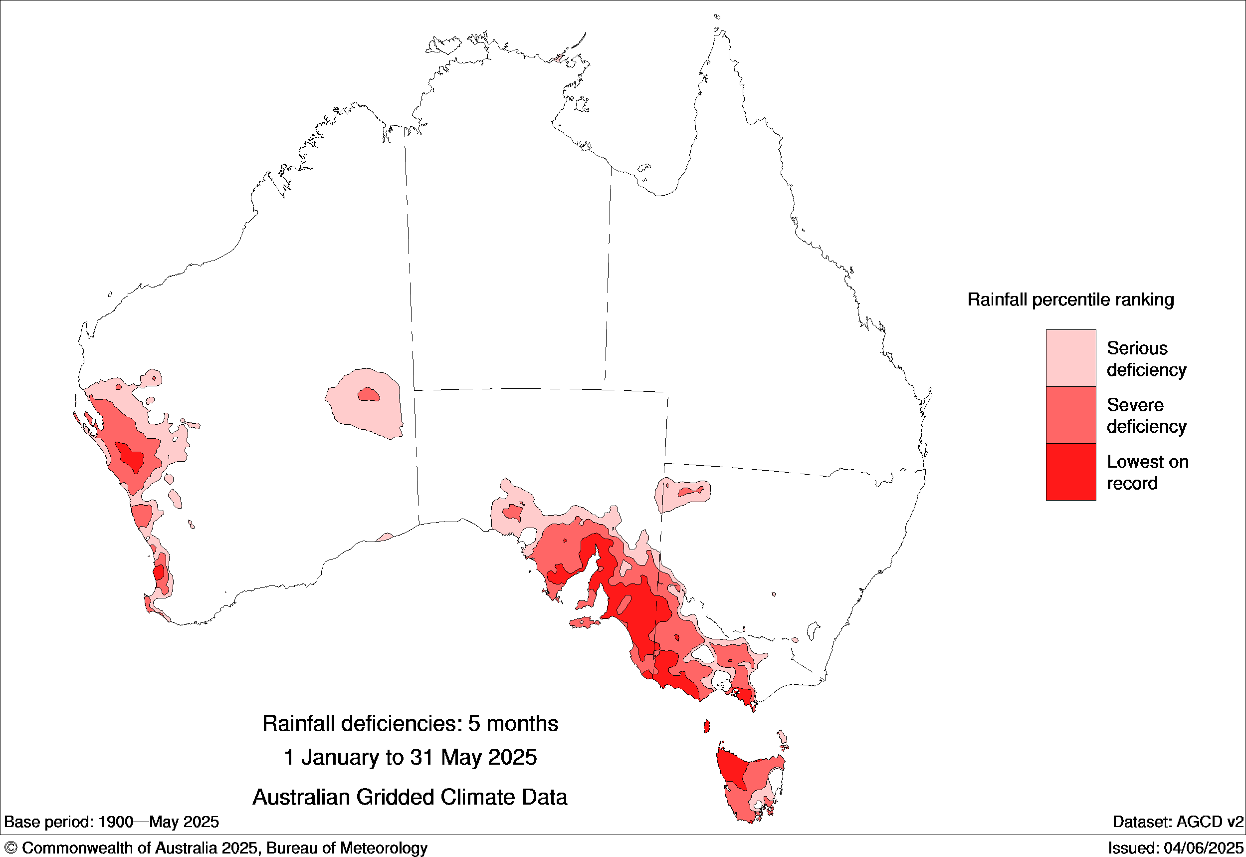
Image: Rainfall deficiencies for the first 5 months of 2025. Source: Bureau of Meteorology
The wind that preceded Monday’s cold front removed topsoil from farms that are in desperate need of rain. Fortunately, the rain did eventually arrive on Monday and by 7pm ACST, falls of 3 to 10 mm had been recorded over the Eyre and York Peninsulas and Kangaroo Island.
Powerful winds and showers will continue to spread over the southern half of SA through Monday night, Tuesday and into Wednesday morning as the complex low and associated fronts cause an ongoing barrage of wet and windy weather. This wintry weather will be exacerbated by a pool of cold air being driven across the state by the low pressure system.
The damaging winds, showers and wintry temperatures associated with this system will also affect Australia’s southeastern states over the next couple of days.
Severe weather warnings are currently in place for parts of SA and several other states. These warnings will be updated in the coming days, so be sure to check the latest warnings in your area for the most up-to-date information.