
Dry end to summer as drought continues in western NSW
Dry weather will persist across most of NSW during the final days of February, with almost all of the state still affected by drought as summer draws to a close.
Despite heavy rain in parts of eastern NSW during January and February, many areas west of the divide have only seen sporadic falls during the opening months of 2020.
_1.jpg)
Between January 1st and February 25th, some areas in eastern NSW received over 400mm more rain than they would typically see during the first two months of the year.
West of the divide, parts of the state's Northwest Slopes and Plains are also running about 50-100mm above average for the year to date. However, most central western, south western and far western parts of the state have seen near or below average rain during the last two months.
While the rain that has fallen has been welcomed with open arms, it hasn't been enough to make up for the rainfall deficits that have built up over the last few years.
During the 24 months ending in January 2020, most of NSW had received between 300 and 1200mm less rain than they usually would throughout this period. This means it will take several months of above average rain to recover from this prolonged dry spell.
As of February 24th, only 1.3 percent of the state was not in drought, according to the Department of Primary Industries. The other 98.7 percent of NSW was in one of three drought categories: Drought Affected (44.6%), Drought (32.7%) and Intense Drought (21.4%). By Tuesday this week, Burrendong Dam, Pindari Dam and Split Rock Dam were all still below 10 percent of capacity.
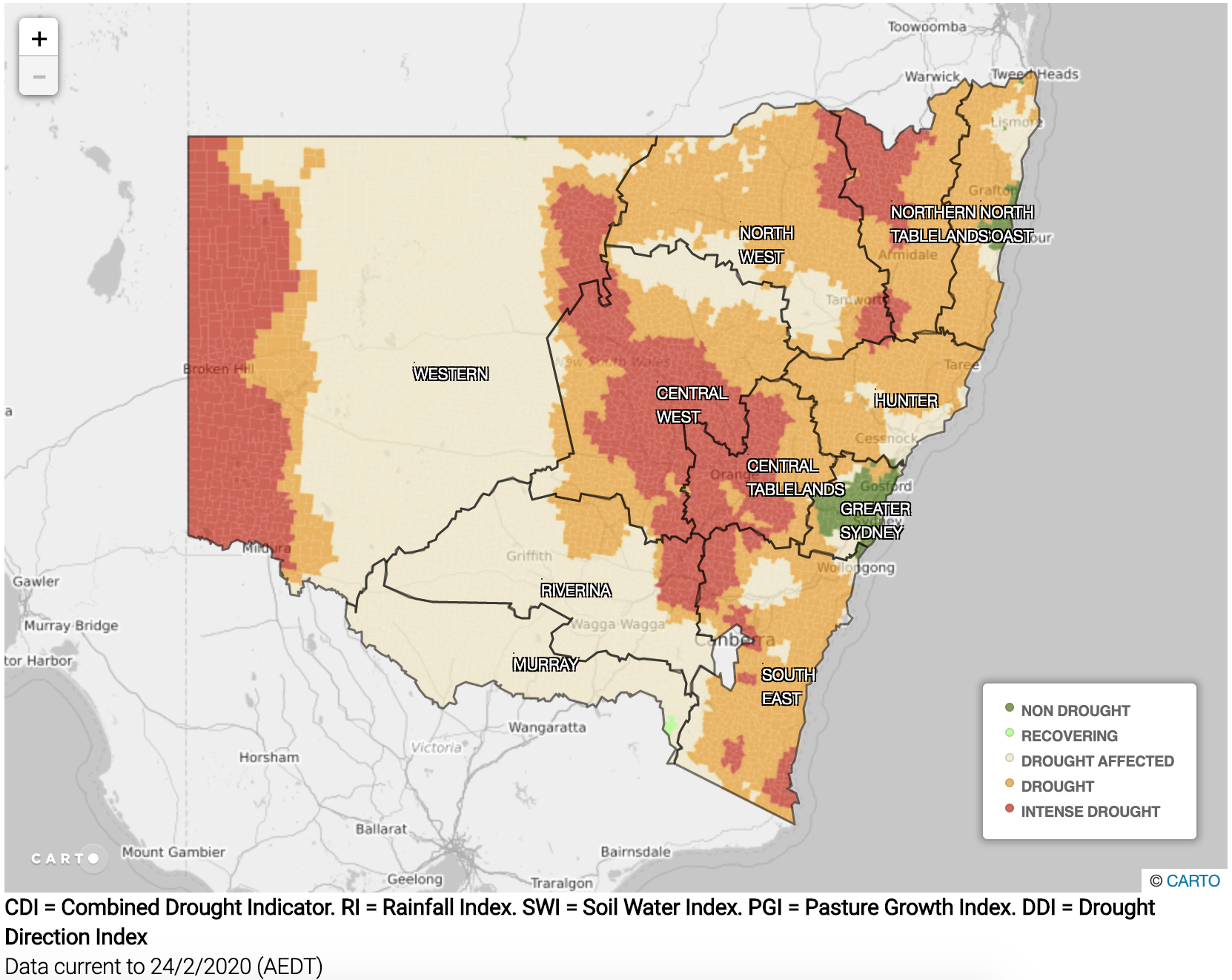
Image: NSW drought declaration map, valid on February 24th, 2020. Source: NSW Department of Primary Industries.
Looking ahead, there are signs that the interaction of tropical moisture with a low pressure trough could bring some rain and storms to western NSW during the opening week of March. While this rain won't break the drought, anything is welcome at the moment.
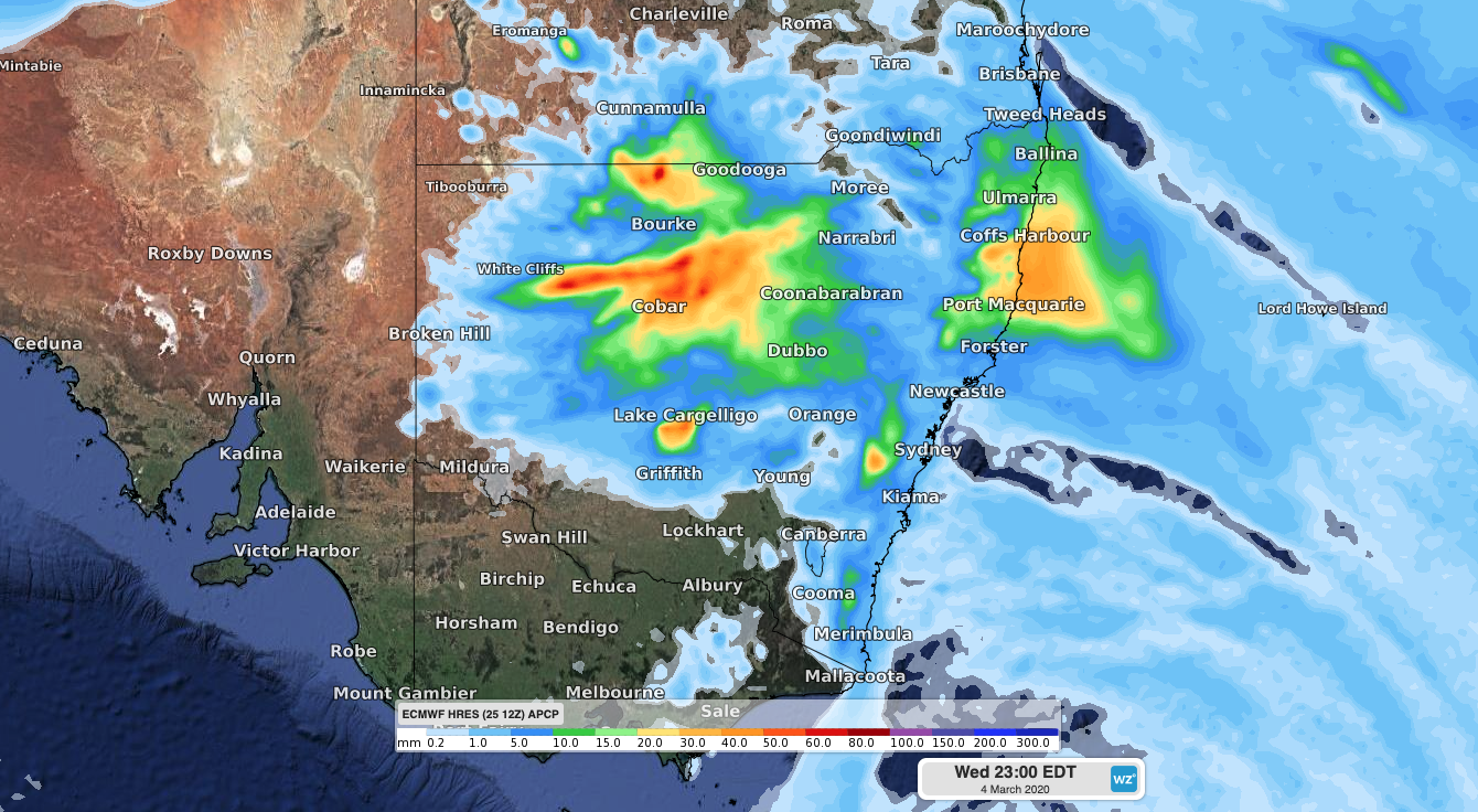
Image: Forecast accumulated rain during the 24 hours to 9am on Wednesday, March 4th, according to the ECMWF-HRES model.
More broadly, climate models indicate that there is an increased chance of above-average rain in parts of western NSW during March as a whole.