
Dry, blustery winds drive record heat across Sydney
Record early-season heat has been blown across Sydney, with the aid of dry, blustery westerly winds.
On Saturday, temperatures reached the low-to-mid 30s in almost all suburbs as humidity dropped to 20 percent and wind gusted 50-80km/h. It heated beyond 33 degrees in some suburbs, including Penrith.
Given the wind direction on Saturday was predominantly westerly, it got similarly warm further east, easily warming past 30 degrees.
At about 2:30pm, the city reached 32.1 degrees, its hottest day this early in the warming season on record, with temperature data going back to 1859. Previously, the earliest in spring it had become this warm was September 13th, in both 2017 and 2009.
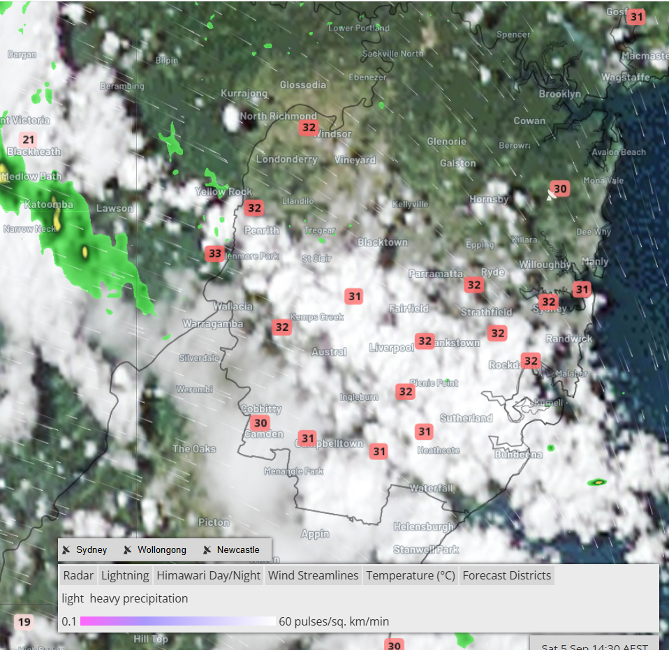 Image: Temperature observations, satellite, radar, wind streamlines at 2:30pm EST on Saturday, September 5, 2026. Source: Weatherzone.
The only suburbs failing to warm into the 30s were those of some beaches, but it still got to the high 20s before sea breezes brought some cooling. Later in the afternoon, cloud then the odd shower moved in from the Blue Mountains into some western suburbs to bring a little more cooling.
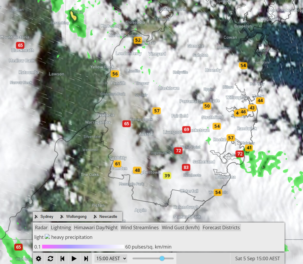 Image: Wind gust (km/h) observations, satellite, radar, wind streamlines at 3:00pm EST on Saturday, September 5, 2026. Source: Weatherzone
It may seem strange that this cooling will be a relief for many, given the blowing pollen and dust and elevated fire danger. Fire Danger reached Extreme in some suburbs. A Total Fire Ban had been declared for Greater Sydney for Saturday until midnight. It's also been unseasonably warm on three of the four past days. Even including a relatively mild Friday when temperatures reached the low-to-mid 20s, it still turned out to be the city's warmest four-day spell this early in the season on record. Across the past four days, Observatory Hill averaged a maximum of 27.93 degrees, eight degrees warmer than the long-term average for early September, and beating the previous record of 27.88 degrees during September 1-4, 1865. This recent spell is also warmer than its long-term average for mid-summer.
Looking ahead, the aforementioned cooling relief isn't far away for all suburbs, commencing this afternoon, heralding a lengthy spell much closer to the long-term average. Check the Sydney forecast.