
Drought relief as winter rain soaks parts of southern Australia
It didn’t break the drought, but a decent drop of rain over the long weekend was a welcome change for parched areas of Victoria, South Australia and Tasmania.
A low pressure complex and an associated series of cold fronts delivered multiple rounds of rain and snow across southern and southeastern Australia over the King’s Birthday long weekend.
The map below shows an estimation of how much rain fell across the region during the past five days.
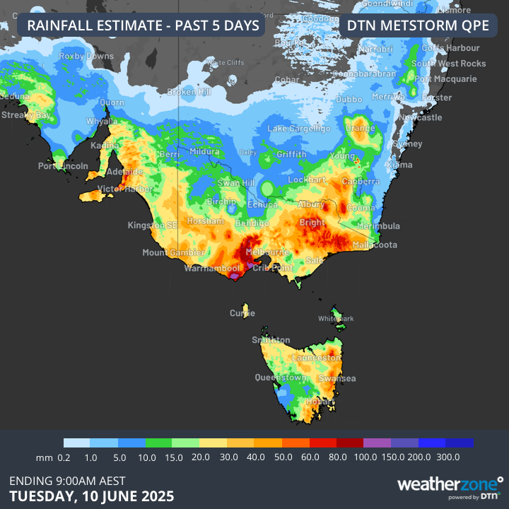
Image: Estimated observed rainfall during the 120 hours ending at 9am AEST on Tuesday, June 10, 2025.
Five-day rainfall totals of about 20 to 50 mm were observed in SA, Vic, Tas and southern NSW. Some areas saw heavier falls, including the mainland alps and southwest Vic. Mount Sabine, located on the Otway Ranges in Vic, received 130 mm of rain in the 48 hours ending at 9am AEST on Monday, June 9.
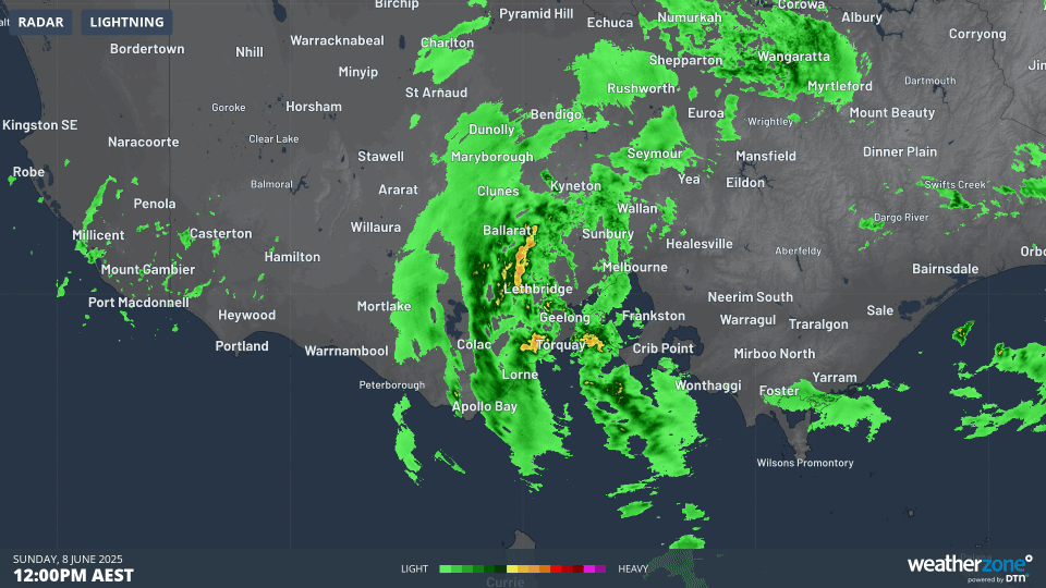
Image: Radar animation showing heavy rain streaming over central and southwest Vic on Sunday, June 8, 2025.
The rain that fell over the long weekend covered areas that have been abnormally dry for a very long time.
Rainfall accumulations since the start of 2025 have been running more than 50 mm below the long-term average in parts of SA, Vic and Tas. At the end of May, year-to-date rainfall deficiencies were even exceeding 200mm in parts of Vic and 400 mm in some areas of Tas. These 2025 rainfall deficiencies built on longer-term shortages that have plagued the region over the last couple of years.
Fortunately, the rain from the past week helped reduce rainfall deficiencies in some areas. However, it wasn’t enough to completely eradicate them in many areas.
The maps below show the rainfall from the past week compared to the rainfall anomalies from the first five months of 2025.
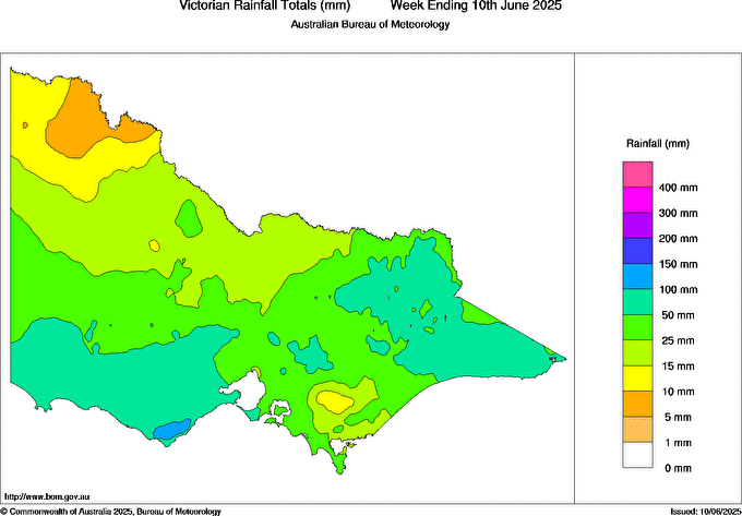
Image: Observed rainfall in Vic during the week ending at 9am on June 10, 2025. Source: Bureau of Meteorology.
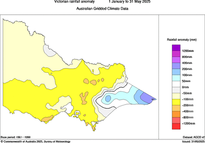
Image: Observed rainfall anomalies in Vic during the first five months of 2025. Source: Bureau of Meteorology.
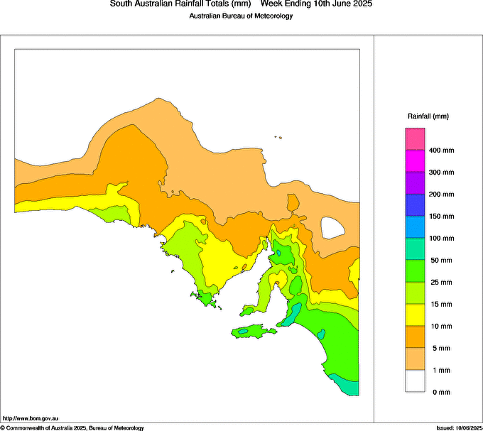
Image: Observed rainfall in SA during the week ending at 9am on June 10, 2025. Source: Bureau of Meteorology.
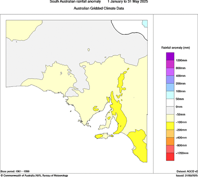
Image: Observed rainfall anomalies in SA during the first five months of 2025. Source: Bureau of Meteorology.
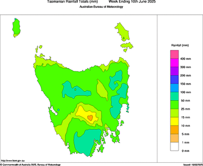
Image: Observed rainfall in Tas during the week ending at 9am on June 10, 2025. Source: Bureau of Meteorology.
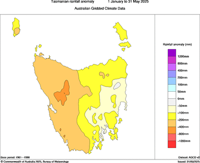
Image: Observed rainfall anomalies in Tas during the first five months of 2025. Source: Bureau of Meteorology.
Southern and southeastern Australia will need to see more healthy rain-bearing systems this winter to further reduce or wipe out the longer-term rainfall deficiencies. With the past week’s rain in the ground, at least the season is off to a positive start.