
Drenching rain in the Kimberley
A tropical low is generating heavy rainfall and squally winds across the far north of Western Australia with some models suggesting more than 300mm possible over the next two days.
A deepening monsoon trough over the Top End conceived a low on Saturday across the Joseph Bonaparte Gulf, in the southern Timor Sea. The system did not spend enough time over water to intensify into a Tropical Cyclone as it started to move southwest, crossing the north Kimberley coast during the afternoon. However, this low is expected to generate widespread and dangerous flooding.
Truscott, Kununurra, and Wyndham have already registered 135, 98, and 78mm, respectively, from Friday 9am WST to Sunday 6am with more rain on the cards.
Given the slow movement of this system, widespread totals of 100mm are possible with localised accumulated rain exceeding 300mm in a 48-hour period.
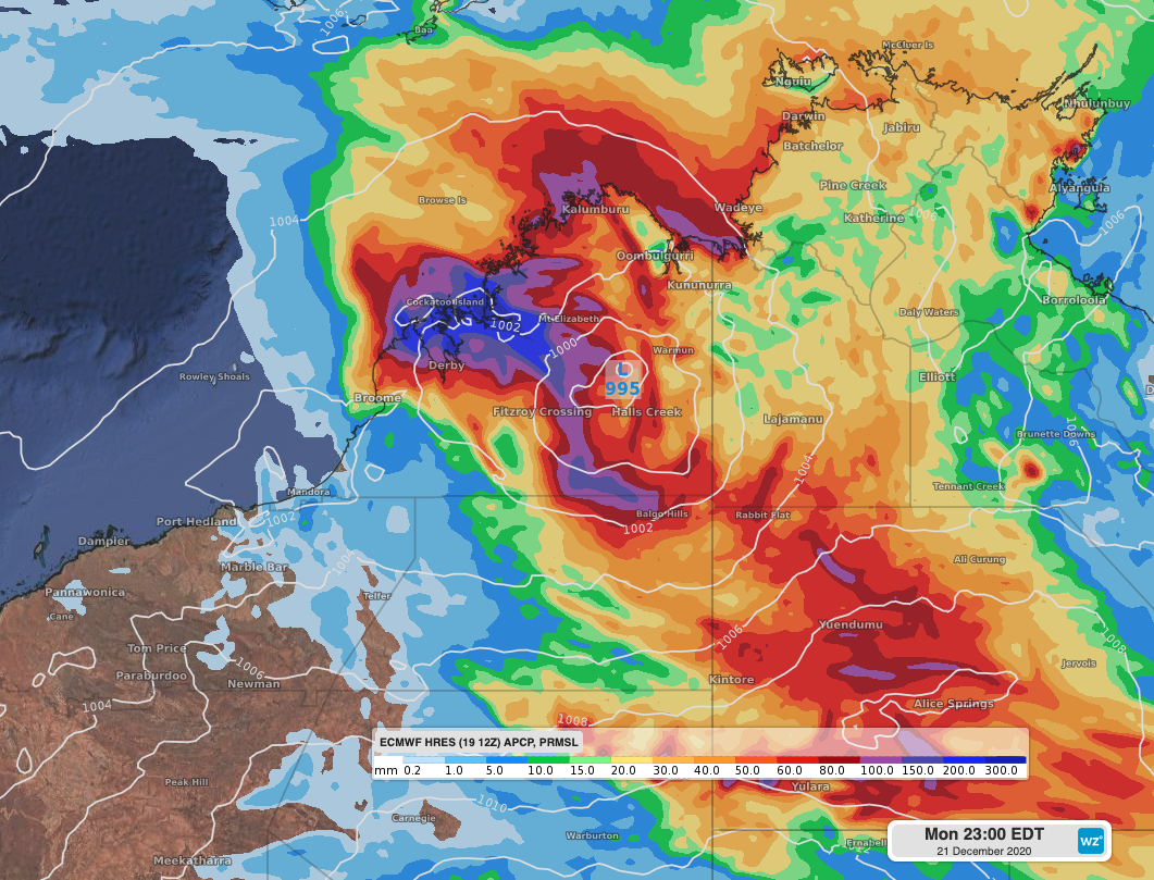 Image: Accumulated rainfall between Sunday and Monday night with mean sea level pressure, according to the ECMWF-HRES model.
As a result, riverine flooding is likely to occur over extensive areas, which may lead roads to become impassable.
The tropical low is likely to track south and then southeast over the next couple of days over the inland Kimberley, spreading heavy rain across western parts of the Northern Territory, dissipating by midweek.
Multiple weather warnings related to this significant weather event are currently in place. You can keep track of the latest warnings here.