
Destructive fronts heading for WA
Two of the strongest cold fronts this year will cause damaging to destructive winds, flooding rain, abnormally high tides and damaging surf in Western Australia this week.
The first cold front will surge out of the Indian Ocean and blast across southwestern districts of WA on Monday night into Tuesday morning.
Wind and rain will increase ahead of this approaching cold front on Monday.
Widespread damaging winds are expected from mid-afternoon on Monday into Tuesday morning over southwestern and western districts WA, including Perth and possibly reaching up to Geraldton.
Some areas in the state's southwest could see gusts in excess of 125 km/h, particularly with showers and along the exposed South West Capes overnight Monday into Tuesday morning.
Squally showers with locally heavy falls will also develop over the western coastal districts and parts of the Great Southern from Monday afternoon into Tuesday morning.
The heaviest falls are likely to occur along the coast and adjacent inland between about Perth and Bunbury, where falls of 40-60mm are possible along the Darling Range. This rain is expected to cause flooding in several rivers, including the Avon, Swan, Murray and Harvey Rivers Catchments.
In addition to wind and rain, this powerful front will also cause abnormally high tides and damaging surf along most of the state's western and southern coastlines on Monday and Tuesday. This may cause beach erosion and flooding in some low-lying coastal areas.
There will be some respite mid-week, before another strong cold front hit the state on Thursday.
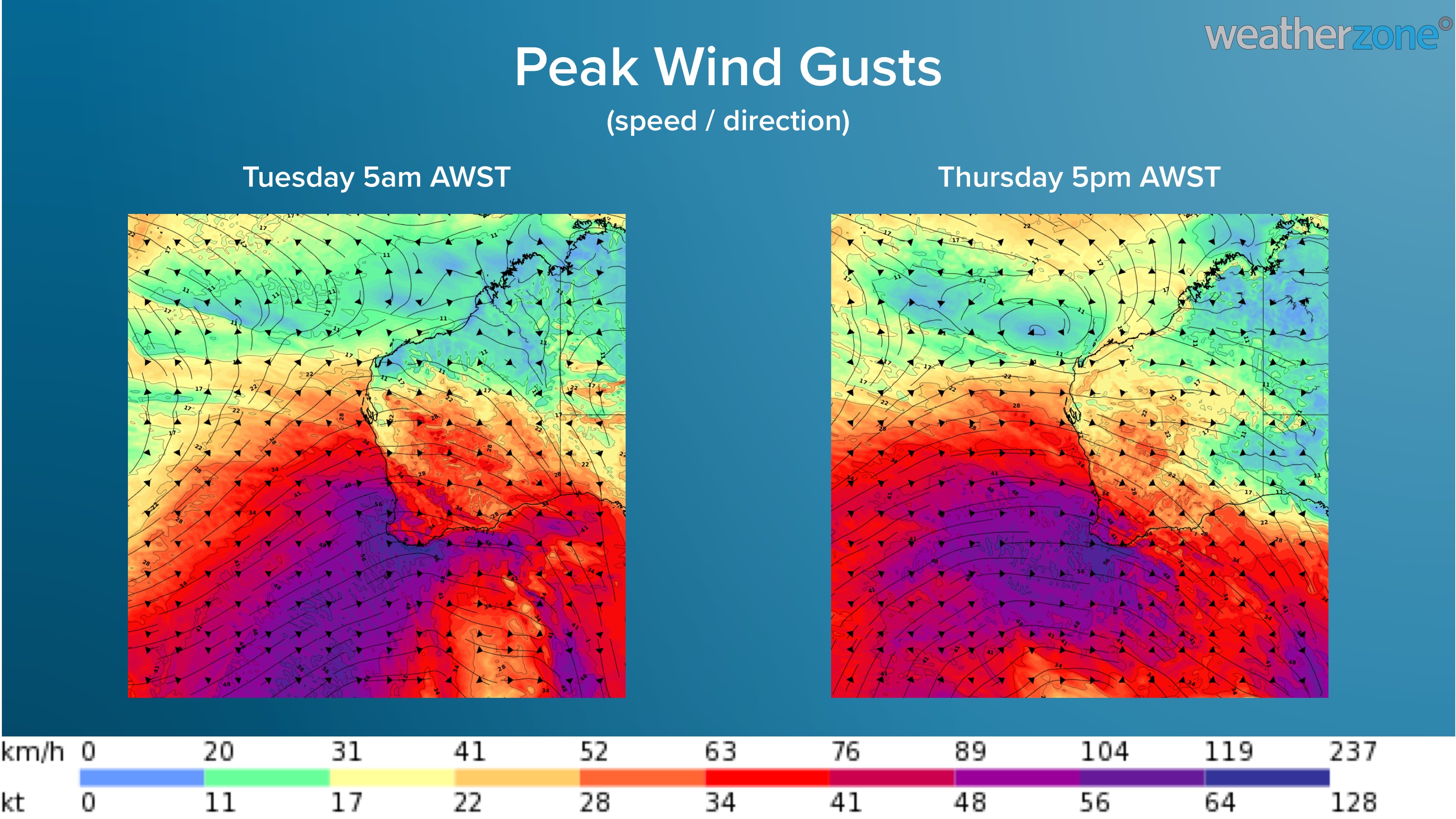
Image: Forecast wind gust speed and direction on Tuesday morning and Thursday evening this week, according to the ECMWF model.
This will be another dangerous system, with more damaging winds, heavy rain, potentially severe thunderstorms and damaging surf all on the cards between Thursday and Saturday morning.
Wind and rain will ease from Saturday, although cold air will linger over the southwest of WA during the weekend. Perth will only reach the mid-teens on Saturday, which is 3-4 degrees below-average for the middle of winter.