
Derechos: What are they and why are they so dangerous?
The peak tornado season has passed in the United States but that’s no reason to be complacent, because this time of year is known for another severe weather system that produces destructive winds.
Although tornadoes often hog the headlines, late spring and summertime can be ripe for a different type of damaging storm called a derecho.
‘Derecho’ is a Spanish word that can mean ‘straight’ or ‘direct’, and this is what distinguishes it from tornadoes: straight line winds instead of rotation.
Derechos are both long-lived and widespread, composed of long bands of thunderstorms that can cross several states and hundreds of miles. Their winds can be as destructive as some tornadoes, and over a much larger area.
Although they can develop anywhere, derechos are most frequent in the Midwest, Mid-Atlantic and Great Lakes regions.
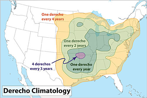
Image: Climatology of derechos in the U.S. Source: NOAA
The Formation of a Derecho
Derechos develop from a unique type of thunderstorm complex that requires the right mix of ingredients to form:
- An unstable atmosphere, with cool and relatively dry air aloft overspreading warm and humid air closer to the surface.
- This allows strong convection to kick off, causing towering thunderstorm clouds to form.
- When there are also strong winds in the middle and upper atmosphere, an organized complex of strong thunderstorms can develop, called a Mesoscale Convective System (MCS).
These steps create the building blocks of a Derecho, but there’s more to it than that – the MCS also needs to become self-sustaining across vast distances.
An MCS can become self-sustaining when heavy precipitation inside the storm complex causes a rapid descent of cooler air, which is forced to spread out horizontally when it hits the ground. This horizontal surge of wind at the surface creates an outflow boundary, also called a ‘gust front’, which can behave like a cold front, forcing the warm air ahead of it to rise and start the thunderstorm formation process all over again.
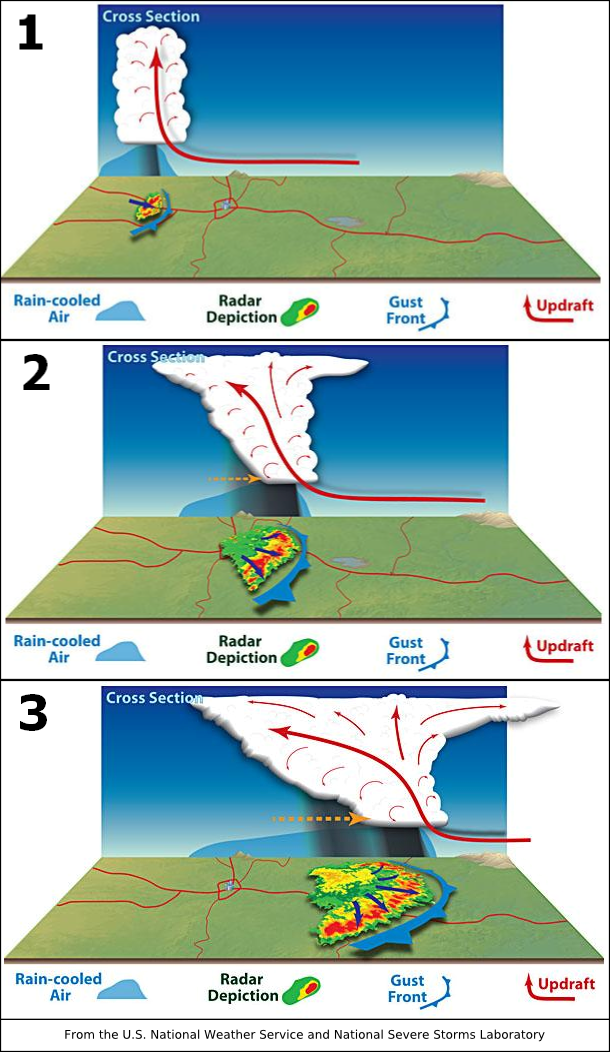
Image: Stages of development for a derecho. Source: NOAA
Once an MCS is well established, downdrafts withing the storm complex can bring strong winds down from the mid-levels of the atmosphere, forcing the line of thunderstorms to bow out in the direction of travel. This process produces stronger storms, more powerful downdrafts, stronger winds and further thunderstorms, in a continuous loop. This self-sustaining feedback loop is what makes derechos so long-lasting and destructive over a large area.
Video: Satellite imagery showing abundant lightning within a derecho that swept across the Northern Plains on May 12, 2022. Source: CSU/CIRA and NOAA
Appearance and Impacts
Weather radars are excellent at revealing the characteristic shape of a derecho. Meteorologists look for a radar signature that shows bow-shaped bands of intense rainfall or hail. Radar will also occasionally spot small circulations at the top and bottom of these bows, which are called ‘bookend vortices’.
Although derechos are characterized by straight-line winds, brief tornadoes can also occur in the same thunderstorm complex. Either way, derechos can cause vast areas of destruction as they rapidly progress across the landscape, bringing down trees and power lines, and damaging properties.
By definition, a derecho must have winds gusts of at least 58 mph and must cross a distance of at least 240 miles. One very notable feature is how fast they move: typically, they race forward at speeds of 50-70mph.
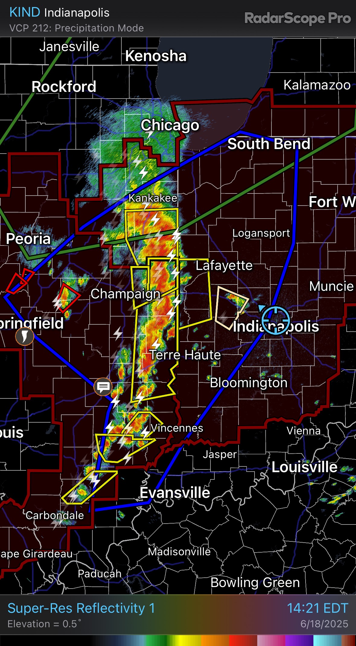
Image: Radar signature of a derecho in June 2025. Source: RadarScope / DTN
Historic Derechos
Thankfully, tools like computer models and weather radars can give good warnings about derechos these days, but it is tough to mitigate against the impacts of these rapid, widespread and powerful storms.
The June 2012 Mid-Atlantic derecho damaged or destroyed thousands of structures across multiple states, while the August 2020 Midwest derecho hit parts of Iowa with hurricane-force winds, causing over $11 billion in damage and destroying millions of acres of crops.
More recently, a derecho ripping across the Ohio Valley on June 17th 2025 led to power outages for around half a million customers from Illinois across Indiana and Ohio to Pennsylvania, with some gusts of 70-80mph and a few isolated tornadoes.