
December rain more likely as MJO looms
After an exceptionally dry November for most of Australia, there are signs that wet weather could ramp up as we head into December under the influence of the Madden-Julian Oscillation.
The Madden-Julian Oscillation, often referred to as the MJO, is a region of increased stormy weather that travels around the world every 30-60 days, moving from west to east near the equator.
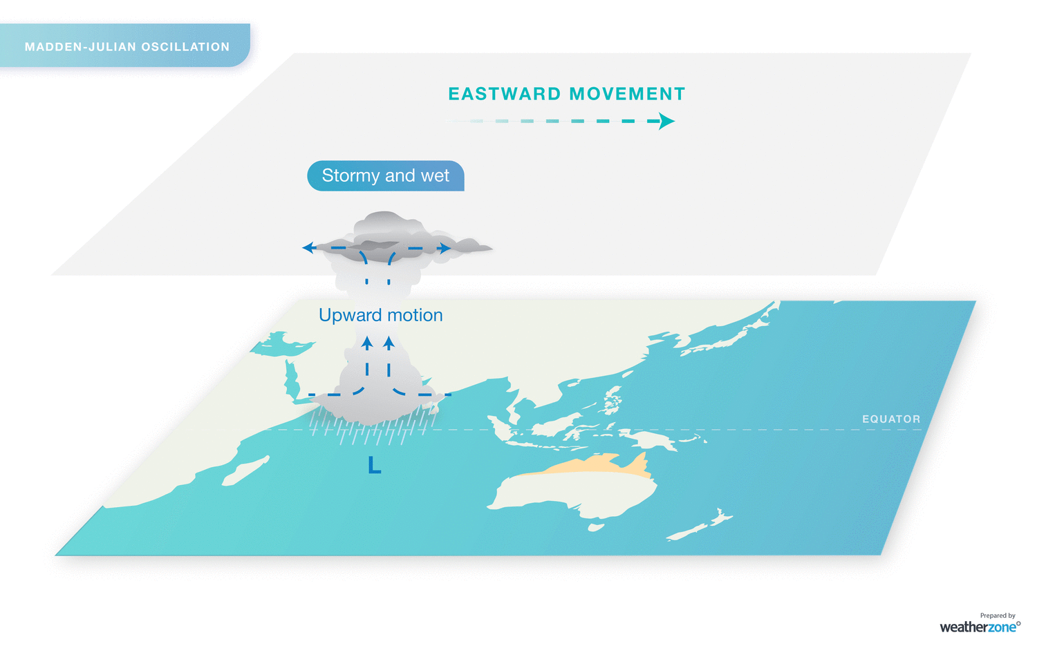
When the MJO is near Australian longitudes, it typically causes more rain and storms to develop over our continent. It can also help spawn tropical cyclones in Australia's area of responsibility.
However, when the MJO is near Africa or over the Indian Ocean, we typically see below-average rain over large parts of Australia.
During November, the MJO passed over Africa and the Indian Ocean. As a result, most of Australia has received below-average rainfall this month.
This month's lack of rain and cloud has also led to a significant build-up of heat, which will sweep across southern and eastern parts of the country later this week.
But there is some positive news on the horizon for those wanting to see rain returning to Australia.

Forecast models suggest that the MJO will move through Australian longitudes as we head into the first week of December. While the MJO is expected to be relatively weak as it passes near Australia, it should be strong enough to increase rainfall over parts of northern Australia. It may also help produce the first tropical cyclone of the season in Australian waters.
The MJO doesn't guarantee rain everywhere. However its presence near Australia in early December should help buck the trend of widespread abnormally dry weather that has dominated most of the country in November.