
Days of wet weather ahead for NSW
Rain will spread over large areas of NSW during the next four days as moisture-laden winds feed into multiple low pressure troughs, with potential for heavy falls along the coast.
Two low pressure troughs will linger over the NSW region during the next few days, one over the state’s inland and another near the coast. These troughs will be fed with winds from the east and northeast, carrying moisture-laden air from the Tasman and Coral Seas.
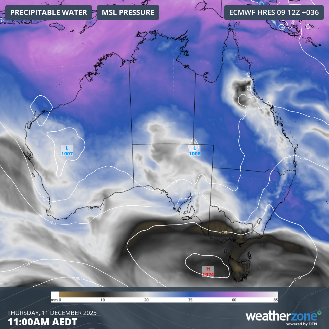
Image: Precipitable water and mean sea level pressure, showing moisture-laden air interacting with low pressure troughs over NSW. Source: Weatherzone.
The combination of the troughs and copious moisture will result in abundant cloud, rainfall and thunderstorms across a broad area of NSW during the next four days, including the ACT and parts of Queensland and Victoria.
More than half of NSW is expected to see about 10 to 30 mm of rain between now and Saturday, with similar totals extending into southern inland Qld, across the ACT and into eastern Vic. Heavier totals are likely in parts of central and northern inland NSW, and along the state’s coast, where some areas could see more than 50 mm.
There is some uncertainty regarding the position and strength of the coastal trough over the next few days, which makes it difficult to predict how much rain will fall in the state’s east. Some models suggest that heavy rain will target the state’s Illawarra or Sydney regions on Thursday and Friday, with potential for accumulated falls of around 50 to 100 mm.
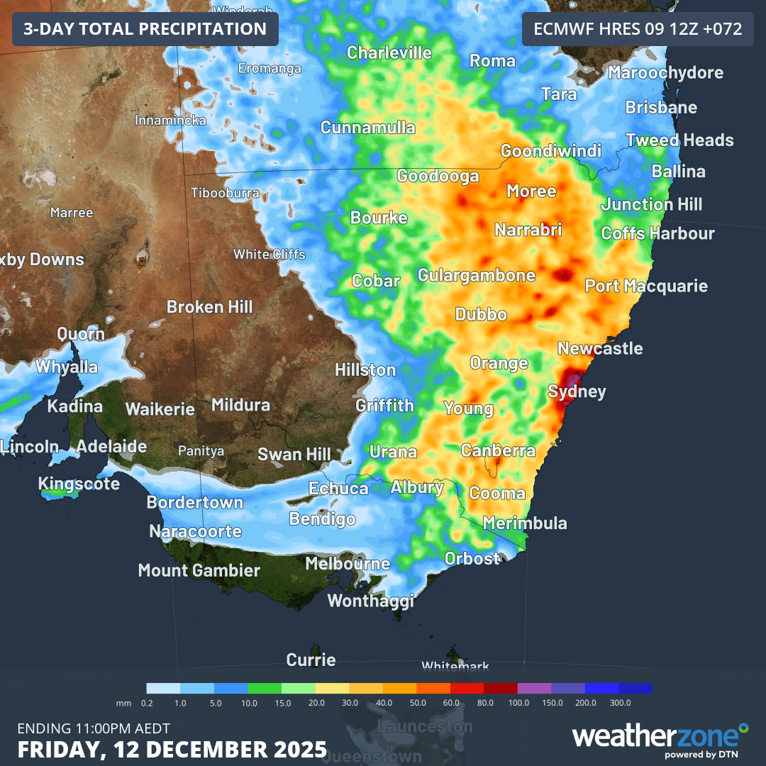
Image: Forecast accumulated rain during the three days ending at 11pm AEDT on Friday, December 12, 2025, according to the ECMWF-HRES model.
Anyone in NSW should keep an eye on the latest forecasts and the radar over the next few days for the latest details on this rain. Severe weather and thunderstorm warnings may also be issued in the coming days if rainfall becomes heavy enough to cause flooding.
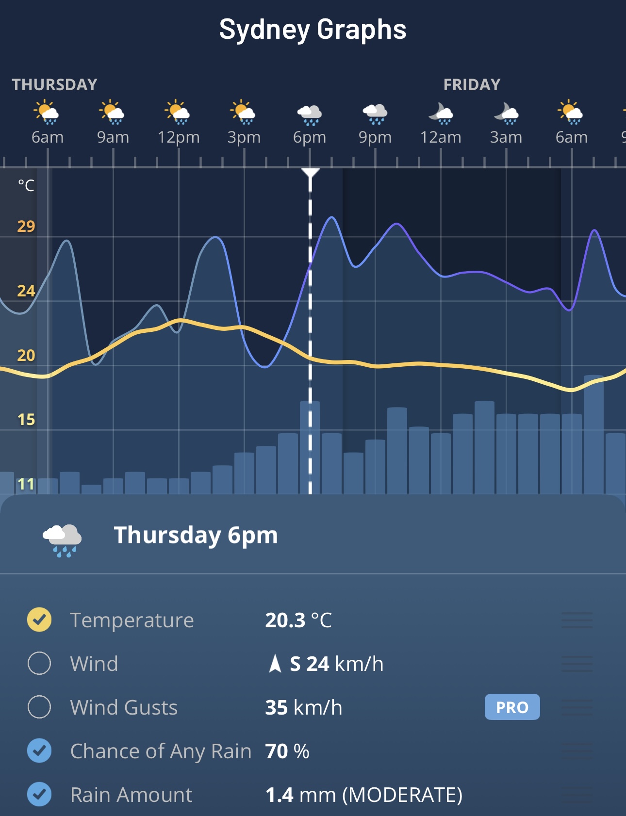
Image: Forecast hourly rainfall and temperature for Sydney, NSW on the Weatherzone app.