
Days of severe thunderstorms ahead for Qld, NSW
A multi-day outbreak of severe thunderstorms will hit parts of Queensland and NSW over the next six days, culminating in a huge rainband sweeping over eastern Australia early next week.
A series of upper-level troughs passing over eastern Australia will cause a period of unstable weather between now and Tuesday. This volatile six-day period will include daily rain and severe thunderstorm activity over parts of Qld and NSW, including numerous storm days around both Brisbane and Sydney.
Thursday and Friday – storms building up
Thursday will feature showers and thunderstorms in both states, mainly about the ranges and some areas of the coast. There may be a few severe thunderstorms over central and southeast Qld and northeast NSW in the afternoon and early evening.
Friday will be more active, with thunderstorms possible over most of NSW and eastern Qld, and even extending down into Vic. Severe thunderstorms are again most likely to occur in central and southeast Qld and northeast NSW on Friday, although there could also be some severe storms in southwest NSW and northern Vic.
Brisbane and western parts of Sydney could see thunderstorms on Friday afternoon or evening, which may disrupt Halloween activities. Be sure to check the radar and thunderstorm warnings before going trick-or-treating on Friday.
Saturday and Sunday – violent thunderstorms likely
Thunderstorms will become more intense on Saturday as the atmosphere becomes increasingly unstable in response to an upper-level trough.
Storms could develop early in the morning over eastern parts of NSW and Qld on Saturday, before becoming more widespread and intense during the afternoon into the evening. Saturday’s storms will be most active between central eastern Qld and central NSW, which could include both Brisbane and Sydney. Supercell thunderstorms are possible on Saturday, and isolated tornadoes can’t be ruled out.
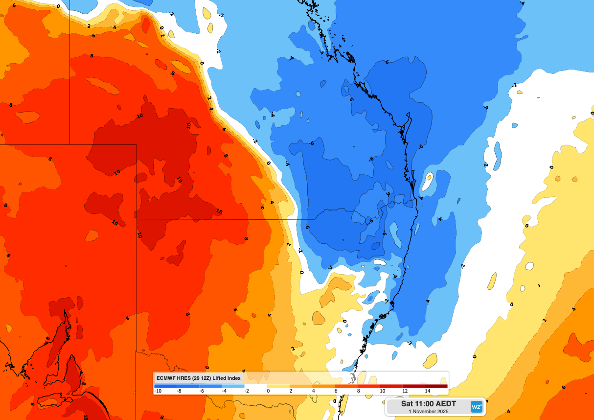
Image: Lifted index (LI) for late morning on Saturday. LI values below zero (blue shading) are indicative of an environment that is conducive to thunderstorms. This map shows that LI values will be lower than –6 in parts of NSW and Qld on Saturday, showing that the atmosphere will be very unstable and ripe for intense thunderstorms.
Sunday’s thunderstorm activity will be less widespread as a brief reduction in atmospheric instability causes storms to mostly become confined to southeast Qld and far northeast NSW.
Monday and Tuesday - Rainband developing with more storms
A potent upper-level cut-off low will move across southeastern Australia early next week, causing areas of rain, thunderstorms and blustery winds across parts of Qld, NSW, the ACT, Vic, Tas, SA and the NT. A broad northwest cloudband ahead of the trough will also spread rain across much of central, eastern and southeastern Australia.
This system will cause a dynamic mix of weather in multiple states on Monday and Tuesday, likely including heavy rain, severe thunderstorms, damaging winds, hail and snow.
Some areas of eastern Australia have a chance of seeing thunderstorms every day for the next six days, with severe storms possible each day.
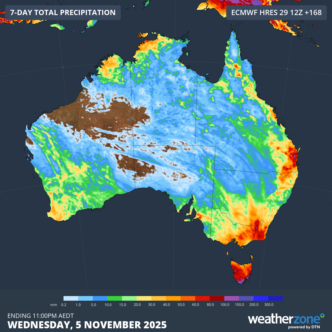
Image: Forecast accumulated rain during the next seven days combined.
Be sure to keep a close eye on the latest forecasts and warnings in your area over the next six days and check the radar to see if storms are about before heading outdoors.