
Days of damaging winds ahead for southeastern Australia
Damaging winds will batter large areas of southern and southeastern Australia over the next few days, with gusts likely to exceed 100 km/h in at least three states between now and Saturday. This dynamic wintry weather pattern will also cause rain, thunderstorms, hail, snow and blizzards.
A bend in the polar jet stream will cause a brisk northwest-to-southwesterly airstream to flow across southeastern Australia during the coming days. This ‘meridional’ jet stream pattern – meaning the upper-level air flows in a north-south orientation – will maintain blustery winds over several Australian states through the second half of this week.
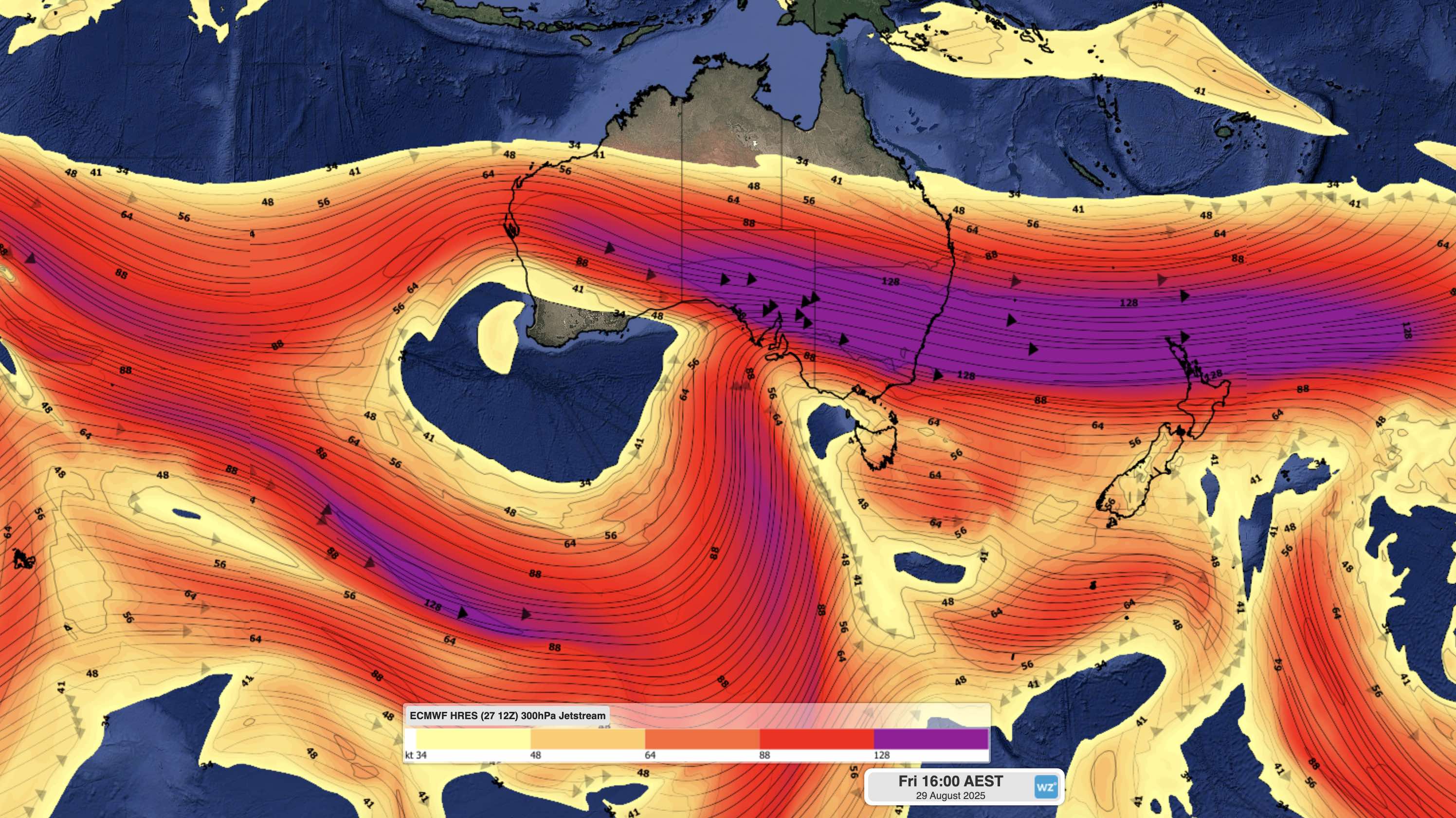
Image: Modelled jet stream winds (at 300 hPa) for 4pm AEST on Friday, showing the polar jet stream bending towards southeastern Australia and a powerful sub-tropical jet stream flowing across the country.
On Thursday, gusty winds, cold air and showers will affect parts of SA, NSW, Vic, Tas and the ACT. Snow and blizzard-like conditions will also affect the Alps on Thursday, and temperatures will feel wintry across much of southeastern Australia.
Conditions will deteriorate further on Friday and Saturday as an intense low pressure system passes over Tasmania and Bass Strait, causing a burst of powerful winds across SA, Vic, NSW, Tas and the ACT.
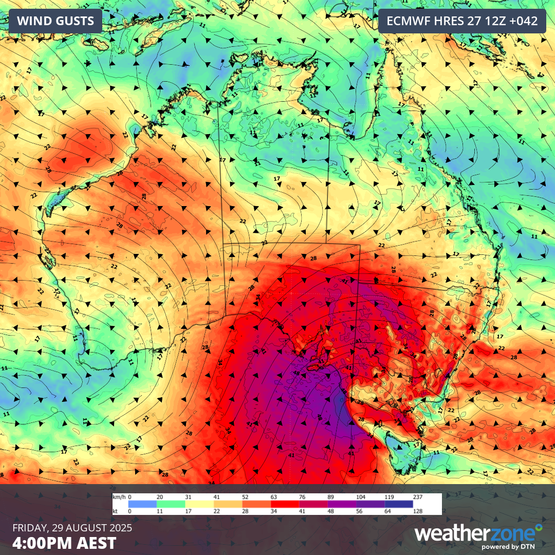
Image: Forecast wind gusts for 4pm AEST on Friday.
Damaging winds are likely in several states on Friday and Saturday, most likely in SA, NSW, Vic and the ACT. These dangerous winds will be accompanied by rain, hail and snow in many areas, particularly on and west of the Great Dividing Range.
Wind gusts could reach about 80 to 100km/h across a broad area of SA, Vic and NSW on Friday and Saturday. The areas around Adelaide, Sydney and the Hunter could also see gusts hitting 90 to 110 km/h, while gusts of about 100 to 120 km/h are possible in the southeast of SA and along the Illawarra/South Coast in NSW. The strongest winds from this event are likely to occur in the mainland Alps, where gusts could reach 110 to 140 km/h.
The wind on Friday and Saturday could be strong enough to topple trees and cause power outages, particularly in areas that have softened soil in the wake of recent rainfall, or areas that see more rain and abrupt changes in wind direction from this system.
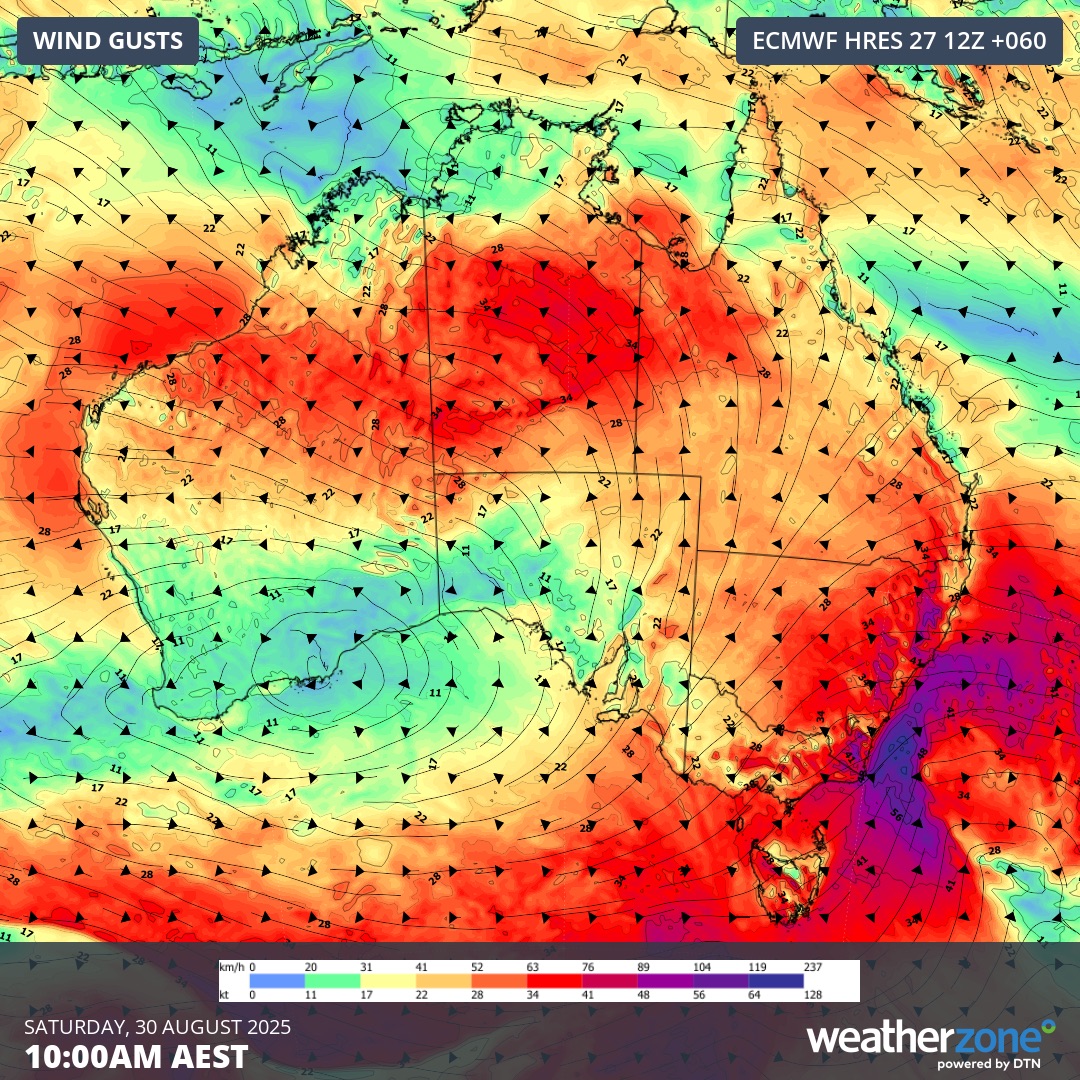
Image: Forecast wind gusts for 10am AEST on Saturday.
A combination of ferocious winds and snow is likely to cause blizzard conditions in the alps on Friday into Saturday morning. This reduced visibility, combined with icy roads, will make conditions hazardous for driving.
Snow is also likely to fall outside the alps on Friday and Saturday, reaching low elevations in Tas, Vic and southern and central NSW. There could even be a bit of snow in SA on Friday.
Be sure to check the latest forecasts and warnings in your area over the next few days and plan your activities around the severe weather that’s on the way.