
Darwin region facing extreme fire danger just days after season's first rain
Hot and windy weather will cause extreme fire danger near Darwin on Wednesday, just days after the city saw its first rain in four months.
Prior to last weekend, Darwin had not seen any rain since May. This dry spell came to an end when rain started pouring into the gauge on Sunday afternoon. Despite only collecting 9 mm, this was the city’s first rain of the build-up and its first sign of the approaching wet season.
In true September fashion, the weekend’s brief rain has been replaced by mostly sunny skies, high temperatures and elevated fire danger ratings this week.
After reaching 35.8°C on Tuesday, Darwin is forecast to reach around 35°C again from Wednesday to Friday. This warmth will combine with gusty southeasterly winds to cause extreme fire danger ratings in parts of the Darwin and Adelaide River district on Wednesday and in the Barkly North district on Tuesday and Wednesday.
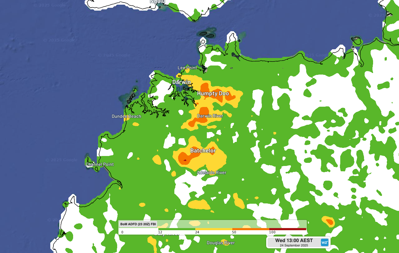
Image: Modelled fire behaviour index over the northwest Top End on Wednesday afternoon. The orange shading shows areas where extreme fire danger is being predicted.
Fires are normal in the NT at this time of year as rising temperatures and abundant dry vegetation provide ideal conditions for fires to take hold. The official Fire Danger Period for the Top End typically runs until early October, while fire activity in the Barkly and Tanami districts usually peaks through spring.
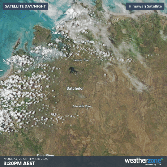
Image: Smoke from a fire near Batchelor on Monday.
Fire danger usually decreases after Australia’s northern rainfall onset, which is defined as the date when at least 50 mm of rain has accumulated after September 1 – this roughly enough rainfall to stimulate plant growth after a typical dry season. This year’s northern rainfall onset it expected to occur earlier than usual for most of the NT.
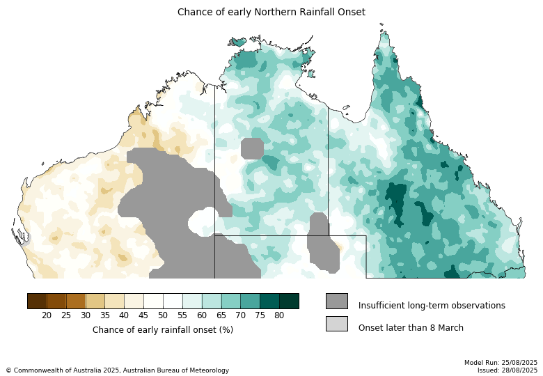
Image: Northern rainfall onset outlook. Source: Bureau of Meteorology
You can keep up to date with the latest fires across the NT by visiting the NT fire incident and warnings map on the PFES website.