
Dangerous waves set to hammer WA coast
Large waves due to a powerful cold front and subsequent series of troughs are set to hammer parts of the west and south coasts of WA from tomorrow Monday and until about Thursday.
A cold front will start crossing the state on Monday morning, driving heavy rainfall, potentially severe thunderstorms, damaging winds and powerful waves. Heading into the afternoon and evening on Monday, significant wave heights could reach up to 7m over parts of west and southwest WA, with the stretch of coastline between Central West and South Coast being the most at risk.
But sadly, the story does not end there… the longer the wind blows, the larger the waves become! In the wake of this cold front, a series of troughs embedded in a persistent and dangerous westerly-southwesterly flow, will cause the waves to increase further, potentially reaching a stunning 7-10 metres (Fig. 1). Wave periods (the time between successive wave peaks) between 13-16 seconds are expected during Tuesday and Wednesday, meaning the waves will pack a serious punch and lead to beach erosion.
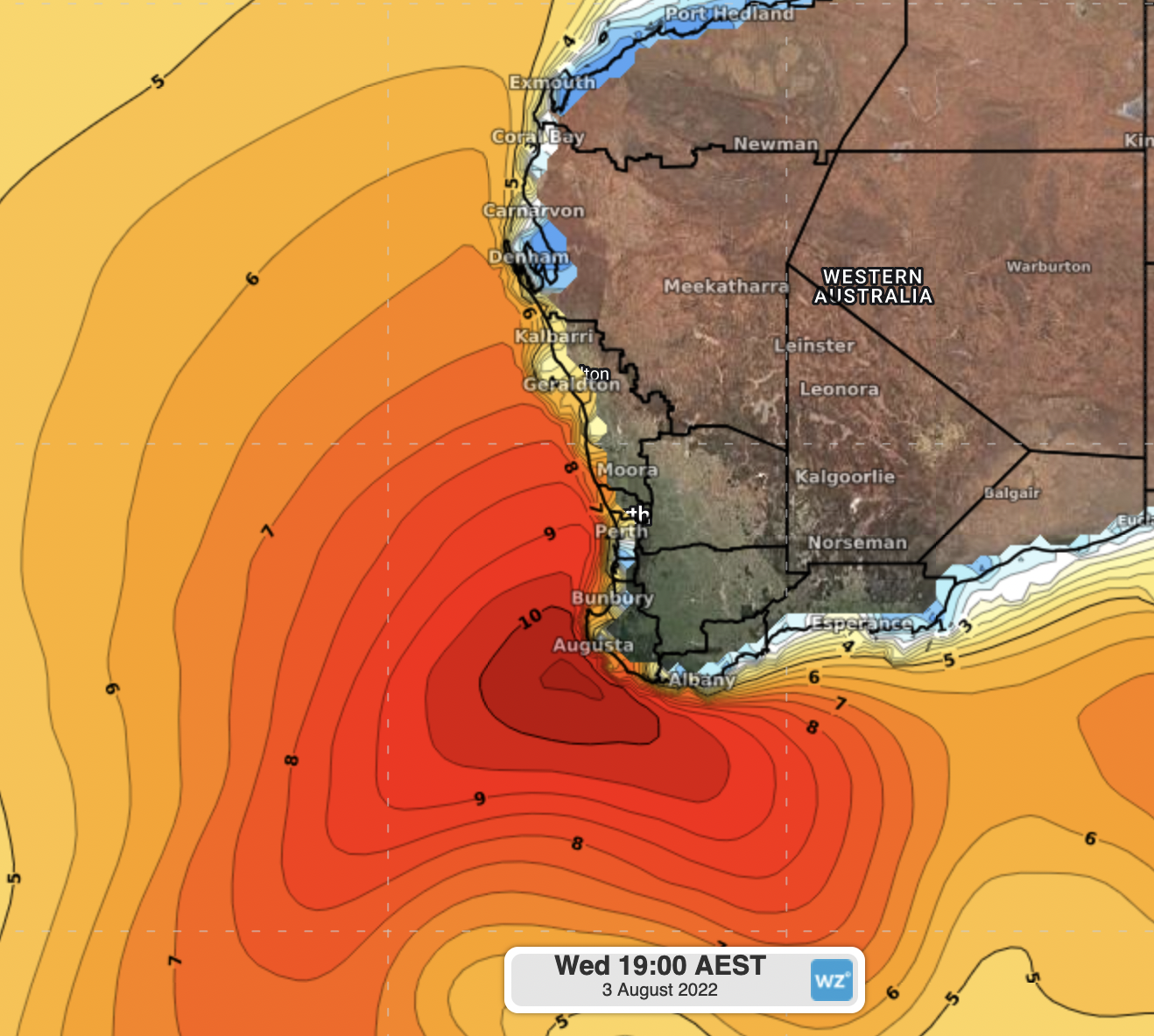
Figure 1. Significant wave height on Wednesday at 17:30 AWST.
Things will start to calm down towards the end of Thursday, with waves expected to range between 4-5 metres along the western and southern coast of the state, easing further into Friday and Saturday.
This prolonged period with powerful waves will lead to significant coastal erosion along the areas affected, so keep yourself update during this dynamic event and check the latest warnings on our website: https://www.weatherzone.com.au/warnings