
Damien to become first severe tropical cyclone since 2013 to make landfall in WA

Tropical Cyclone Damien is likely to make landfall over Western Australia's Pilbara coast this weekend, likely becoming the first severe tropical cyclone to cross the state's coast since 2013.
On Thursday afternoon, Tropical Cyclone Damien became the third system to be named in Australian waters so far this season, when it was about 400 kilometres to the north northeast of Port Hedland. By 5am AWST on Friday, the system had strengthened into a category two tropical cyclone and was moving towards the west, roughly parallel to the Pilbara coast.
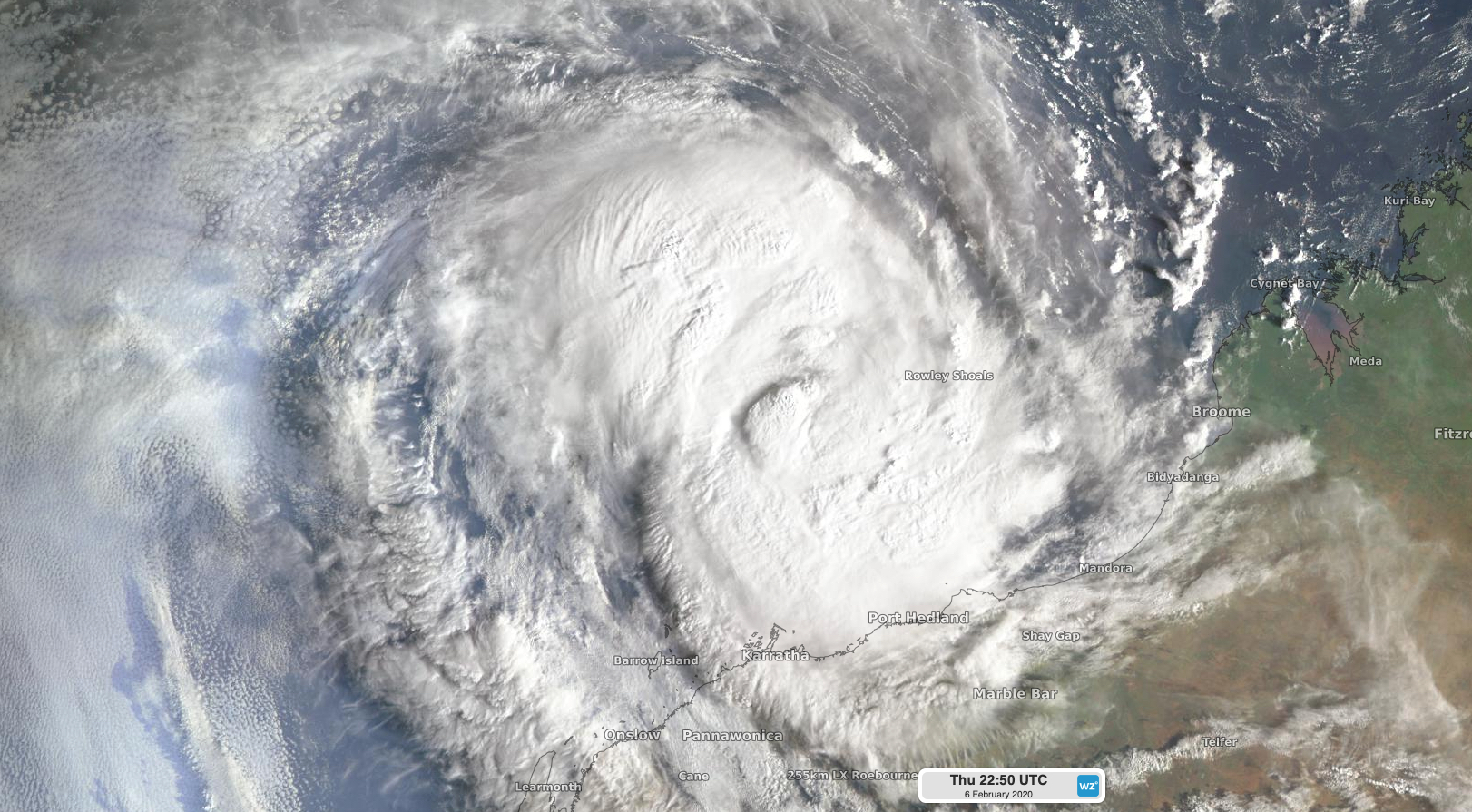
Image: Tropical Cyclone Damien shortly after sunrise on Friday morning.
Damien is expected to turn towards the south on Friday and gain more strength as it approaches the Pilbara coast into Friday night and Saturday morning. Forecast models suggest that the intensifying system will become a category three severe tropical cyclone by Friday night and could reach category four strength by Saturday morning.
At this stage, Damien is expected to make landfall somewhere between Port Hedland and Mardie any time between Saturday morning and Sunday morning. The most likely scenario as of 9am AWST is a coastal crossing near Karratha on Saturday morning as a category four tropical cyclone.
Rain and wind will increase over the Pilbara coast from Friday night, with more intense weather likely to develop as Damien gets closer to the coast on Saturday. Gale force winds, heavy rain and a storm surge will affect a broad area of the Pilbara district as Damien approaches and crosses the coast during the next 24-to-48 hours. The most dangerous weather, including very destructive wind gusts over 200km/h, are likely close to the system's core at landfall.
Tropical Cyclone Damien will start to weaken after crossing the coast, although heavy rain and blustery winds will spread inland with the decaying system over the weekend and early next week.
Damien is on track to become the first severe tropical cyclone (category three or higher) to make landfall in Western Australia since Tropical Cyclone Christine in 2013.