
Damaging winds to batter South Australia Monday
A deep low pressure system will pass over waters to the south of SA, bringing damaging wind gusts initially to coastal SA from late Sunday evening. Damaging wind gusts of 90-110km/h are then expected to impact much of southern SA, including the Adelaide area, and possibly western Victoria from Monday mid-morning to evening as the low pressure centre tracks closer to the coast of southeast SA. This system will also deliver notably cold air aloft with sufficient instability to fuel fast-moving, severe thunderstorms with isolated gusts exceeding 110km/h particularly from late morning to early evening on Monday.
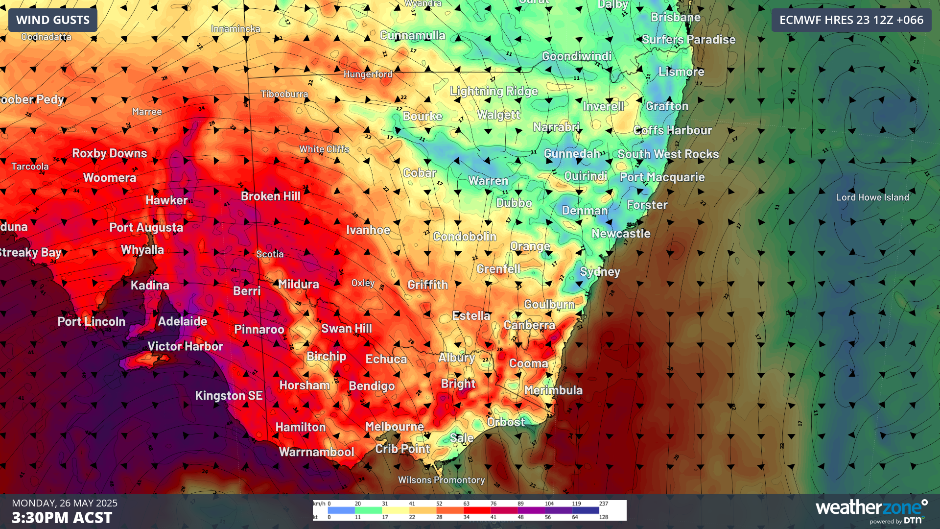
Image: Wind gusts at 3:30pm ACST Monday 26th May according to the ECMWF model.
The low pressure system is expected to weaken early Tuesday morning while tracking over the Bass Strait. However, the risk of damaging wind gusts in excess of 90km/h will persist over elevated terrain in Victoria and southeast NSW until Tuesday evening.
Be sure to check the latest weather warnings as this situation unfolds.