
Damaging winds, fire, snow and rain to hit southeast Australia
A strong cold front will cross southeastern Australia during the next 48 hours, bringing elevated fire danger, rain, thunderstorms, damaging winds and low-level snow in several states.
The satellite images below show a cold front passing over South Australia and Victoria on Tuesday morning. Behind the front is a huge mass of cold air that is producing a large field of speckled clouds over the Great Australian Bight.
.gif)
This cold front will move further north and east on Tuesday and Wednesday, forcing cold air to spread across southeastern Australia and push against a much warmer air mass across NSW and Qld. The interaction between these contrasting air masses will create a mix of volatile weather, which will feature elevated fire danger ratings, heavy rain, damaging wind gusts and snow.
Wind and cold weather in Vic, Tas and SA
Damaging winds are likely over parts of Tas and Vic today and tonight with the passage of the cold front and an associated low pressure system. Severe weather warnings have been issued in both states and gusts above 100 km/h had already been observed in parts of Victoria.
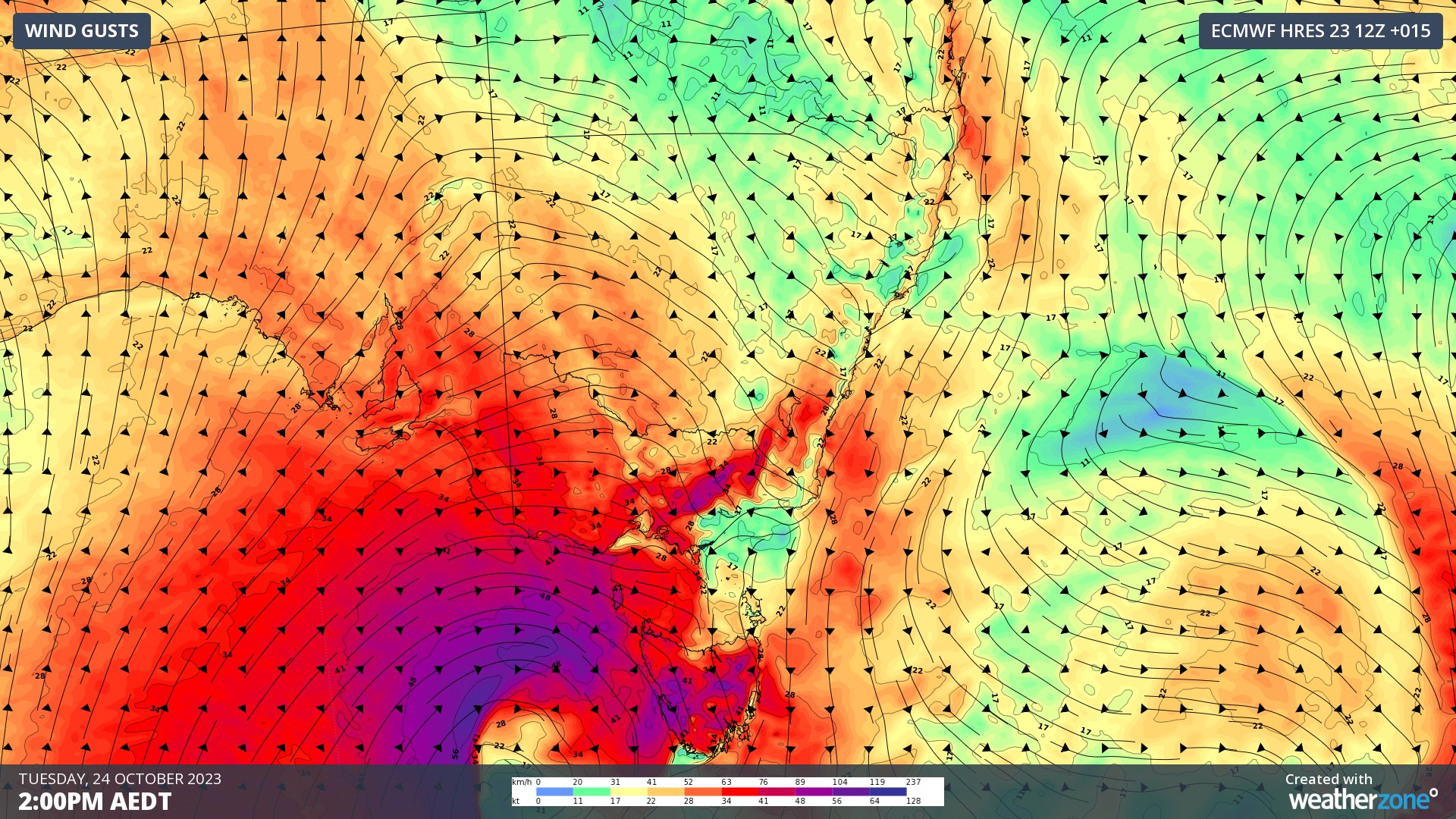
Image: Forecast wind gusts on Tuesday afternoon, according to the ECMWF-HRES model.
Following Tuesday’s burst of wind, cold air and showers will spread over parts of SA, Tas and Vic from Tuesday night into Wednesday. This wintry air will cause temperatures to plummet and allow snow to reach relatively low levels for this time of year.
Snow could reach down to around 600 m above sea level in Tas and 800 to 900 m in Vic on Wednesday. This late-season cold snap has prompted a Bush Walkers Weather Alert in the Western and Central Plateau forecast districts of Tas, while Sheep Graziers Warnings are also in place for parts of Tas and Vic.
Adelaide and Melbourne are only forecast to reach 15ºC on Wednesday and Hobart is predicted to reach 13ºC. These maximums are about 5 to 6ºC below average for this time of year.
Fire, rain and storms in NSW and Qld
A surge of hot and dry air will spread through eastern Australia on Tuesday and Wednesday ahead of a mostly dry southerly change.
The hot pre-frontal air will help to cause High to Extreme fire danger ratings in parts of NSW and Qld on Wednesday. Any fires that grow in this warm and windy weather ahead of the front will then face the problematic southerly wind change, which will cause fires to change their direction of spread and likely expand some of the fire fronts.
Fortunately, an injection of moisture-laden air in the wake of the front will cause rain to develop over parts of eastern and northeast NSW and southeast Qld from Thursday into Friday. This rain should help extinguish some of the fires in the region and add some much-needed water into the parched landscape.
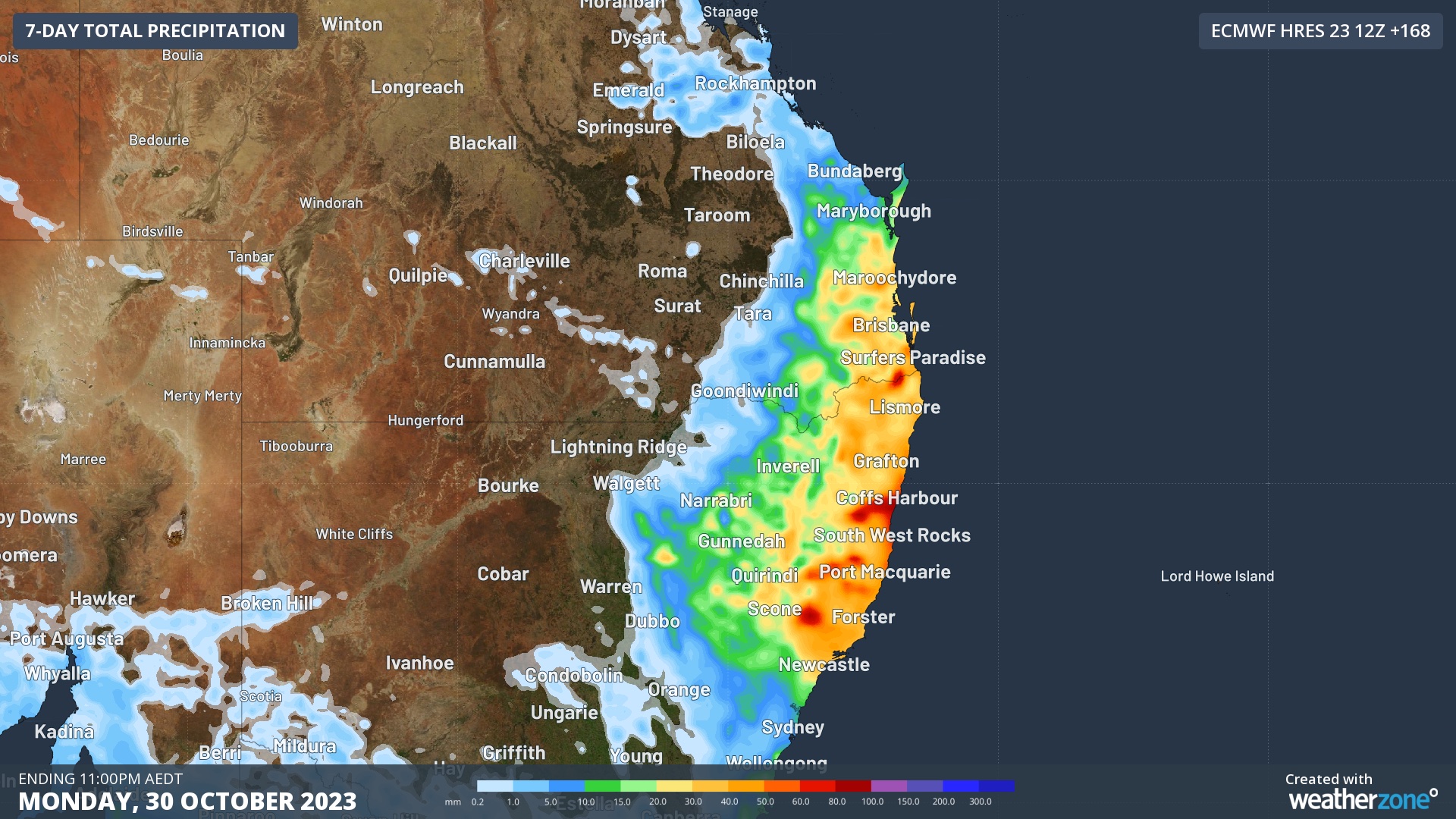
Image: Forecast accumulated rain during the next 7 days according to the ECMWF-HRES model.
Some of the rain over northeast NSW and southeast Qld on Thursday could be accompanied by thunderstorms, with a risk of severe storms in some areas.
Be sure to check the latest forecasts and warnings in your state over the next 48 hours for the most up-to-date information on this dynamic weather system.